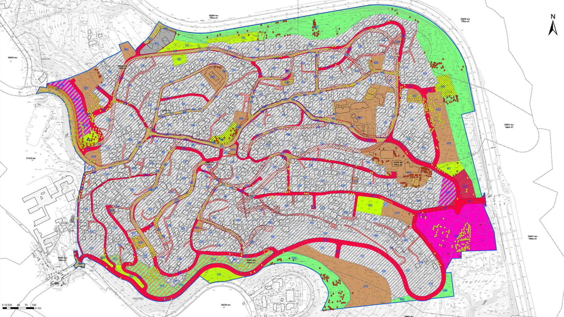
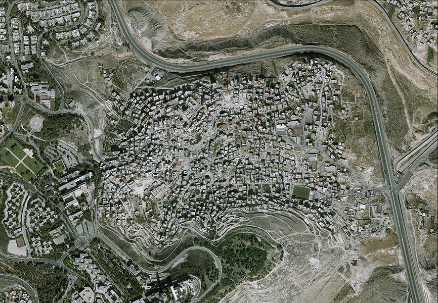
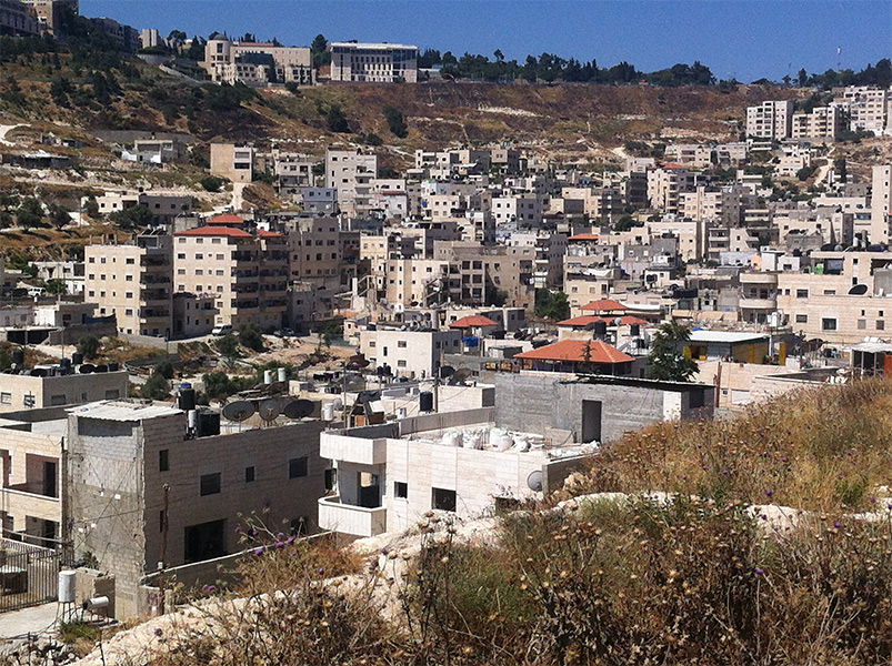
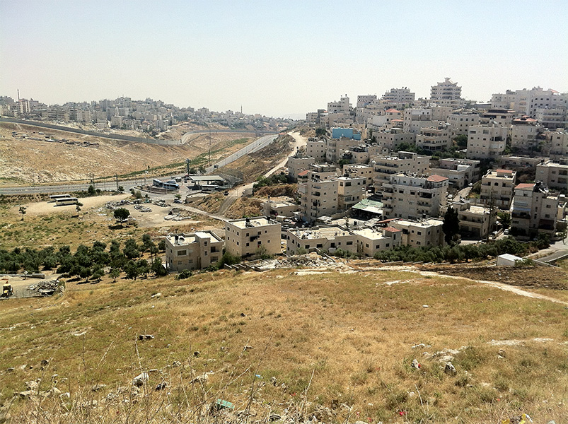
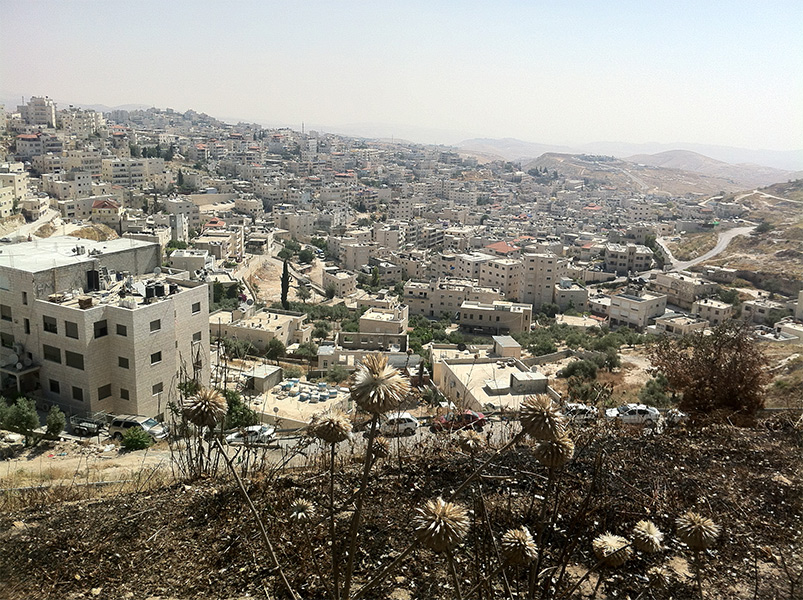
This project is a proposed master plan for the entire neighborhood of Isawiya in east Jerusalem. The planning environment in this case is an informal environment, where urban development occurred almost organically over the years, except for a basic road system. The plan proposes a mechanism combining two planning levels. The first is a one-stage level including strengthening the road system and the public transportation system and locating land for large public institutions and central parks as well as housing. The second level is a dual-stage planning process in existing residential areas which includes determining provisions for preparing building plans with local approval authority (as part of the building permit application process) and allocating land for public use according to a division to compounds based on geographic characteristics and family affiliation. The plan is based on a survey of existing construction and population, conducted by the planning team, leaning on multiple sources and cross-referenced data, aerial photo analysis and field surveys. The planning process is carried out with public participation of the neighborhood residents, while adjusting the planning output to their needs as well as the needs of the city at large
Isawiya, Jerusalem- Detailed Master Plan
Project Initiation: 2015
Location: East Jerusalem
Project Area: 1,050 dunam
Status: In approval process
Program: Residential, commercial and employment uses, as well as local public use facilities
Planning Team: Ari Cohen, Miriam Brody-Choueka, Amir Elisha, Ismail Salah
In partnership with: Dr. Chaim Fialkoff, Osnat Post and the IPCC
 תשריט
תשריט
This project is a proposed master plan for the entire neighborhood of Isawiya in east Jerusalem. The planning environment in this case is an informal environment, where urban development occurred almost organically over the years, except for a basic road system. The plan proposes a mechanism combining two planning levels. The first is a one-stage level including strengthening the road system and the public transportation system and locating land for large public institutions and central parks as well as housing. The second level is a dual-stage planning process in existing residential areas which includes determining provisions for preparing building plans with local approval authority (as part of the building permit application process) and allocating land for public use according to a division to compounds based on geographic characteristics and family affiliation. The plan is based on a survey of existing construction and population, conducted by the planning team, leaning on multiple sources and cross-referenced data, aerial photo analysis and field surveys. The planning process is carried out with public participation of the neighborhood residents, while adjusting the planning output to their needs as well as the needs of the city at large