All posts by שירית
Ramat Gan, Building renewal – adjustment of TAMA 38 to the city of Ramat Gan
Jerusalem – Preparation of a New Parking Standard for the city
Petah Tikva, Hayarkon Park Area – Detailed Plan
Ramla, Building Renewal – Adjusting Tama 38 to the City of Ramla
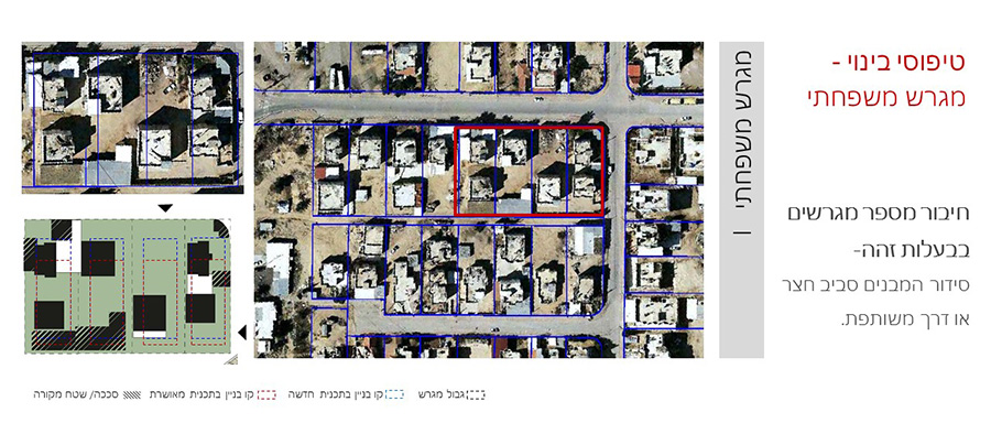
Abu Karinat- Neighborhood 12
Abu Karinat- Neighborhood 14
Abu Karinat- Neighborhood 9
Wadi El Na’am, Neighborhood No. 9- Detailed Plan
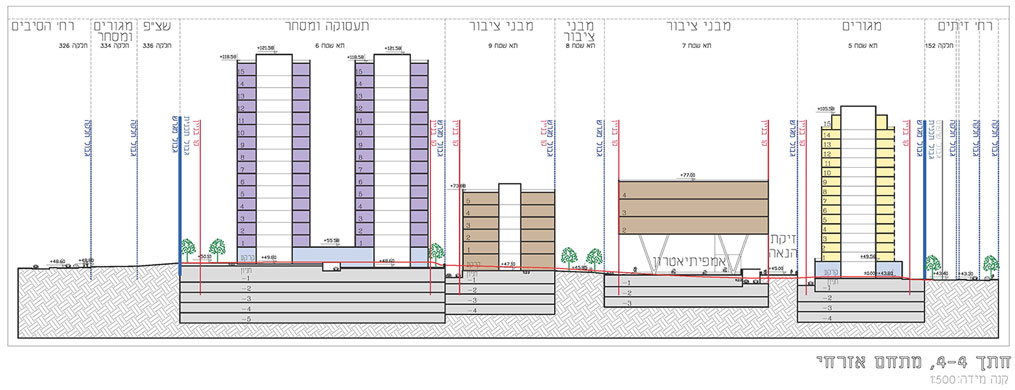
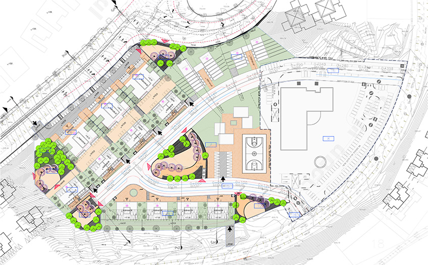
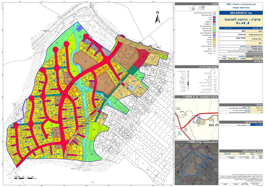
Wadi El Na’am, Neighborhoods No. 4 5- Detailed Plan
Wadi El Na’am, Neighborhood No. 6- Detailed Plan
Givat Ram, Northern Parking Lot, Jerusalem- Employment & Commercial Building
Kiryat Ye’arim, Complexes C D and the Country Cgd Commerce
Kiryat Gat, Habanim St.- Urban Renewal
Beit Shemesh, Bein Ha’Gvaot– Condensation of existing Ret
Gedera South- Residential neighborhood
Nof Yarkon, Hod Hasharon- Residential Neighborhood
Ness Ziona, City Center – Intensification & Urban Renewal
Wadi Joz, Jerusalem – Employment Center
Carmon St. Beit Hakerem, Jerusalem – Residential Complex
Al-Bwadi Neighborhood, Abu Talul- Residence
Ness Ziona, near Science Park- Residential Neighborhood
Northwest Ramot, Yerushalayim – Adjacent Development to a Residential Neighborhood
Beit Shemesh- Employment Complex
Nahal Sorek, Beit Shemesh – Residential Neighborhood
Cosell, Givat Ram, Jerusalem- Residential Complex with fCommerce
South-East Gilo Neighborhoods, Jerusalem – Detailed Planning
Modiin Illit – Industrial & Employment Complex
Zondek St., Jerusalem – Resident
Katamon Neighborhood, Jerusalem – Urban Renewal
Beit Shemesh, City Entrance- Reside
Southwest Nazareth- City Building Plan
Hemed Complex, Jerusalem- Park & Drive
Tzur Complex, Kidmat Hasharon (Herzliya) – City Building Plan
Tuviahu Blvd. Be’er Sheva- Skeleton Plan
Ha’Arad St. Tel Aviv – Employment and Residence
Derech Hebron, Jerusalem – Commerce, Hotel & Residence
Lod, South- Urban Renewal In various Sites
Kseife- Neighborhood 22
Petah Tiqva, City Center- Policy Document for Renewal
Light Rail, Jerusalem- “Blue Line” Derech Hevron St.
Light Rail, Jerusalem- “Blue Line” Emek Refaim St.
Light Rail, Jerusalem- “Pale Blue Line”
Light Rail, Jerusalem- “Blue Line” David Ha’Melech St.
Sha’ar Ha’Mifratz, Haifa – Southern Complex
National Outline Plan 73- Temporary Residential Sites for Alliya (Immigration)
Light Rail, Jerusalem- “Blue Line” Modai Bridge
Light Rail, Jerusalem- “Blue Line” Nachal Sorek Parking Structure
Kiryat Ye’arim- ‘Nofei Tels-Stone’ Residential Compound
Kiryat Ye’arim- Daycare centers and Synagogue
Ramat Ha’Hayal- Israel Electricity Company
Azur- Yitzchak Sade Compound
Yeruham- Two High-tech complexes
Ben Gurion Complex, Shlomi
Planning Team: אבי
Nir Galim- Master Plan
Neve Ilan- Master Plan
Planning Team: אבי
Railway complex, Ramla
Giora Neighborhood, Ramla
Tasso Cemetery- Ma’ar Ben Zvi Tel Aviv
Sde Dov, Tel Aviv- Detailed Plans
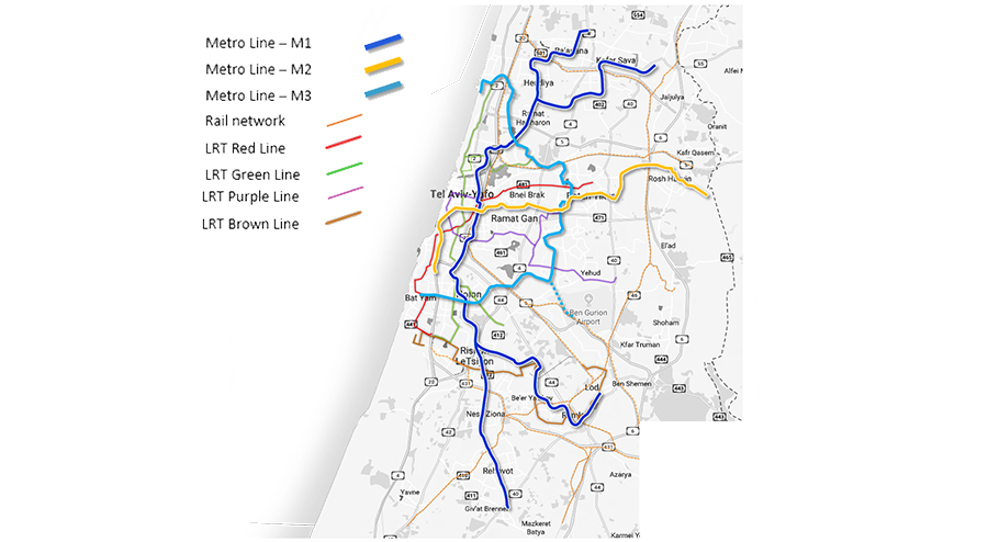
Tel Aviv Metro Stations – Feasibility study for development around metro stations
Or Yehuda- Rabin West\Kfar Aana
Or Yehuda – North Orchard Compound
Or Yehuda, Southern Neighborhoos – Urban Renewal
Metro, Tel Aviv Metropolin- feasibility study
Client: NTA
Project Initiation: 2017
Location: Tel-Aviv metropolitan area
Status: Completed
Program: 140 km of track and 109 stations, depot sites and park & ride lots.
Planning Team: Ari Cohen, Avi Lindenbaum, Sharon (Matar) Arie
Project Initiation: 2017
Location: Tel-Aviv metropolitan area
Status: Completed
Program: 140 km of track and 109 stations, depot sites and park & ride lots.
Planning Team: Ari Cohen, Avi Lindenbaum, Sharon (Matar) Arie
The strategic plan for public transportation in the TA metropolitan area was completed in 2016. This plan recommended the creation of three metro lines, and suggested a general route for each.
The feasibility study required the planning team to manage competing interests. On the one hand, they needed to address the needs of the planning that had already been set in motion for the next twenty years (providing optimal service in the heart of the metropolis). On the other hand, they needed to define a framework for long-term development – 30-40 years (a second and a third layer surrounding the metropolis, generating demand for development around the stations).
The study assessed the routes suggested by the strategic plan, suggesting alternative routes and station locations for each. The alternatives were compared using an MCA that included 35 parameters from different domains: urbanism, population, employment, transit, environment, economic benefits, operation, etc.
Completed in early 2019, the results of the feasibility study have provided the principles and guidelines for the metro’s future planning, along with a detailed route that includes the locations of stations and depot sites.
 רשת המטרו
The strategic plan for public transportation in the TA metropolitan area was completed in 2016. This plan recommended the creation of three metro lines, and suggested a general route for each.
The feasibility study required the planning team to manage competing interests. On the one hand, they needed to address the needs of the planning that had already been set in motion for the next twenty years (providing optimal service in the heart of the metropolis). On the other hand, they needed to define a framework for long-term development – 30-40 years (a second and a third layer surrounding the metropolis, generating demand for development around the stations).
The study assessed the routes suggested by the strategic plan, suggesting alternative routes and station locations for each. The alternatives were compared using an MCA that included 35 parameters from different domains: urbanism, population, employment, transit, environment, economic benefits, operation, etc.
Completed in early 2019, the results of the feasibility study have provided the principles and guidelines for the metro’s future planning, along with a detailed route that includes the locations of stations and depot sites.
Harduf Rd. Jerusalem- Urban Renewal
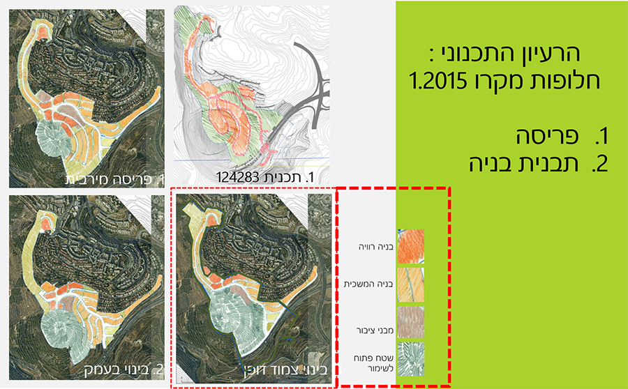
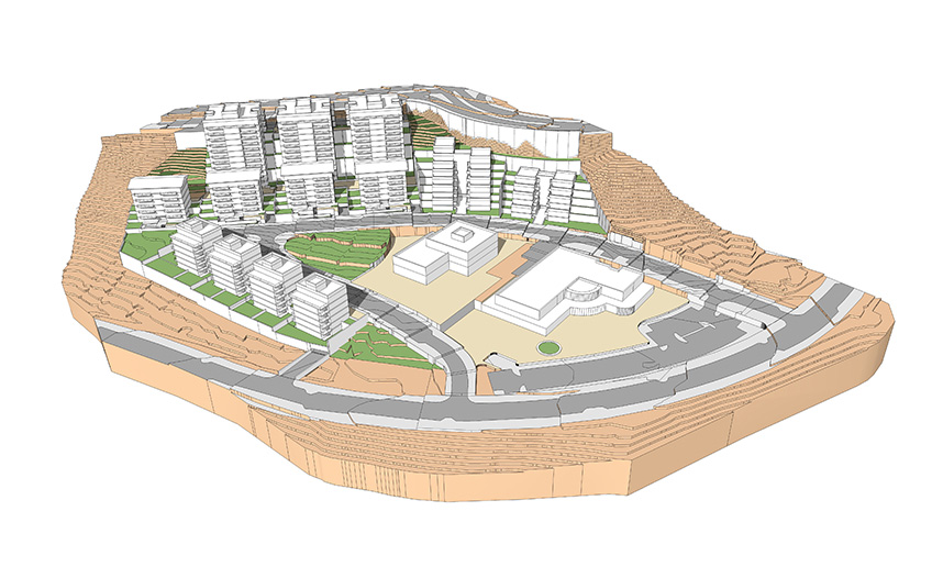
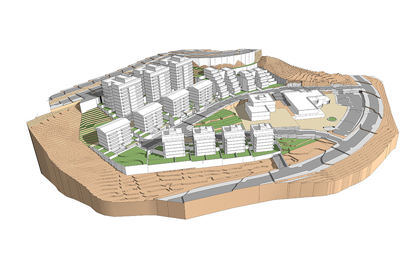
Program: פינוי בינוי של 180 יח"ד והקמה של 750 יח"ד.
Ma’of Neighborhood, Arad – Neighborhood development
Client: Ministry of Construction & Housing
Project Initiation: 2016
Location: Arad
Project Area: Approx. 115 Dunam
Status: Planning
Program: 370 residential units and 17 hospitality units
Planning Team: Ari Cohen, Michael Wind, Eti Efrati-Arieh, Shirit Fink-Glassner, Yael Ben-Zecharia, Einat Gazit-Lifshitz
Project Initiation: 2016
Location: Arad
Project Area: Approx. 115 Dunam
Status: Planning
Program: 370 residential units and 17 hospitality units
Planning Team: Ari Cohen, Michael Wind, Eti Efrati-Arieh, Shirit Fink-Glassner, Yael Ben-Zecharia, Einat Gazit-Lifshitz
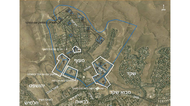
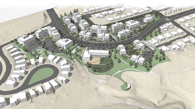
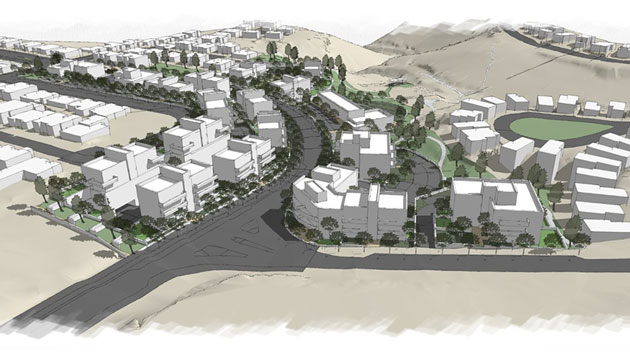
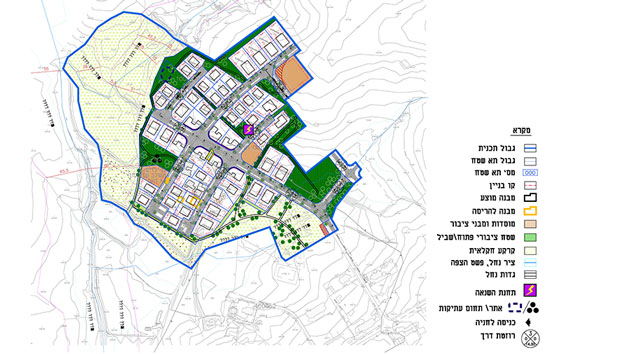
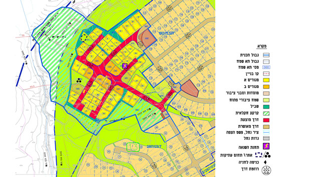
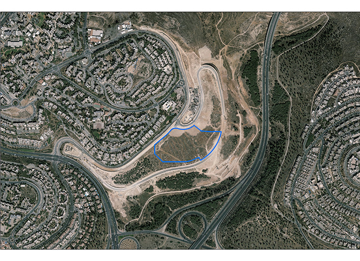
The implementation of the plans for Ma’of left spaces that have not yet been built upon, or for which the uses set down in the detailed plan were unjustified.
The Ministry of Housing, in cooperation with the Municipality of Arad, instigated a plan for using these spaces to create a continuous construction, reinforcing the existing neighborhood and its connections to the city. After examining the space and conducting survey tours with the plan’s commissioners and the City’s representatives, five areas were selected for development. The additional residential units will total 387 (of which 17 will be for hospitality), at an average density of 6-8 units per dunam.
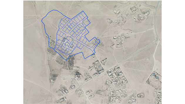
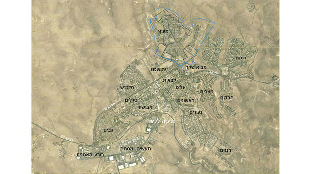 מיקום השכונה
The implementation of the plans for Ma’of left spaces that have not yet been built upon, or for which the uses set down in the detailed plan were unjustified.
The Ministry of Housing, in cooperation with the Municipality of Arad, instigated a plan for using these spaces to create a continuous construction, reinforcing the existing neighborhood and its connections to the city. After examining the space and conducting survey tours with the plan’s commissioners and the City’s representatives, five areas were selected for development. The additional residential units will total 387 (of which 17 will be for hospitality), at an average density of 6-8 units per dunam.
Be’er Sheva CBD
Kiryat Gat- Industrial Zone expansion
Alexandrion St. and Elazar Ben Yair St. Jerusalem- Urban renewal of Residential & Public institution
Beit Ha’hahachlama Slopes, Kiryat Yearim
Hebron Rd. Jerusalem- Residential Commercial & Hotel
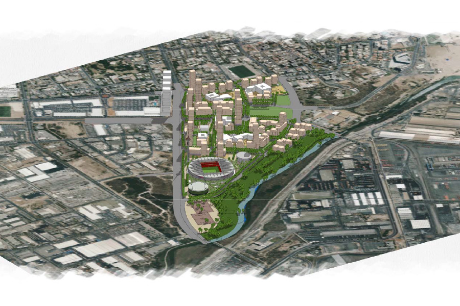
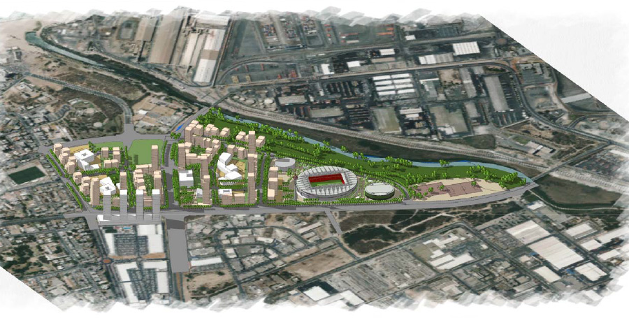
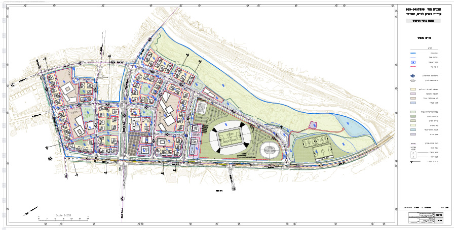
Kiryat Gat- Employment and Stadium area
Status: בהליכי אישור
Romema, Jerusalem- Residential and Public Institutions
Kiryat Ye’arim- Daycare Center
Status: בבנייה
Bulivia Rd. Jerusalem- City Renewal
Status: בהליכי אישור
.Aqueduct Site, Jerusalem- Residence on Derech Hevron St.
Status: בהליכי אישור
South of Ramat Rachel- New Residential Neighborhood
North of Ramat Rachel- New Residential Neighborhood
Kiryat Gat- Industrial Zone expansion
Status: בתכנון
Kiryat Gat- South-Quarter Skeleton plan
Ramat Gan- a Business Center on the Park
Status: בתכנון
Ar’ara in the Negev- New Industrial Zone
Status: בתכנון
Wadi El Na’am- West, South & East Detailed plans
Status: בתכנון
Planning Team: אבינועם אקסלרוד, אמיר אלישע
Planning Team: אבינועם אקסלרוד, אמיר אלישע
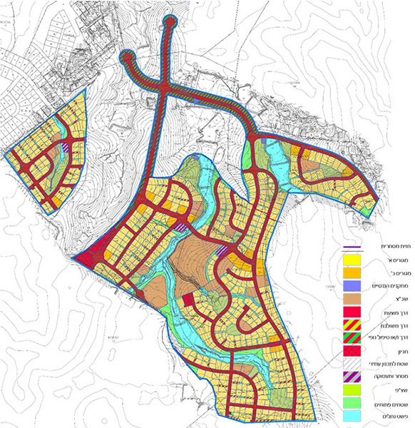
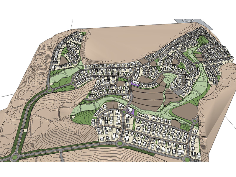
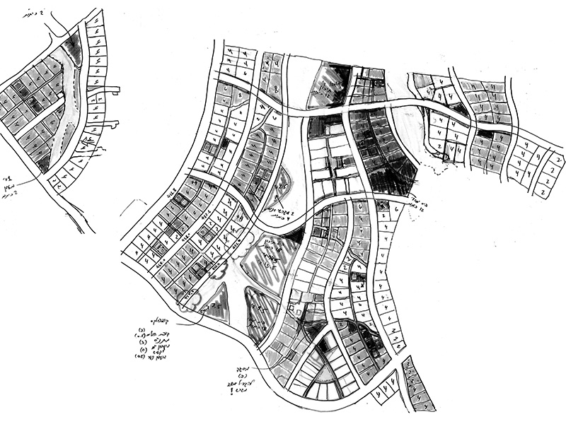
Wadi El Na’am- Master Plan for a New Settlement
Client: 'Bedouin Development Authority, by 'Tik Projects
Project Initiation: 2016
Location: South of Segev Shalom
Project Area: 11, 740 dunam
Status: Approved
Program: 14,000 residence, 50,000 square meters for commerce and services.
Planning Team: Ari Cohen, Yaara Manor-Rozner, Avinoam Axelrod, Amir Elisha
Project Initiation: 2016
Location: South of Segev Shalom
Project Area: 11, 740 dunam
Status: Approved
Program: 14,000 residence, 50,000 square meters for commerce and services.
Planning Team: Ari Cohen, Yaara Manor-Rozner, Avinoam Axelrod, Amir Elisha
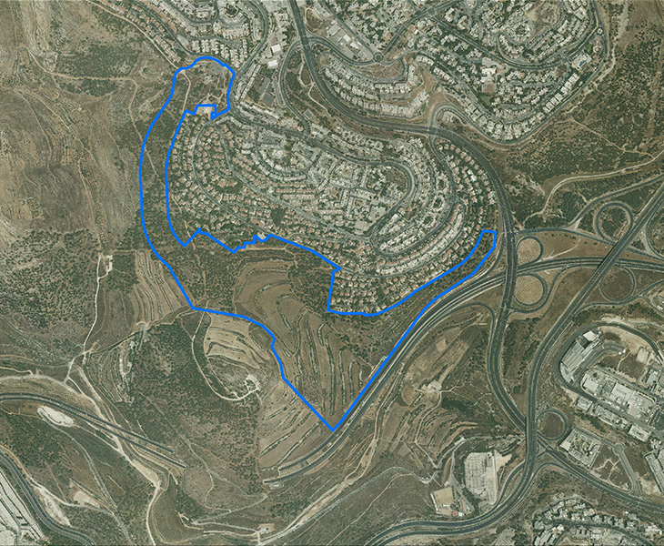
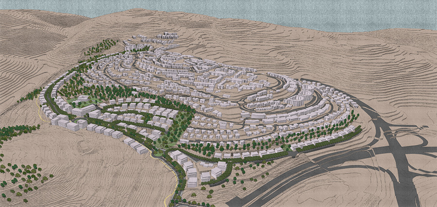
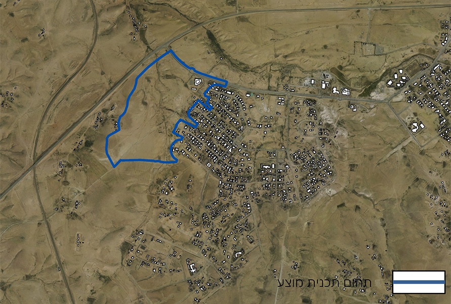
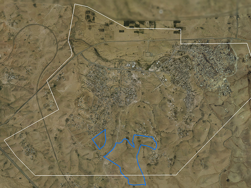
Wadi el-Noam will be located on ‘Tzon’ Hill, about 1.5 km south of Be’er Sheva. To the north, the plan will border on Segev Shalom, with route 6 to the south and route 40 to the west. The Naot Hovav industrial park is located 4 km southwest.
The master plan, which covers an area of 11,740 dunam, was designed to provide a formal alternative for the unrecognized settlement currently located near Be’er Sheva prison, Naot Hovav, and along route 40 until Hanegev junction. The bulk of this settlement’s residents currently live within the coundaries of the Naot Hovav industrial park.
In February, 2015, the Ministerial Committee on settlement of the Bedouins in the Negev decided to assess the possibility of creating a new settlement for the Wadi el-Na’am diaspora in the area near their current location, but outside the boundaries of Naot Hovav. In January, 2016, the National Authority decided to recommend to the government that this new settlement be constructed south of Segev Shalom.
The boundaries of the new pan currently include the homes of a small part (several hundred) of the unrecognized village of Wadi el-Na’am’s approximately 7000 current residents. Demographic projections predict that the population of the new settlement will be 14,000 by 2035.
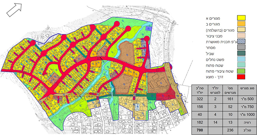
The plan incorporates Bedouin cultural values, such as allowing traditional grazing in the residential areas, using the streams for agricultural purposes and also economic feasibility for the benefit of the residents of the new settlement. It defines a number of residence and settlement types, allocates public land according to the future residents’ needs, and includes the option of agricultural development according to both traditional and intensive modern models.
Wadi el-Noam will be located on ‘Tzon’ Hill, about 1.5 km south of Be’er Sheva. To the north, the plan will border on Segev Shalom, with route 6 to the south and route 40 to the west. The Naot Hovav industrial park is located 4 km southwest.
The master plan, which covers an area of 11,740 dunam, was designed to provide a formal alternative for the unrecognized settlement currently located near Be’er Sheva prison, Naot Hovav, and along route 40 until Hanegev junction. The bulk of this settlement’s residents currently live within the coundaries of the Naot Hovav industrial park.
In February, 2015, the Ministerial Committee on settlement of the Bedouins in the Negev decided to assess the possibility of creating a new settlement for the Wadi el-Na’am diaspora in the area near their current location, but outside the boundaries of Naot Hovav. In January, 2016, the National Authority decided to recommend to the government that this new settlement be constructed south of Segev Shalom.
The boundaries of the new pan currently include the homes of a small part (several hundred) of the unrecognized village of Wadi el-Na’am’s approximately 7000 current residents. Demographic projections predict that the population of the new settlement will be 14,000 by 2035.
The plan incorporates Bedouin cultural values, such as allowing traditional grazing in the residential areas, using the streams for agricultural purposes and also economic feasibility for the benefit of the residents of the new settlement. It defines a number of residence and settlement types, allocates public land according to the future residents’ needs, and includes the option of agricultural development according to both traditional and intensive modern models.
Segev Shalom-Addition of building rights for residential and public buildings
Abu Karinat- Neighborhood 6
Status: בתכנון
Planning Team: אבינועם אקסלרוד, רביד פלג, אמיר אלישע
Planning Team: אבינועם אקסלרוד, רביד פלג, אמיר אלישע
Abu Karinat- Neighborhood 7
Status: בתכנון
Planning Team: אבינועם אקסלרוד, רביד פלג, אמיר אלישע
Planning Team: אבינועם אקסלרוד, רביד פלג, אמיר אלישע
Abu Karinat- Neighborhood 8
Status: בתכנון
Planning Team: אריאל שרעבי, רביד פלג, אמיר אלישע
Planning Team: אריאל שרעבי, רביד פלג, אמיר אלישע
Home of The Academy of the Hebrew Language, Jerusalem
Status: בתכנון
Tira- Planning Residentg 9-11
Status: בתכנון
Ar’ara in the Negev- North entrance
Status: בתכנון
Kseife- Neighborhood 54
Status: בתכנון
Kseife- Neighborhood 80
Status: בתכנון
Kseifa – Expansion of neighborhood 13
Client: Israel Land Authority, Bedouin Development Authority
Project Initiation: 2017
Location: Neighborhood 13, southwest of the existing town of Kseifa, east of Beersheba River
Project Area: Approx. 110 Dunam
Status: Approved
Program: A 160 unit residential neighborhood, spaces for public buildings, open and agricultural spaces
Planning Team: Ari Cohen, Ella Zilberfarb-Ben Ezra, Ariel Sharabi, Amit Segal, Ravid Peleg
As part of a detailed master plan for regularization, and in light of the natural growth of Kseifa’s resident population, this plan was drawn up as an extension of neighborhood 13, in the southwest corner of Kseifa’s jurisdiction. The plan provides regularization for residents already living within its borders, defining residential lots on spaces that are currently inhabited in practice, and offers additional lots to accommodate the natural increase of the population. In additional to residential space, the plan also allocates spaces for public structures and institutions, open spaces, and a system of roads, all of which were designed in cooperation with the area’s current residents, and in accordance with the detailed plans that have been approved nearby.
 מגרשים על רקע תצלום אוויר
As part of a detailed master plan for regularization, and in light of the natural growth of Kseifa’s resident population, this plan was drawn up as an extension of neighborhood 13, in the southwest corner of Kseifa’s jurisdiction. The plan provides regularization for residents already living within its borders, defining residential lots on spaces that are currently inhabited in practice, and offers additional lots to accommodate the natural increase of the population. In additional to residential space, the plan also allocates spaces for public structures and institutions, open spaces, and a system of roads, all of which were designed in cooperation with the area’s current residents, and in accordance with the detailed plans that have been approved nearby.
South West Kiryat Gat- Neighborhood
Transportation Center & Urban Center, Ammunition Hill, Jerusalem
Light Rail, Gush Dan- “Green Line” Stations Planning
Road 39- Eastern Segment
Ma’of Neighborhood, Arad- planing 1:500
Kiryat Park Lachish, Ashdod- 1:500 plan
Status: מאושר
Planning Team: אתי אפרתי-אריה, ישי שמיאן
Planning Team: אתי אפרתי-אריה, ישי שמיאן
Court of Law Compound, Ashdod- Residence
Status: בהליכי אישור
Planning Team: אתי אפרתי-אריה, טל דילר-אורנשטיין, שירית פינק-גלסנר
Planning Team: אתי אפרתי-אריה, טל דילר-אורנשטיין, שירית פינק-גלסנר
Light Rail, Jerusalem- “Blue Line” detailed plan
Status: בתכנון
Planning Team: אתי אפרתי-אריה, יעל בן זכריה, תומר רבינוביץ'-ירדן, נמרוד דניאל רוזנפלד, צוריאל עוזרי, יוסף חסאסנה
Planning Team: אתי אפרתי-אריה, יעל בן זכריה, תומר רבינוביץ'-ירדן, נמרוד דניאל רוזנפלד, צוריאל עוזרי, יוסף חסאסנה
Abu Ghosh- Southern district
Client: Abu Ghosh Municipality
Status: Planning
Status: Planning
Tel aviv- Reading Marina
Client: עיריית ת"א
Status: בהליכי אישור
Status: בהליכי אישור
Detention Center, Jerusalem- feasibility study for new placement
Status: מוקפא
Planning Team: אבי לנדנבאום, יעל גולד ארד
Planning Team: אבי לנדנבאום, יעל גולד ארד
Givat Shaul, Jerusalem- feasibility study for employment area
Status: Planning
Planning Team: Avi Lindenbaum, Amit Segal
Planning Team: Avi Lindenbaum, Amit Segal
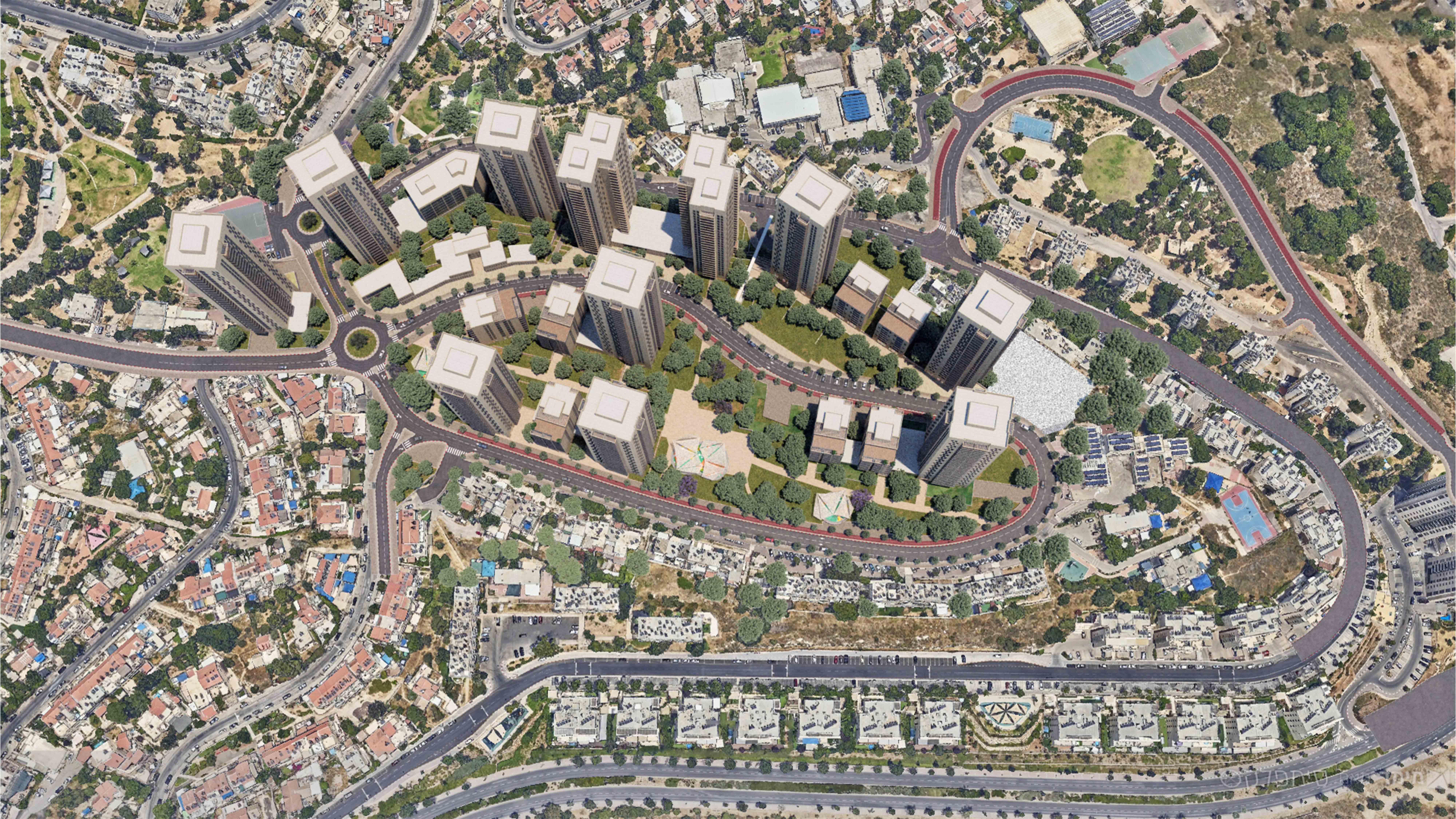
Givat Shmuel- Residential & empoyment buildings, and city square
Client: Giv’at Shmuel municipality
Project Initiation: 2016
Location: Giv’at Shmuel
Project Area: 62 dunam
Status: Completed developing chosen alternative
Program: The plan includes 500 residential units, 50 special residential units, 33,000 sqm devoted to industry and commerce, and 57,000 sqm for various public structures.
Planning Team: Ari Cohen, Yael Gold-Arad, Avi Lindenbaum
In partnership with: Chaim Fialkoff
The plan is part of a larger master plan for Giv’at Shmuel which is currently in preparation, and which includes two sites along Hanasi street (between Hazeitim St. and Hamelekh Road): a residential space and a public space.
The plan includes three additional residential lots for the urban renewal program in Giyora (427-0594846), which are being designed in concern to interact with one another.
Planning principles:
- Creating and connecting roads according to the recommendations of the general master plan (in preparation). The plan reinforces public activity along Hanasi street by means of a town square and commercial storefronts.
- The plan proposes the creation of a central square for Giv’at Shmuel, surrounded by public structures for various uses, as detailed below.
- The plan proposes multiple uses: public (culture, community, sports, offices and special housing), residential and commercial.
- The construction will define the contours of the streets and square. All structures will include commercial storefronts on the ground floor.
- Buildings Height varies depending on the use of the building from a 4 story cultural center to a 21 story residential building.
Under the auspices of a regional committee, planning has been completed and approved by the local committee.
 מבט מכיוון דרום-מזרח
The plan is part of a larger master plan for Giv’at Shmuel which is currently in preparation, and which includes two sites along Hanasi street (between Hazeitim St. and Hamelekh Road): a residential space and a public space.
The plan includes three additional residential lots for the urban renewal program in Giyora (427-0594846), which are being designed in concern to interact with one another.
Planning principles:
- Creating and connecting roads according to the recommendations of the general master plan (in preparation). The plan reinforces public activity along Hanasi street by means of a town square and commercial storefronts.
- The plan proposes the creation of a central square for Giv’at Shmuel, surrounded by public structures for various uses, as detailed below.
- The plan proposes multiple uses: public (culture, community, sports, offices and special housing), residential and commercial.
- The construction will define the contours of the streets and square. All structures will include commercial storefronts on the ground floor.
- Buildings Height varies depending on the use of the building from a 4 story cultural center to a 21 story residential building.
Under the auspices of a regional committee, planning has been completed and approved by the local committee.
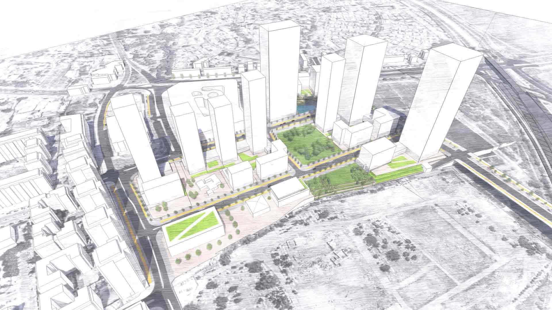
Holon- Ha’Yovel area
Client: עיריית חולון
Project Initiation: 2017
Location: מתחם היובל, חולון
Status: בתכנון
Program: 1,700 יח"ד, 120,000-240,000 מ"ר לתעסוקה, 12,000 מ"ר למגורים
Planning Team: ארי כהן, יעל גולד-ארד, אבי לינדנבאום, עינב יגל, לאה אטיאס-ריחני, משה כהן וצוותו
Project Initiation: 2017
Location: מתחם היובל, חולון
Status: בתכנון
Program: 1,700 יח"ד, 120,000-240,000 מ"ר לתעסוקה, 12,000 מ"ר למגורים
Planning Team: ארי כהן, יעל גולד-ארד, אבי לינדנבאום, עינב יגל, לאה אטיאס-ריחני, משה כהן וצוותו
Derech Chevron St. Jerusalem- Hotel
Client: רשות מקרקעי ישראל
East Rehovot- proposal for detailed master plan
Client: Rechovot Municipality
Project Initiation: 2017
Location: East Rehovot, across Route 40
Project Area: 2,000 dunam
Status: Competition proposal
Program: Residential, commercial, employment and public space, municipal park
Planning Team: Ari Cohen, Tomer Rabinowitz-Yarden, Zlil Atias, Yael Gold-Arad, Ella Zilberfarb-Ben Ezra
In partnership with: Matanya Zack
The east Rehovot plan is being promoted as part of the Mayor’s vision for the expansion of the city and in accordance with the National Committee for Special Planning Issues’ decision as part of NOP 1/35, which approved an extension east of Begin Road.
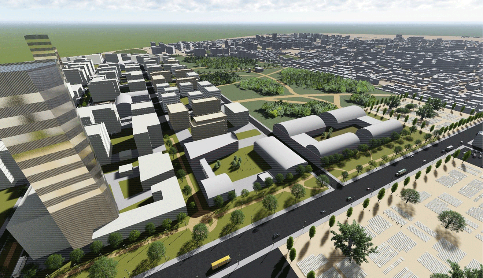
The planning team’s proposal for the “Kedem District” stems from a vision of sustainability, striving to minimize the area’s ecological footprint while fulfilling the varied needs of a growing, dense urban population. The plan proposes a large urban park, which will serve both existing and future residents, and become part of the “Rehovot” experience, setting the stage for vibrant urban activity. This activity will strengthen city center renewal processes, while supporting the transformation of Rehovot into a city attractive to a variety of populations. The planning proposal views the new eastern areas as a rare urban opportunity for the entire city (not only for the new quarter itself), and thus wishes to be ‘generous’ to the city, both in terms of the scope of area allocated for external public usage, as well as in terms of their location as the district’s showcase
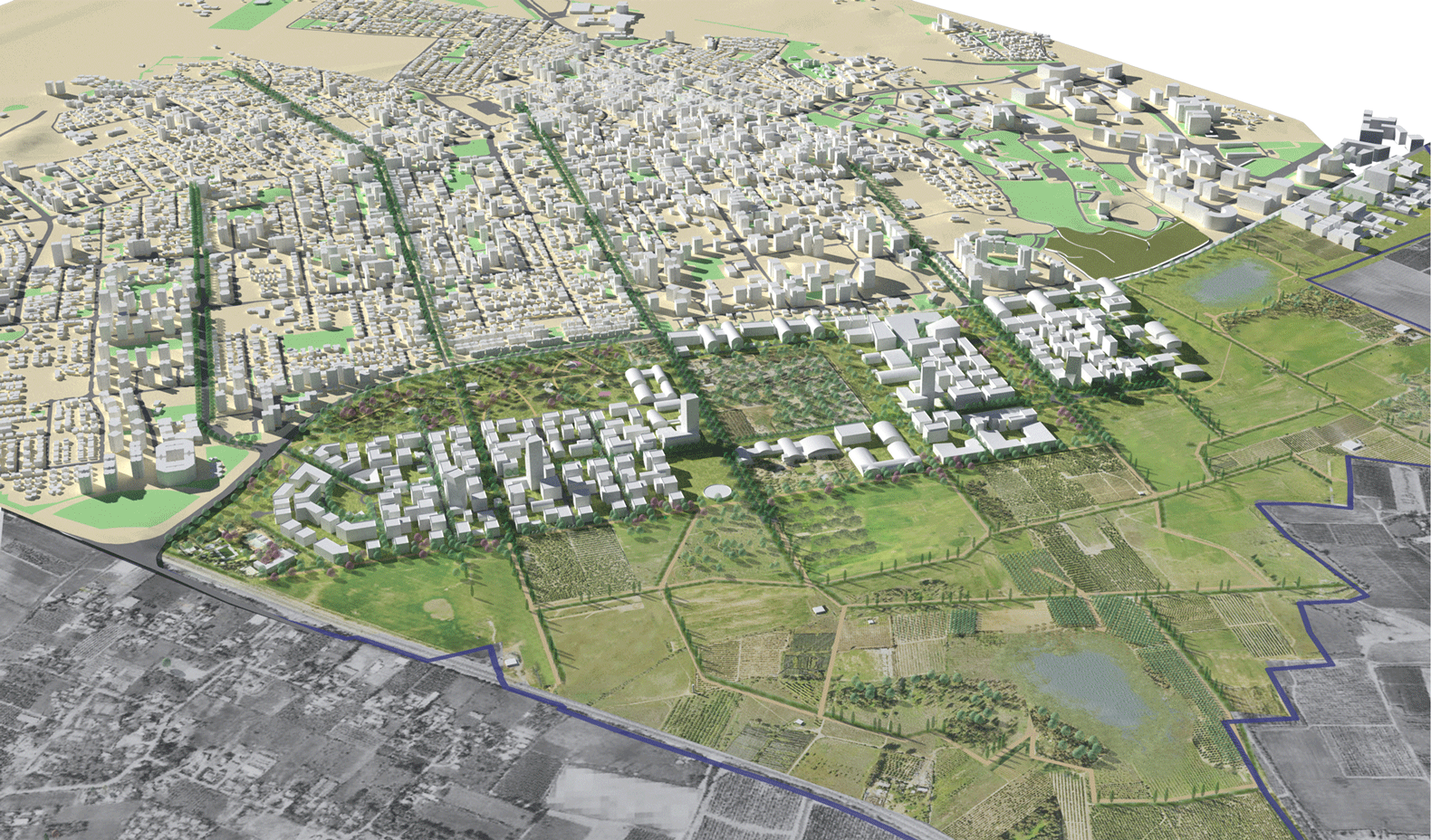 מבט ממזרח

The east Rehovot plan is being promoted as part of the Mayor’s vision for the expansion of the city and in accordance with the National Committee for Special Planning Issues’ decision as part of NOP 1/35, which approved an extension east of Begin Road.
The planning team’s proposal for the “Kedem District” stems from a vision of sustainability, striving to minimize the area’s ecological footprint while fulfilling the varied needs of a growing, dense urban population. The plan proposes a large urban park, which will serve both existing and future residents, and become part of the “Rehovot” experience, setting the stage for vibrant urban activity. This activity will strengthen city center renewal processes, while supporting the transformation of Rehovot into a city attractive to a variety of populations. The planning proposal views the new eastern areas as a rare urban opportunity for the entire city (not only for the new quarter itself), and thus wishes to be ‘generous’ to the city, both in terms of the scope of area allocated for external public usage, as well as in terms of their location as the district’s showcase
Kseifeh- Neighborhood 52
Light Rail, Tel Aviv- Yafo- “Red Line” plan
Light Rail, Jerusalem- “Red Line” plan
Client: Jerusalem Transport Master Plan Team
Project Initiation: 1999
Location: Jerusalem, from Pisgat Ze'ev in the north to Mount Herzl in the south
Project Area: 800 dunam
Status: Approved
Program: 14 kilometers of railway tracks, 23 stations, depots and engineering facilities to enable the functioning of the light rail systems. Development, road upgrades and improved access in the public sphere
Planning Team: Ari Cohen, Nahum Meltzer, Elinoar Barzaki, Cesar Yehudkin
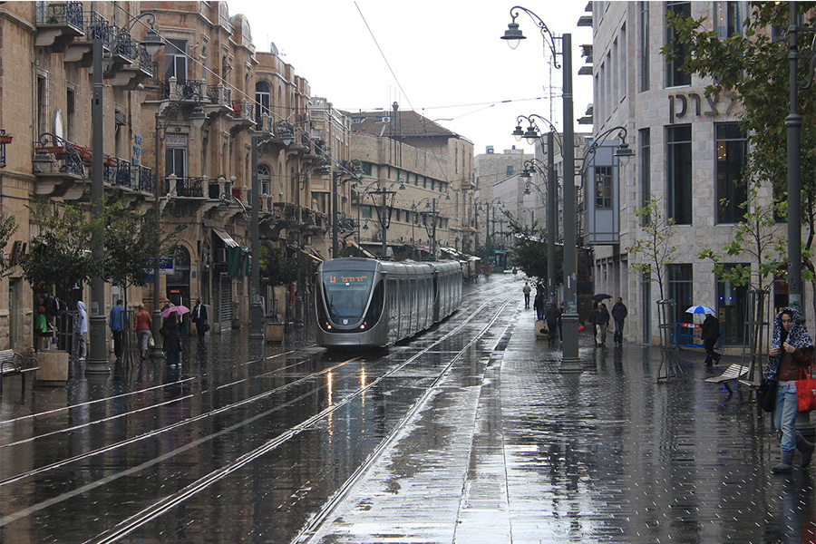
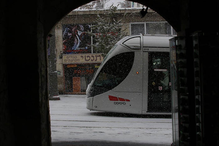
The plan defines the first light rail track line (the “Red Line”), including the locations of aboveground stations and the engineering facilities required to operate the light rail system. The red line connects the neighborhood of Pisgat Ze’ev in the north of the city, through the city center, the central bus station and the neighborhood of Beit Hakerem, to Mount Herzl. The total length of the line is about 14 kilometers and it represents the central pillar of the new public transport system, and the first one of the five mass transit lines planned in Jerusalem to be carried out.
The line is currently being extended to the neighborhood of Neve Yaakov in the north and through the neighborhood of Kiryat Yovel to the Ein Kerem “Hadassah” medical center in the south. The “Red Line” exceeded all expectations preceding its construction: it is used by 140,000 passengers every day, more than all the daily passengers of all other rail lines in Israel
 רחוב יפו. צילום: נבות מילר. מתוך אתר ויקימדיה

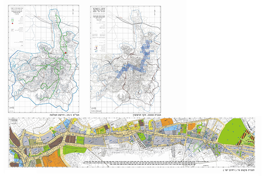
The plan defines the first light rail track line (the “Red Line”), including the locations of aboveground stations and the engineering facilities required to operate the light rail system. The red line connects the neighborhood of Pisgat Ze’ev in the north of the city, through the city center, the central bus station and the neighborhood of Beit Hakerem, to Mount Herzl. The total length of the line is about 14 kilometers and it represents the central pillar of the new public transport system, and the first one of the five mass transit lines planned in Jerusalem to be carried out.
The line is currently being extended to the neighborhood of Neve Yaakov in the north and through the neighborhood of Kiryat Yovel to the Ein Kerem “Hadassah” medical center in the south. The “Red Line” exceeded all expectations preceding its construction: it is used by 140,000 passengers every day, more than all the daily passengers of all other rail lines in Israel
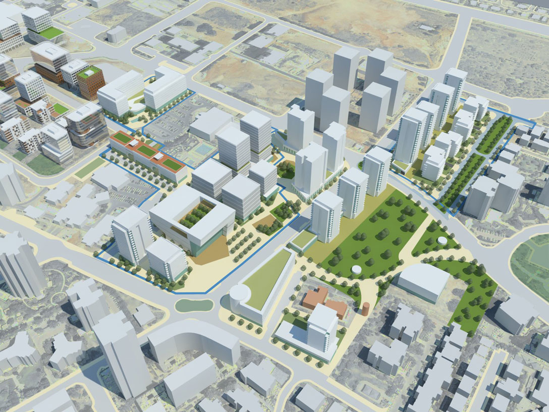
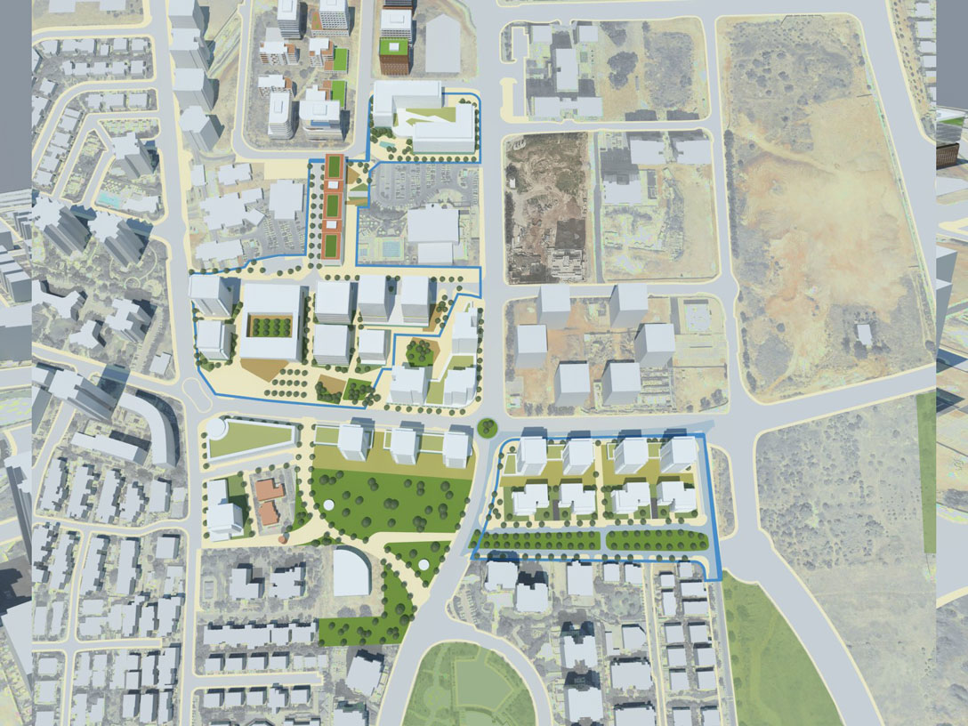
Ma’agalei Yavne compound in Gonenim, Jerusalem- urban renewal
Client: Ashdar construction company
Project Initiation: 2015
Location: Jerusalem
Project Area: 45 dunam
Status: Planning
Program: The program proposes 1,250 residential units in place of the 380 existing units. The program includes spaces for public use with an emphasis on the connectivity of the compound to the Railway Park and the surrounding neighborhoods
Planning Team: Ari Cohen, Yael Gold-Arad, Avi Lindenbaum
The feasibility study was conducted after the neighborhood’s residents (about 340 families) contacted a number of different construction companies with the request of preparing an urban renewal plan for the Ma’agalei Yavne compound. If this program comes to fruition, it will be one of the largest and most complicated urban renewal programs in Jerusalem.
The planning proposal must meet a variety of criteria: economic viability; implementation stages; the creation of a successful urban space; finding traffic solutions and meeting requests by the residents who are the clients.
The planning proposal aligns with the central tenets of the Gonenim neighborhood strategic plan. The plan suits and supports the changes expected in the neighborhood in the coming decades – densification, the introduction of a light rail system and development of the Gonenim and Railway parks. The plan proposal includes a mixed use compound with 1,250 residential units at different heights, from a school of 3-4 floors up until 30 story residential towers
 תצ"א לפני
The feasibility study was conducted after the neighborhood’s residents (about 340 families) contacted a number of different construction companies with the request of preparing an urban renewal plan for the Ma’agalei Yavne compound. If this program comes to fruition, it will be one of the largest and most complicated urban renewal programs in Jerusalem.
The planning proposal must meet a variety of criteria: economic viability; implementation stages; the creation of a successful urban space; finding traffic solutions and meeting requests by the residents who are the clients.
The planning proposal aligns with the central tenets of the Gonenim neighborhood strategic plan. The plan suits and supports the changes expected in the neighborhood in the coming decades – densification, the introduction of a light rail system and development of the Gonenim and Railway parks. The plan proposal includes a mixed use compound with 1,250 residential units at different heights, from a school of 3-4 floors up until 30 story residential towers
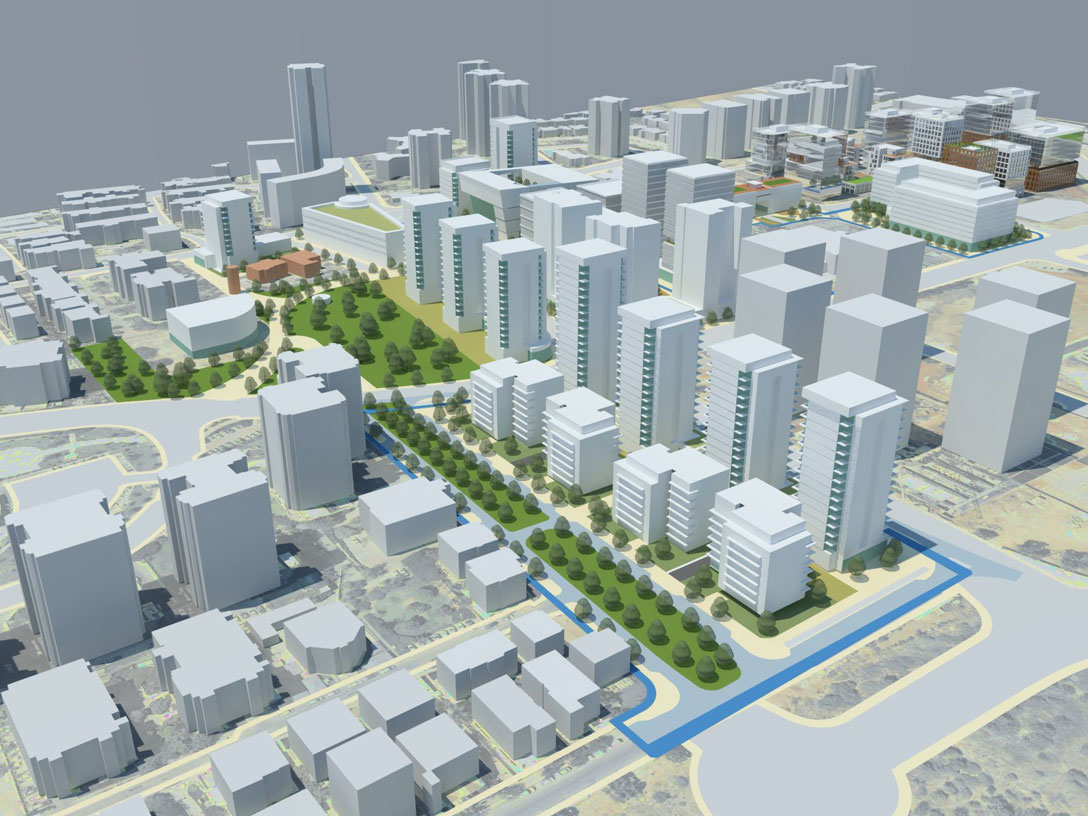
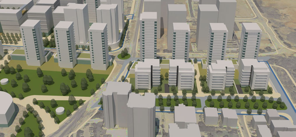
HaNurit Street, Jerusalem- urban renewal
Client: Jerusalem Municipality, Moriah Jerusalem Development Corporation
Project Initiation: 2015
Location: Jerusalem
Project Area: 75 dunam
Status: Approved
Program: The program proposes 1,700 residential units in place of the 650 existing units
Planning Team: Ari Cohen, Yael Gold, Avi Lindenbaum
Project Initiation: 2015
Location: Jerusalem
Project Area: 75 dunam
Status: Approved
Program: The program proposes 1,700 residential units in place of the 650 existing units
Planning Team: Ari Cohen, Yael Gold, Avi Lindenbaum
The feasibility study was commissioned in accordance with the municipal policy, as set out in the Yuvalim-Ganim Strategic Plan, that defines the Nurit area as an area slated for urban regeneration.
The planning proposal must meet a variety of criteria: economic viability; implementation stages; the creation of a successful urban space and finding traffic solutions.
The plan deals with a compound in a very poor state of maintenance – one of the worst in the city. Alongside the desire to renew and improve the quality of life for the residents, the program must meet economic viability standards. The balance between these requirements is expressed in the plan proposal, which proposes high-rise buildings with significant and continuous open spaces between buildings. In this program, the first in Jerusalem, the possibility of using complementary land is being examined in order to contribute to the reduction of future residential density in the compound
 מבט על
The feasibility study was commissioned in accordance with the municipal policy, as set out in the Yuvalim-Ganim Strategic Plan, that defines the Nurit area as an area slated for urban regeneration.
The planning proposal must meet a variety of criteria: economic viability; implementation stages; the creation of a successful urban space and finding traffic solutions.
The plan deals with a compound in a very poor state of maintenance – one of the worst in the city. Alongside the desire to renew and improve the quality of life for the residents, the program must meet economic viability standards. The balance between these requirements is expressed in the plan proposal, which proposes high-rise buildings with significant and continuous open spaces between buildings. In this program, the first in Jerusalem, the possibility of using complementary land is being examined in order to contribute to the reduction of future residential density in the compound
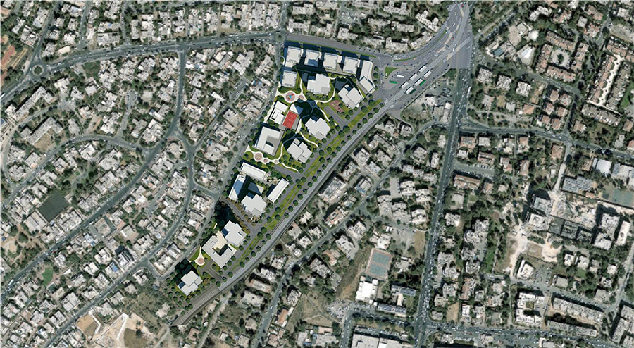
Tel Aviv- housing mix, tool to assist teams’ work
Client: Tel-Aviv-Yafo municipality
Project Initiation: 2015
Location: Tel-Aviv
Project Area: The entire city
Status: Approved
Program: Creating a municipal housing mix policy, accompanied by dynamic tools for updating this policy as dependent upon four variables: 1. Existing and anticipated population composition; 2. Existing housing stock; 3. Inventory of approved plans; 4. Objectives of Master Plan TA/5000
Planning Team: Head of the planning team: Dr. Chaim Fialkoff; Architects: Ari Cohen, Avi Lindenbaum
A policy paper prepared for the Tel-Aviv-Yafo municipality applying to the entire city. The document was prepared as a continuation of Master Plan TA/5000 in order to create and/or preserve diverse housing mixes throughout the city, to help realize the city’s policies, including encouraging urban renewal processes in the existing urban fabric and informed development of new residential areas
 דוח סופי-עמוד השער
A policy paper prepared for the Tel-Aviv-Yafo municipality applying to the entire city. The document was prepared as a continuation of Master Plan TA/5000 in order to create and/or preserve diverse housing mixes throughout the city, to help realize the city’s policies, including encouraging urban renewal processes in the existing urban fabric and informed development of new residential areas
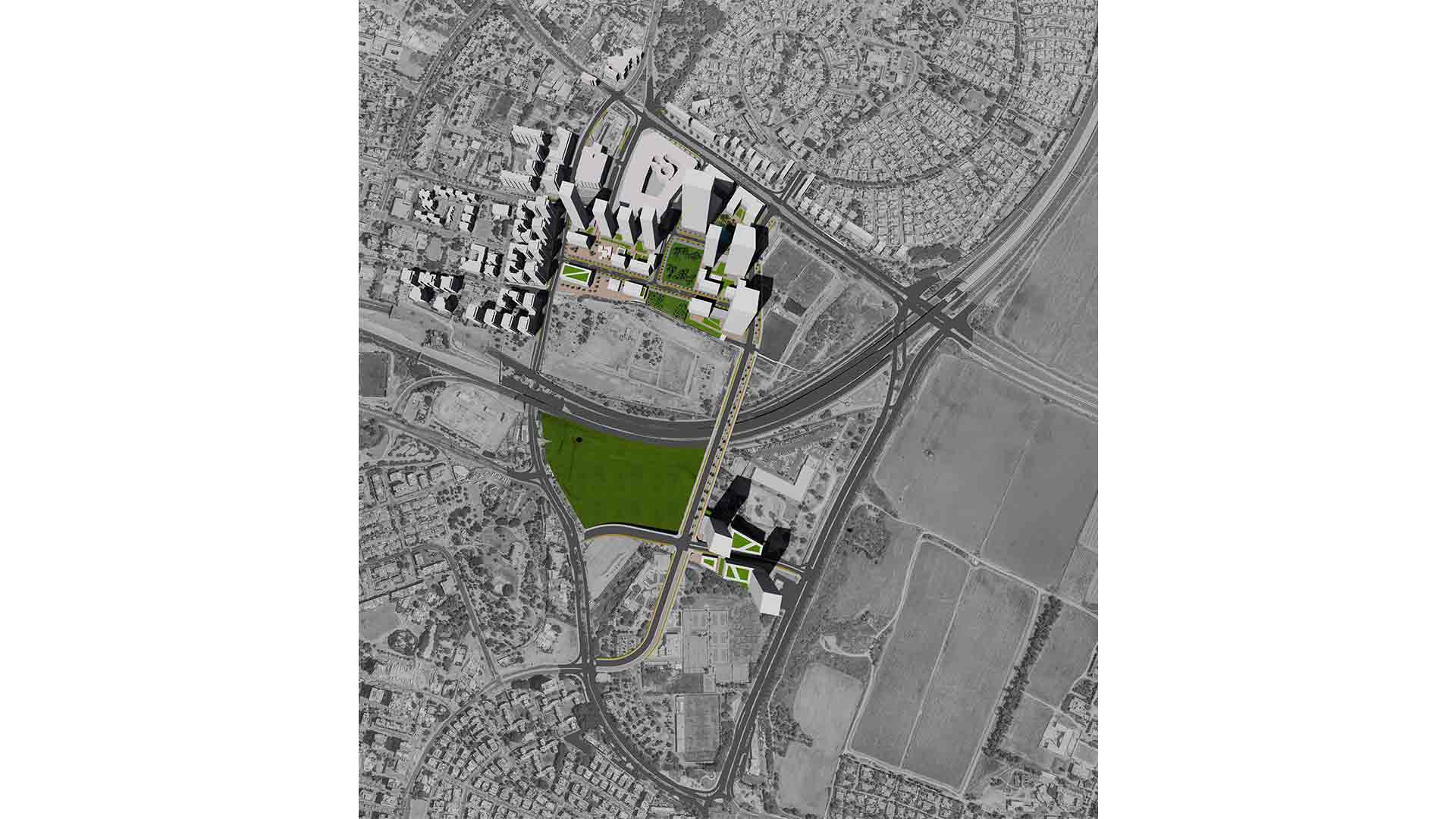
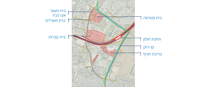
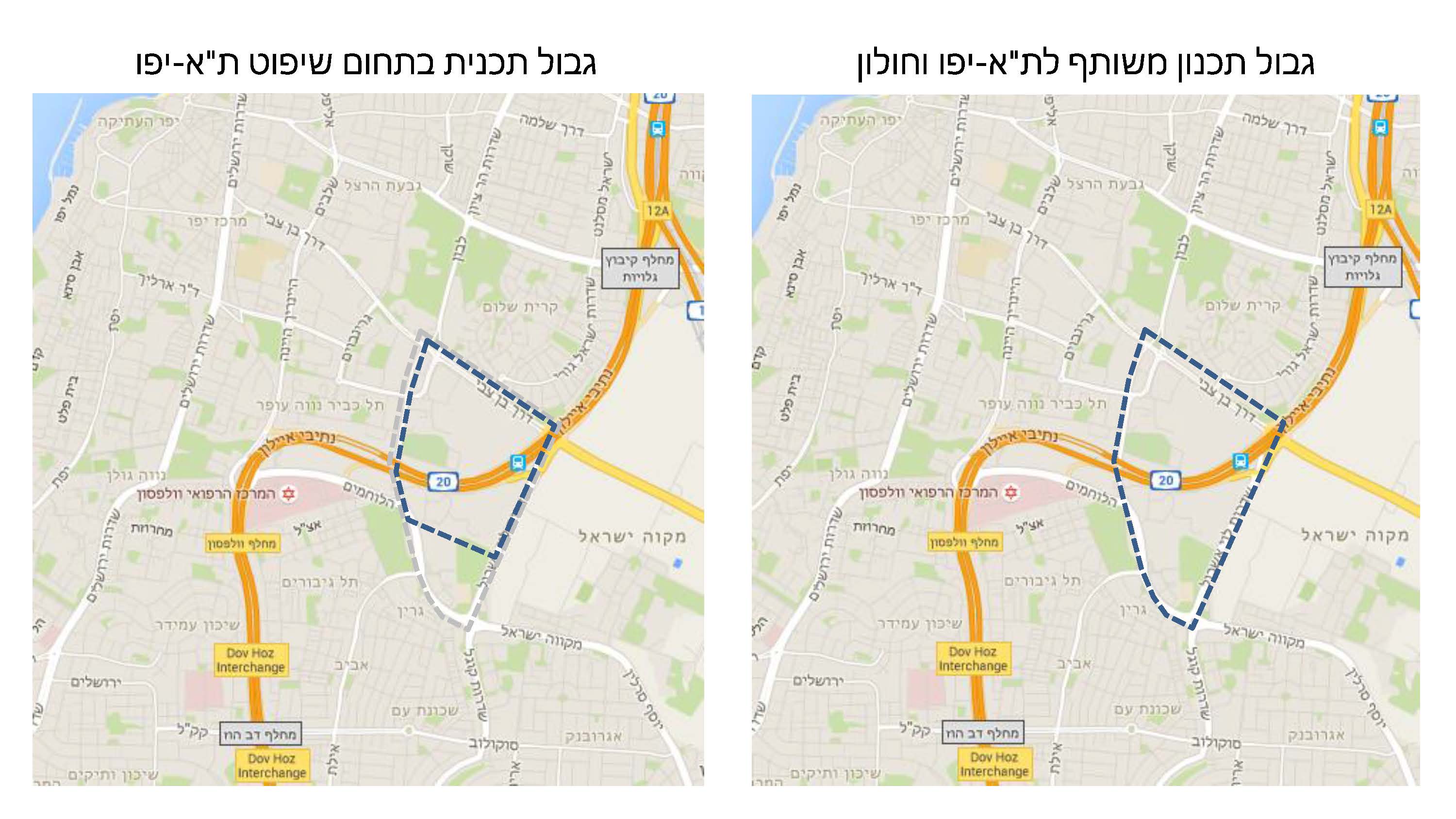
Ben Tzvi CBD
Client: Tel Aviv-Jafo Municipality
Project Initiation: 2015
Location: Tel-Aviv, Holon
Project Area: 610 dunam in Tel Aviv jurisdictional area and 185 more dunam in Holon jurisdictional area
Status: Planning
Program: 1.3 square meters built area, including a 30,000 seat stadium, a transportation center and marketable lots for mixed uses: commercial, residential, employment, public facilities and open spaces. The transportation center will include a train station, 3 light rail stations, buses and private vehicles, partially covered and with a new (additional) bridge above the Ayalon highway between Holon and Tel Aviv
Planning Team: Ari Cohen, Avi Lindenbaum, Tal Diller-Orenstein, Einav Yagel
The Ben Tzvi CBD plan is located on the border of Tel Aviv and Holon, between Ben Tzvi Boulevard to the north, Mikve Israel to the east, Kugel Square to the south and HaLochamim Street to the west. The area is currently largely vacant, close to existing and planned mass transit systems and serves as a land reserve for a metropolitan employment center.
The plan proposes a vision based on a metropolitan, rather than only a municipal, perception of the area. The plan provides solutions to benefit future users, regardless of jurisdictional or other borders.
In order to enable the proposed development, the plan suggests moving three large compounds to alternative sites: the Holon Country Club, the DMV and the Tel Aviv municipality logistics complex. Alongside the proposed development, the plan conserves local nature values, together with an existing Muslim cemetery and two historical ‘Well Houses’ within the plan limits
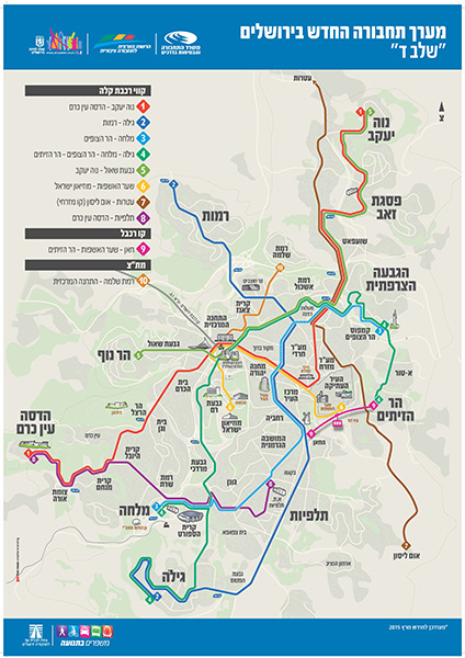
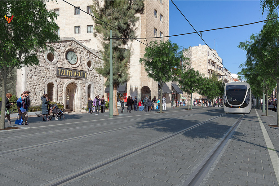
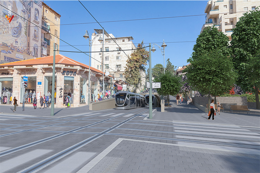
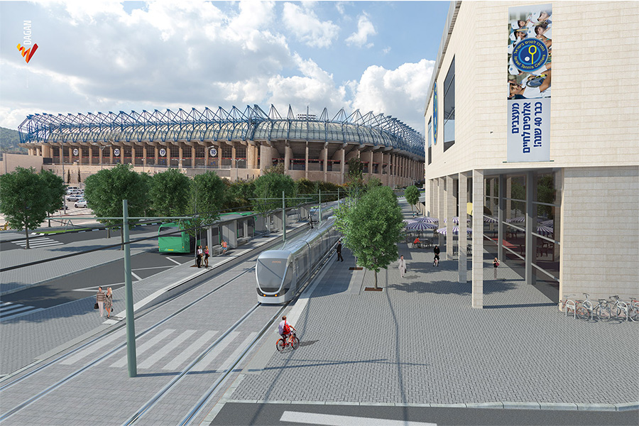
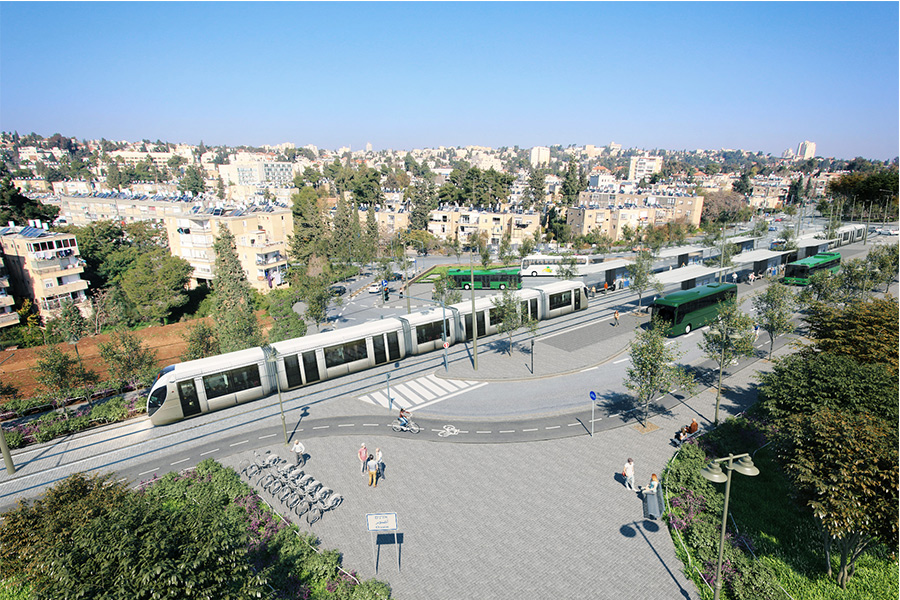
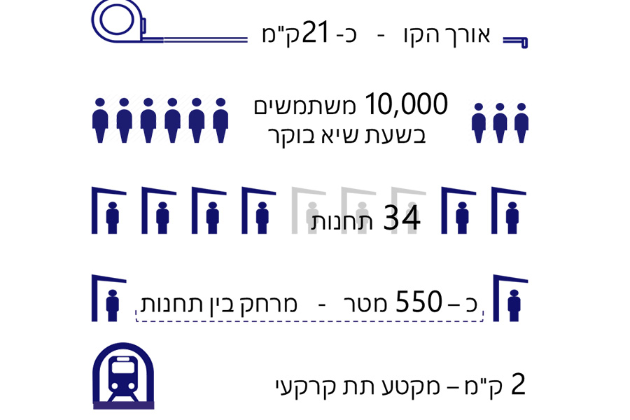
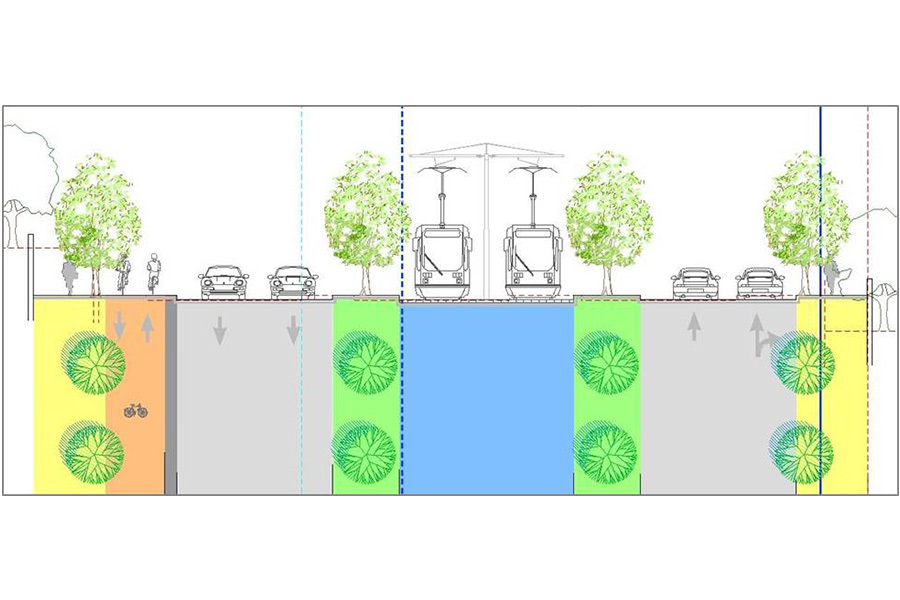
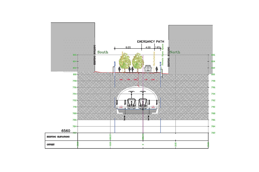
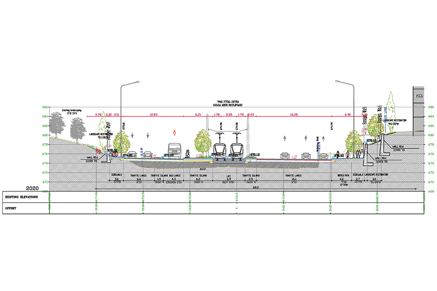
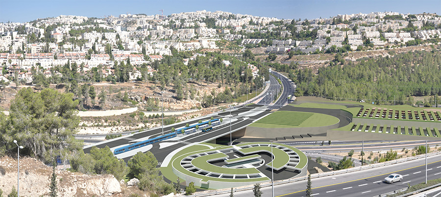
Light Rail, Jerusalem- “Blue Line” plan
Client: Jerusalem Transport Master Plan Team, DEL Group
Project Initiation: 2012
Location: Jerusalem, from Ramot in the north to Malha and Gilo in the south
Project Area: 1,250 dunam
Status: Approved
Program: 21 kilometers of railway tracks, of them 2 kilometers underground; 34 stations, of them 3 underground; parking lots and engineering facilities to enable the functioning of the light rail systems. Development, road upgrades and improved access in the public sphere
Planning Team: Ari Cohen, Eti Efrati-Arieh, Avi Lindenbaum, Amiya Michaeli Menashe, Shirit Fink-Glassner, Tomer Rabinowitz, Miriam Brody Choueka, Tzlil Attias
The Blue Line of the Jerusalem light rail is part of the city’s urban transport system. The plan defines the Blue Line’s light rail track, including the locations of aboveground and underground stations and the engineering facilities required to operate the light rail system. The line will connect the neighborhood of Ramot, in the north, to the city center, and from there the line continues on two different routes that connect the center to the southern neighborhoods of Malha and Gilo. The Blue Line has a few interfaces with other light rail lines (Red and Green), with a complementary bus system and with private vehicles via Park and Ride lots. All these will enable the Blue Line to improve the public transport service in Jerusalem
 רחוב קינג ג'ורג', הדמיה- מור דגן

The Blue Line of the Jerusalem light rail is part of the city’s urban transport system. The plan defines the Blue Line’s light rail track, including the locations of aboveground and underground stations and the engineering facilities required to operate the light rail system. The line will connect the neighborhood of Ramot, in the north, to the city center, and from there the line continues on two different routes that connect the center to the southern neighborhoods of Malha and Gilo. The Blue Line has a few interfaces with other light rail lines (Red and Green), with a complementary bus system and with private vehicles via Park and Ride lots. All these will enable the Blue Line to improve the public transport service in Jerusalem
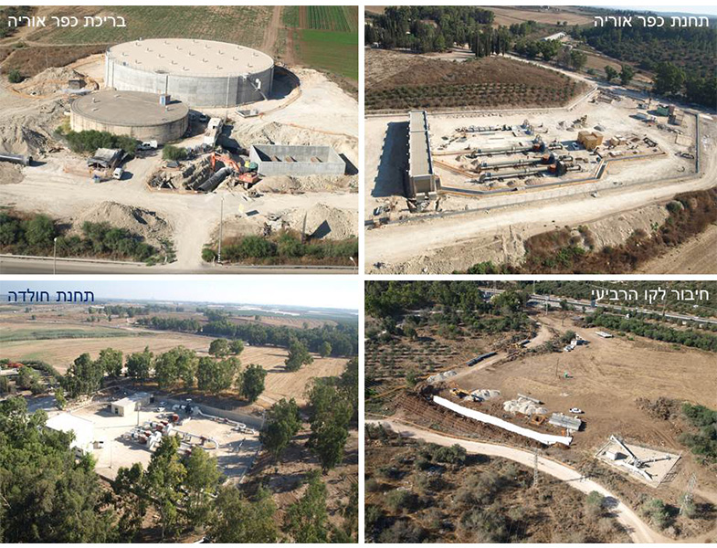
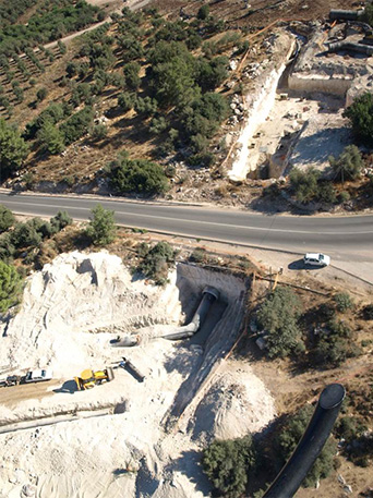
Fifth water line to Jerusalem
Client: Mekorot
Project Initiation: 2007
Location: Mateh Yehuda regional council, Gezer regional council, Jerusalem
Project Area: 1,400 dunam (western section), 930 dunam (eastern section)
Status: Approved
Program: A water system including a 2.5 meter diameter pipeline, pools, pumping stations, power facilities and more
Planning Team: Ari Cohen, Eti Efrati-Arieh, Avi Lindenbaum
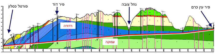
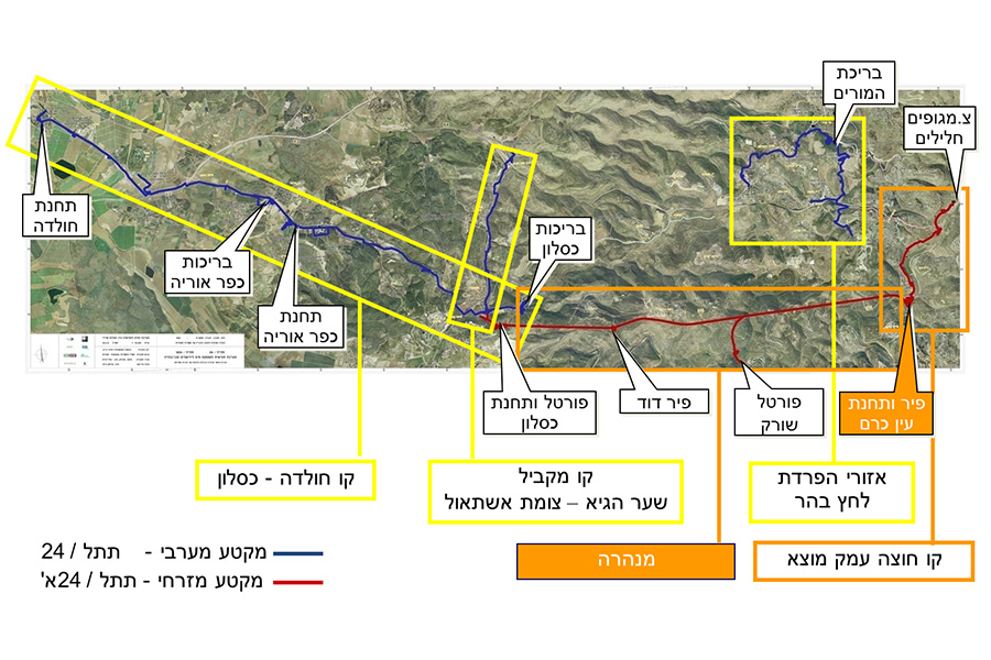
The fifth water system will meet the water consumption needs of Jerusalem and the surrounding hill areas for the years 2015-2065.
Due to the complexity of the project, its scope and geographic reach, the project was divided into two statutory plans: National Infrastructure Plan 24 (the western section) and NIP 24/A (the eastern section).
The fifth water line connects Jerusalem to the national water carrier for the first time. The water line connects to the national water system at the west Hulda intersection, then proceeds east until Shimshon intersection, after which it enters a tunnel 300 meters underground, then ending at the Ein Kerem dam.
The project is one of the largest and most complex in the water sector in recent years. The total cost is estimated at $ 2.5 billion
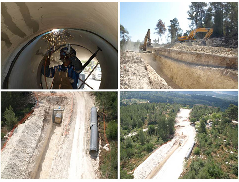 הנחת קו המים. צילום- באדיבות חב' מקורות
The fifth water system will meet the water consumption needs of Jerusalem and the surrounding hill areas for the years 2015-2065.
Due to the complexity of the project, its scope and geographic reach, the project was divided into two statutory plans: National Infrastructure Plan 24 (the western section) and NIP 24/A (the eastern section).
The fifth water line connects Jerusalem to the national water carrier for the first time. The water line connects to the national water system at the west Hulda intersection, then proceeds east until Shimshon intersection, after which it enters a tunnel 300 meters underground, then ending at the Ein Kerem dam.
The project is one of the largest and most complex in the water sector in recent years. The total cost is estimated at $ 2.5 billion
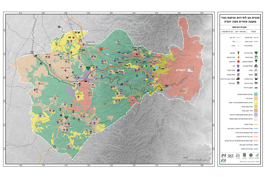
Mateh Yehuda Regional Council- Tourism and Rural Development Master Plan
Client: Mateh Yehuda Regional Council
Project Initiation: 2010
Location: Mateh Yehuda Regional Council
Project Area: 520 square kilometers
Status: Approved
Program: The plan addresses the entire regional council area – the open spaces and 56 different settlements (communal villages, kibbutzim and moshavim). The plan provides tools for developing the tourism resource, from the lone developer (per land parcel), to the settlement and council level
Planning Team: Ari Cohen, Avi Lindenbaum
In partnership with: TIK Projects
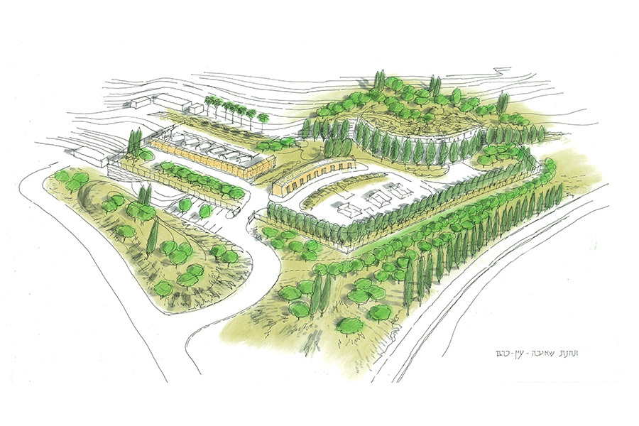
The purpose of the master plan is to position the Mateh Yehuda council on the tourist map of Israel as “The Green Heart” – a tourism, leisure and recreational area in the Jerusalem Tel Aviv inter-metropolitan area. Tourism will serve as a lever to strengthen the local economy, as a tool for conservation of open spaces and agricultural activities, and as a source of identity and belonging for residents of the rural communities. The program covers various aspects of the tourism industry: beginning with the open areas, through natural, archeological and historical attractions and including settlement development, business foundations, construction on rural land parcels and more
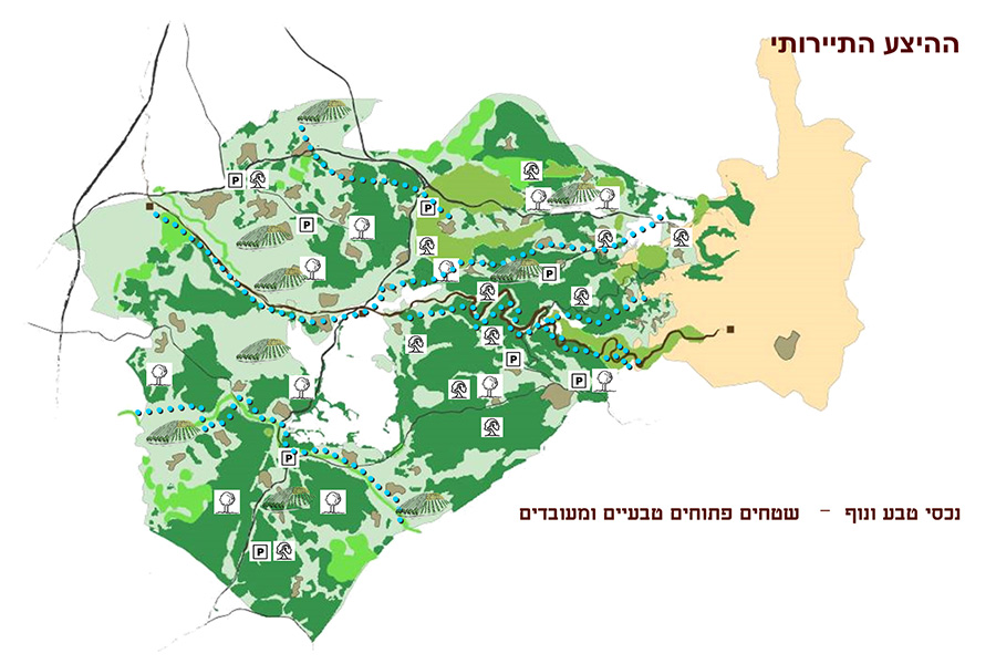 היצע תיירותי-שטחים פתוחים
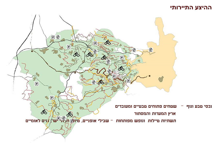
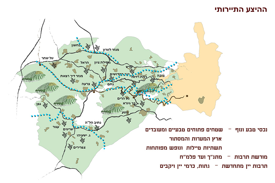
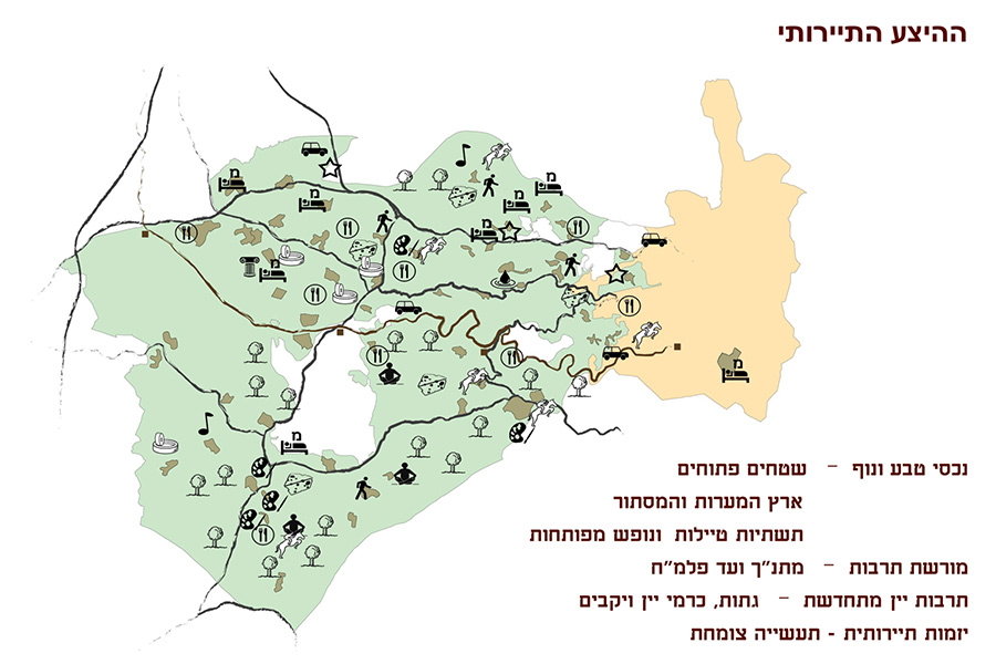
The purpose of the master plan is to position the Mateh Yehuda council on the tourist map of Israel as “The Green Heart” – a tourism, leisure and recreational area in the Jerusalem Tel Aviv inter-metropolitan area. Tourism will serve as a lever to strengthen the local economy, as a tool for conservation of open spaces and agricultural activities, and as a source of identity and belonging for residents of the rural communities. The program covers various aspects of the tourism industry: beginning with the open areas, through natural, archeological and historical attractions and including settlement development, business foundations, construction on rural land parcels and more
Abu Karinat- Neighborhood 5
Client: The Bedouin Development Authority, Ehud Tayar, Ltd.
Project Initiation: 2015
Location: Abu Karinat
Project Area: 200 dunam
Status: Approved
Program: About 90 residential units
Planning Team: Ari Cohen, Yaara Rosner-Manor, Tzlil Attias, Amir Elisha
Project Initiation: 2015
Location: Abu Karinat
Project Area: 200 dunam
Status: Approved
Program: About 90 residential units
Planning Team: Ari Cohen, Yaara Rosner-Manor, Tzlil Attias, Amir Elisha
The planned area is within the village of Abu-Karinat, belonging to the Neve Midbar regional council. The purpose of the plan is to regulate the existing Bedouin settlement currently situated in an area designated as an employment center. The plan proposes to transfer the existing population to a new residential neighborhood within the area of the settlement, accompanied by a public participation process. The settlement’s residents were full partners throughout the entire planning process, from the program formulation up to the design of a general road network, the allocation of public lands and the distribution of residential lots appropriately according to the divisions of the subgroups within the population, for the current generation and for two generations forward
 תחום תכנון מבוקש על-ידי תושבים
The planned area is within the village of Abu-Karinat, belonging to the Neve Midbar regional council. The purpose of the plan is to regulate the existing Bedouin settlement currently situated in an area designated as an employment center. The plan proposes to transfer the existing population to a new residential neighborhood within the area of the settlement, accompanied by a public participation process. The settlement’s residents were full partners throughout the entire planning process, from the program formulation up to the design of a general road network, the allocation of public lands and the distribution of residential lots appropriately according to the divisions of the subgroups within the population, for the current generation and for two generations forward
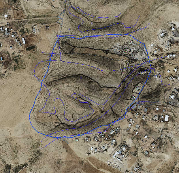
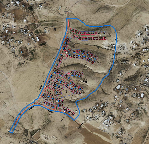
Ar’ara- Dimona Region- feasibility study for settlement regulation
Client: הרשות לפיתוח והתיישבות הבדואים בנגב, אהוד תייר בע"מ
Project Initiation: 2013
Location: ערערה בנגב, צפונית לדימונה
Project Area: 320,000 דונם
Status: מאושר
Planning Team: ארי כהן, יערה רוזנר-מנור, מור קרסט, ליאורה חמי
Project Initiation: 2013
Location: ערערה בנגב, צפונית לדימונה
Project Area: 320,000 דונם
Status: מאושר
Planning Team: ארי כהן, יערה רוזנר-מנור, מור קרסט, ליאורה חמי
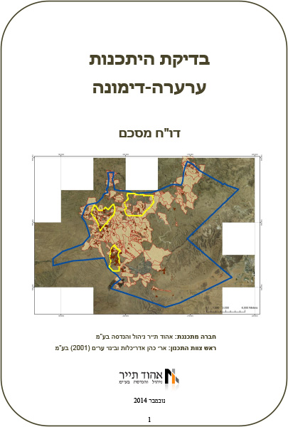 דף שער-דו"ח מסכם
Kseifeh- additional building rights
Client: Bedouin Development Authority
Project Initiation: 2015
Location: Kseifeh
Project Area: 2,100 dunam
Status: Approved
Program: Nominal capacity of 4,000 residential units
Planning Team: Ari Cohen, Mor Kertes, Amir Elisha
Project Initiation: 2015
Location: Kseifeh
Project Area: 2,100 dunam
Status: Approved
Program: Nominal capacity of 4,000 residential units
Planning Team: Ari Cohen, Mor Kertes, Amir Elisha
The populated neighborhoods of the Kseifeh local council are characterized by relatively large plots with limited building rights. This fact, along with the growing housing shortage in the town, led to the initiation of this plan for additional building rights in existing plots. The planning process included an examination of the carrying capacity of the typical plots (land cover, lot lines, parking solutions, etc.) as well as the carrying capacity of the entire town in terms of infrastructure, public buildings and open spaces. Accordingly, the plan set a maximum density for the plots relative to their size and to the additional housing units to the entire town, as well as implementation stages and infrastructure upgrades
 טיפוסי בינוי
The populated neighborhoods of the Kseifeh local council are characterized by relatively large plots with limited building rights. This fact, along with the growing housing shortage in the town, led to the initiation of this plan for additional building rights in existing plots. The planning process included an examination of the carrying capacity of the typical plots (land cover, lot lines, parking solutions, etc.) as well as the carrying capacity of the entire town in terms of infrastructure, public buildings and open spaces. Accordingly, the plan set a maximum density for the plots relative to their size and to the additional housing units to the entire town, as well as implementation stages and infrastructure upgrades
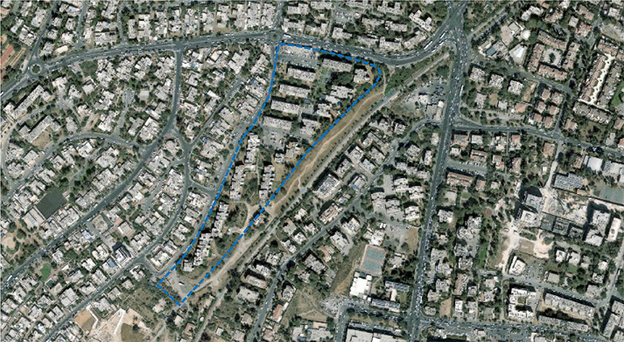
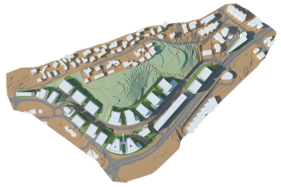
Ramot Slopes, Jerusalem
Client: Israel Land Authority
Project Initiation: 2014
Location: The neighborhood of Ramot in Jerusalem
Project Area: 419 dunam
Status: In approval process
Program: 1,435 residential units, 240 assisted living units
Planning Team: Ari Cohen, Ariel Sharabi, Amir Elisha
Project Initiation: 2014
Location: The neighborhood of Ramot in Jerusalem
Project Area: 419 dunam
Status: In approval process
Program: 1,435 residential units, 240 assisted living units
Planning Team: Ari Cohen, Ariel Sharabi, Amir Elisha
The plan is located in an area of high landscape and environmental sensitivity and is adjacent to an existing residential neighborhood. Both these parameters are the main components in creating the planning concept and formulating the plan itself. The plan emphasizes development contiguous to the existing neighborhood, in a manner that minimizes damage to open areas and to the wildlife in the planning area and its immediate surroundings. Another emphasis was put on specific reference to adjacent residences and limiting the heights of new buildings in order to reduce friction as much as possible. A new trails and roads system will link the existing neighborhood of Ramot through the new neighborhood to Emek Ha’arazim Park and the Mitzpe Naftoach hilltop to the west
 התמצאות
The plan is located in an area of high landscape and environmental sensitivity and is adjacent to an existing residential neighborhood. Both these parameters are the main components in creating the planning concept and formulating the plan itself. The plan emphasizes development contiguous to the existing neighborhood, in a manner that minimizes damage to open areas and to the wildlife in the planning area and its immediate surroundings. Another emphasis was put on specific reference to adjacent residences and limiting the heights of new buildings in order to reduce friction as much as possible. A new trails and roads system will link the existing neighborhood of Ramot through the new neighborhood to Emek Ha’arazim Park and the Mitzpe Naftoach hilltop to the west
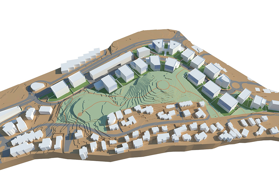
Country club compound, Ramot, Jerusalem
Client: Israel Land Authority
Project Initiation: 2016
Location: The Ramot neighborhood of Jerusalem
Project Area: 42 dunam
Status: Approved
Program: 195 residential units
Planning Team: Ari Cohen, Michael Wind, Tzlil Atias, Amir Elisha
Project Initiation: 2016
Location: The Ramot neighborhood of Jerusalem
Project Area: 42 dunam
Status: Approved
Program: 195 residential units
Planning Team: Ari Cohen, Michael Wind, Tzlil Atias, Amir Elisha
This plan is located at the edge of the Ramot neighborhood of Jerusalem, on an area that had been designated as land for a country club. With the establishment of a large sports compound as part of the development of Emek Ha’arazim Park, there is no longer a need for a country club in the neighborhood, so the Jerusalem municipality and state authorities initiated a plan to change the land use to a residential neighborhood. The plan proposes completing the urban fabric of adjacent plans that are in advanced stages of detailed design and construction, and designates an area for a neighborhood park and public buildings in its center, as well as a 9 dunam plot for a swimming pool. The planning area is characterized by steep inclines, reaching up to 40%
 התמצאות

This plan is located at the edge of the Ramot neighborhood of Jerusalem, on an area that had been designated as land for a country club. With the establishment of a large sports compound as part of the development of Emek Ha’arazim Park, there is no longer a need for a country club in the neighborhood, so the Jerusalem municipality and state authorities initiated a plan to change the land use to a residential neighborhood. The plan proposes completing the urban fabric of adjacent plans that are in advanced stages of detailed design and construction, and designates an area for a neighborhood park and public buildings in its center, as well as a 9 dunam plot for a swimming pool. The planning area is characterized by steep inclines, reaching up to 40%
Ar’ara in the Negev- Neighborhood 11
Client: Bedouin Development Authority, Ehud Tayar Ltd.
Project Initiation: 2016
Location: The northwestern area of Ar'ara in the Negev
Project Area: 390 dunam
Status: Approved
Program: 650 residential units
Planning Team: Ari Cohen, Ariel Sharabi, Amir Elisha
Project Initiation: 2016
Location: The northwestern area of Ar'ara in the Negev
Project Area: 390 dunam
Status: Approved
Program: 650 residential units
Planning Team: Ari Cohen, Ariel Sharabi, Amir Elisha
The plan is located on state-owned land at the entrance to Ar’ara in the Negev, as a contiguous development of adjacent existing neighborhoods. The plan proposes a diverse mix of residential lots with a density ranging from 4 to 12 units per dunam. The housing mix will be suitable both for meeting demand generated by natural growth of the existing population as well as emerging trends in Bedouin society favoring higher living densities
 התמצאות
The plan is located on state-owned land at the entrance to Ar’ara in the Negev, as a contiguous development of adjacent existing neighborhoods. The plan proposes a diverse mix of residential lots with a density ranging from 4 to 12 units per dunam. The housing mix will be suitable both for meeting demand generated by natural growth of the existing population as well as emerging trends in Bedouin society favoring higher living densities
Kiryat Park Lachish, Ashdod
Client: Israel Land Authority
Project Initiation: 2016
Location: The city of Ashdod- north
Project Area: 650 dunam
Status: Approved
Program: 3,000 residential units, a 100-dunam sports city and a 150 dunam river park
Planning Team: Ari Cohen, Ella Zilberfarb-Ben Ezra, Amir Elisha
Project Initiation: 2016
Location: The city of Ashdod- north
Project Area: 650 dunam
Status: Approved
Program: 3,000 residential units, a 100-dunam sports city and a 150 dunam river park
Planning Team: Ari Cohen, Ella Zilberfarb-Ben Ezra, Amir Elisha
This plan is located in the northern part of the city of Ashdod and includes a diverse program of urban-level uses. The proximity of the plan to the steadily-flowing section of the Lachish River provides an opportunity to create a continuous border along the whole length of a significant and large-scale park, while creating a public framework for a new neighborhood that will serve as an entrance gate to the park and link to the existing city. The sports city in the northern part of the plan will serve as an active urban district throughout the day, including hubs of commercial, employment and recreational activity for all age and population groups
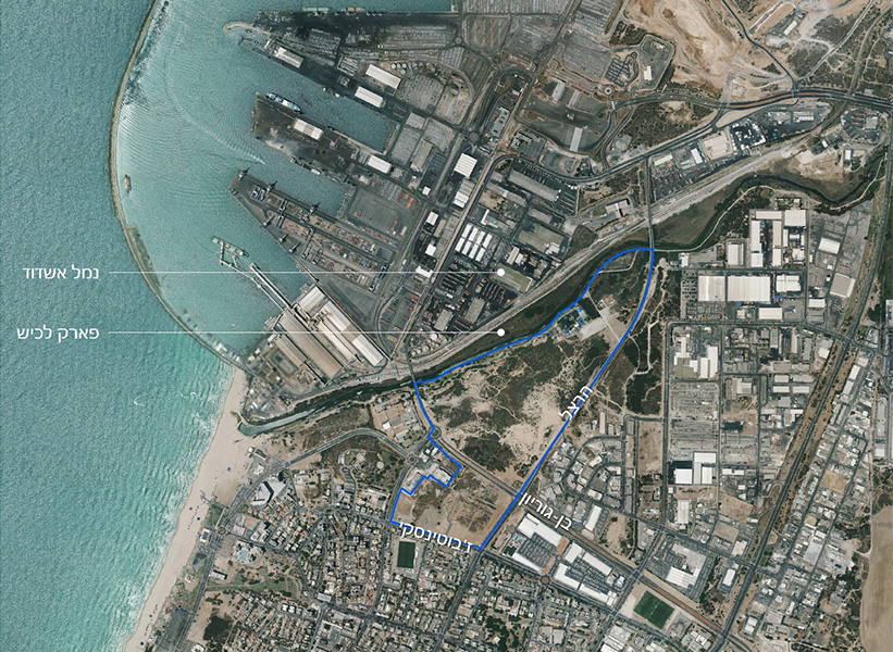 התמצאות
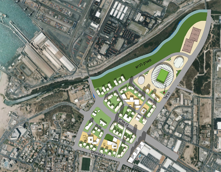
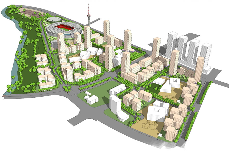
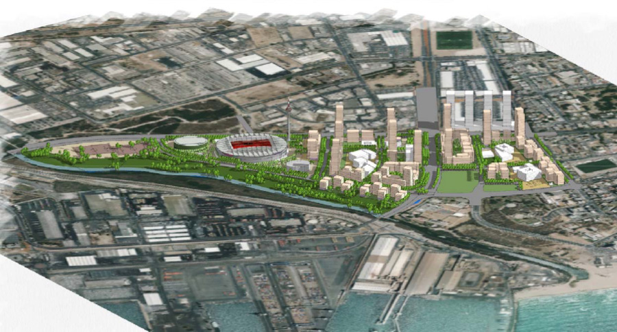
This plan is located in the northern part of the city of Ashdod and includes a diverse program of urban-level uses. The proximity of the plan to the steadily-flowing section of the Lachish River provides an opportunity to create a continuous border along the whole length of a significant and large-scale park, while creating a public framework for a new neighborhood that will serve as an entrance gate to the park and link to the existing city. The sports city in the northern part of the plan will serve as an active urban district throughout the day, including hubs of commercial, employment and recreational activity for all age and population groups
Ar’ara in the Negev- additional building rights
Ar’ara in the Negev- Neighborhoods 13
Ar’ara in the Negev- Neighborhood 12
Status: בהליכי אישור
Planning Team: אריאל שרעבי, אמיר אלישע
Planning Team: אריאל שרעבי, אמיר אלישע
Julis Camp, Be’er Tuvia/Shafir Regional Council
Ar’ara in the Negev-neighborhood 10
Client: Bedouin Development Authority, Ehud Tayar Ltd.
Project Initiation: 2015
Location: The Bedouin Development and Settlement Authority, Ehud Tayar Ltd.
Project Area: 970 dunam
Status: Approval
Program: 1,400 residential units
Planning Team: Ari Cohen, Avi Lindenbaum, Ariel Sharabi, Amir Elisha
Project Initiation: 2015
Location: The Bedouin Development and Settlement Authority, Ehud Tayar Ltd.
Project Area: 970 dunam
Status: Approval
Program: 1,400 residential units
Planning Team: Ari Cohen, Avi Lindenbaum, Ariel Sharabi, Amir Elisha
State-owned lands are a rare commodity in some of the Bedouin communities in the Negev, and in many cases their absence acts as a barrier to development and to the ability to respond to the population’s natural growth. District 10 (Lot 700) is the last significant state-owned land division in the town of Ar’ara in the Negev, hence the irregular shape of the planning area. During the planning process a wide mix of housing was examined, to find the balance that would use the land resources most efficiently on one hand, and would suit the housing and residential patterns of the plan’s target audience on the other. The bulk of the residential lots are intended to meet demand generated by the natural growth of the existing community, with a small portion designated for families living in homesteads north of the town. These families were included in a participatory process which helped adjust the program to the unique needs of the group
 שטח התכנית

State-owned lands are a rare commodity in some of the Bedouin communities in the Negev, and in many cases their absence acts as a barrier to development and to the ability to respond to the population’s natural growth. District 10 (Lot 700) is the last significant state-owned land division in the town of Ar’ara in the Negev, hence the irregular shape of the planning area. During the planning process a wide mix of housing was examined, to find the balance that would use the land resources most efficiently on one hand, and would suit the housing and residential patterns of the plan’s target audience on the other. The bulk of the residential lots are intended to meet demand generated by the natural growth of the existing community, with a small portion designated for families living in homesteads north of the town. These families were included in a participatory process which helped adjust the program to the unique needs of the group
Isawiya, Jerusalem- Detailed Master Plan
Client: The Jerusalem municipality
Project Initiation: 2015
Location: East Jerusalem
Project Area: 1,050 dunam
Status: In approval process
Program: Residential, commercial and employment uses, as well as local public use facilities
Planning Team: Ari Cohen, Miriam Brody-Choueka, Amir Elisha, Ismail Salah
In partnership with: Dr. Chaim Fialkoff, Osnat Post and the IPCC
This project is a proposed master plan for the entire neighborhood of Isawiya in east Jerusalem. The planning environment in this case is an informal environment, where urban development occurred almost organically over the years, except for a basic road system. The plan proposes a mechanism combining two planning levels. The first is a one-stage level including strengthening the road system and the public transportation system and locating land for large public institutions and central parks as well as housing. The second level is a dual-stage planning process in existing residential areas which includes determining provisions for preparing building plans with local approval authority (as part of the building permit application process) and allocating land for public use according to a division to compounds based on geographic characteristics and family affiliation. The plan is based on a survey of existing construction and population, conducted by the planning team, leaning on multiple sources and cross-referenced data, aerial photo analysis and field surveys. The planning process is carried out with public participation of the neighborhood residents, while adjusting the planning output to their needs as well as the needs of the city at large
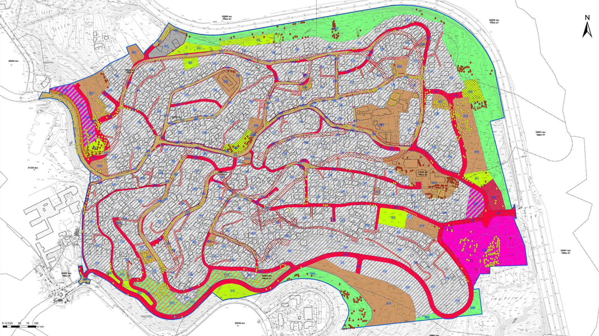 תשריט
תשריט
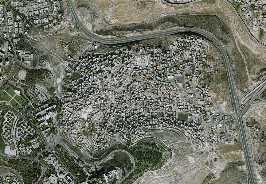
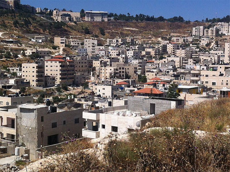
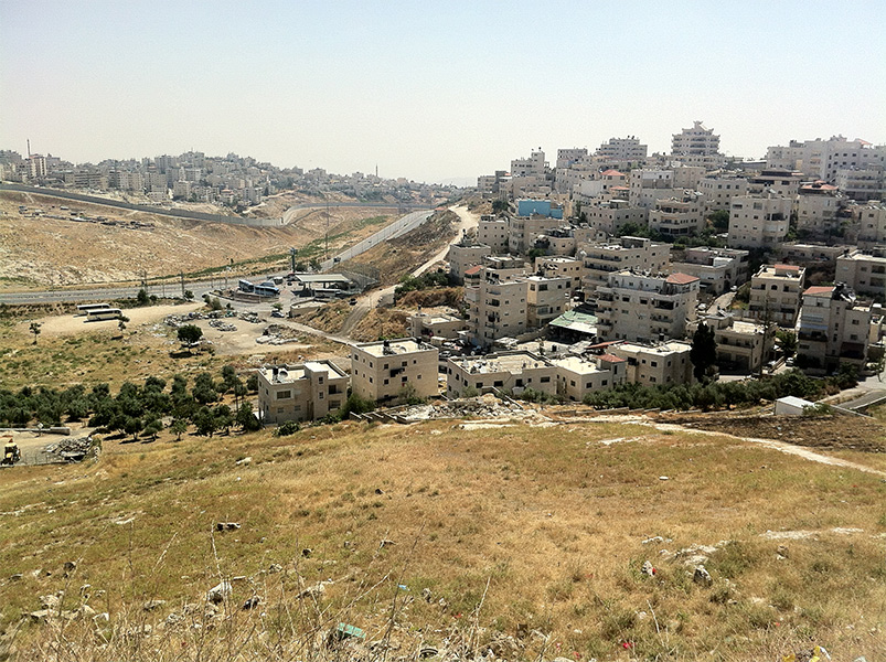
This project is a proposed master plan for the entire neighborhood of Isawiya in east Jerusalem. The planning environment in this case is an informal environment, where urban development occurred almost organically over the years, except for a basic road system. The plan proposes a mechanism combining two planning levels. The first is a one-stage level including strengthening the road system and the public transportation system and locating land for large public institutions and central parks as well as housing. The second level is a dual-stage planning process in existing residential areas which includes determining provisions for preparing building plans with local approval authority (as part of the building permit application process) and allocating land for public use according to a division to compounds based on geographic characteristics and family affiliation. The plan is based on a survey of existing construction and population, conducted by the planning team, leaning on multiple sources and cross-referenced data, aerial photo analysis and field surveys. The planning process is carried out with public participation of the neighborhood residents, while adjusting the planning output to their needs as well as the needs of the city at large
Mateh Yehuda Regional Council- Master Plan
Client: Mateh Yehuda Regional Council
Project Initiation: 2012
Location: All of Mateh Yehuda Regional Council
Project Area: 480,000 dunam
Status: Planning
Planning Team: Ari Cohen, Eti Efrati-Arieh, Miriam Brody-Choueka, Sharon Matar, Amir Elisha
In partnership with: TIK Projects
Project Initiation: 2012
Location: All of Mateh Yehuda Regional Council
Project Area: 480,000 dunam
Status: Planning
Planning Team: Ari Cohen, Eti Efrati-Arieh, Miriam Brody-Choueka, Sharon Matar, Amir Elisha
In partnership with: TIK Projects
The comprehensive master plan of Mateh Yehuda Regional Council is a pioneering model for comprehensive master plans for regional councils throughout the country. The plan is being prepared according to the Council’s strategic vision to lead and encourage agricultural-rural-tourism initiatives, while defining the relationship between the open areas and the development centers. The planning process is being carried out in practice on two levels of detail: Planning 57 communities in the area of the Council while defining residential unit capacity, communal public needs, rural tourism and employment, as well as planning the open areas outside the boundaries of the settlements, the majority of which have high scenic and environmental values and are protected by various national master plans (forests, nature reserves, national parks, etc.). In spite of the differing levels of detail and areas of concern, the master plan will serve as a holistic document, outlining the development and conservation directions of the regional council for years to come, both within and outside the different settlements of the regional council
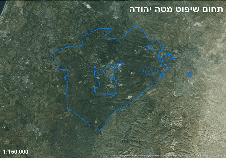 תחום שיפוט מטה יהודה
The comprehensive master plan of Mateh Yehuda Regional Council is a pioneering model for comprehensive master plans for regional councils throughout the country. The plan is being prepared according to the Council’s strategic vision to lead and encourage agricultural-rural-tourism initiatives, while defining the relationship between the open areas and the development centers. The planning process is being carried out in practice on two levels of detail: Planning 57 communities in the area of the Council while defining residential unit capacity, communal public needs, rural tourism and employment, as well as planning the open areas outside the boundaries of the settlements, the majority of which have high scenic and environmental values and are protected by various national master plans (forests, nature reserves, national parks, etc.). In spite of the differing levels of detail and areas of concern, the master plan will serve as a holistic document, outlining the development and conservation directions of the regional council for years to come, both within and outside the different settlements of the regional council
Eliyahu compound, Ta’as HaSharon
Mevasseret Tzion- Western slopes of Ha’Hotzvim Boulevard
Client: Israel Land Authority
Project Initiation: 2014
Location: The Maoz Tzion neighborhood of the town of Mevasseret Tzion
Project Area: 180 dunam
Status: Approved
Program: 200 residential units, 70,000 square meters employment
Planning Team: Ari Cohen, Eti Efrati-Arieh, Ariel Sharabi, Amir Elisha
Project Initiation: 2014
Location: The Maoz Tzion neighborhood of the town of Mevasseret Tzion
Project Area: 180 dunam
Status: Approved
Program: 200 residential units, 70,000 square meters employment
Planning Team: Ari Cohen, Eti Efrati-Arieh, Ariel Sharabi, Amir Elisha
The existing workshop area adjacent to HaHotzvim Boulevard in the Maoz Tzion neighborhood contains uses considered unappealing in an urban environment. The many changes occurring in the immediate surroundings- the HaHotzvim Boulevard upgrade, the Magresa plan to the west which includes 1,100 new residential units, and the plan for the eastern slopes of HaHotzvim Boulevard- served as the impetus for the redesign and upgrade of this compound. The plan proposes a multi-step mechanism of a phased withdrawal of workshops and similar uses that are considered urban disturbances; and the slow introduction of commercial and employment uses alongside housing, complementing the surrounding emergent urban fabric and meeting the local master plan’s vision for this area
 מבט מדרום
The existing workshop area adjacent to HaHotzvim Boulevard in the Maoz Tzion neighborhood contains uses considered unappealing in an urban environment. The many changes occurring in the immediate surroundings- the HaHotzvim Boulevard upgrade, the Magresa plan to the west which includes 1,100 new residential units, and the plan for the eastern slopes of HaHotzvim Boulevard- served as the impetus for the redesign and upgrade of this compound. The plan proposes a multi-step mechanism of a phased withdrawal of workshops and similar uses that are considered urban disturbances; and the slow introduction of commercial and employment uses alongside housing, complementing the surrounding emergent urban fabric and meeting the local master plan’s vision for this area
Rehovot city center- urban renewal Master Plan
Client: The Ministry of Construction and Housing
Project Initiation: 2015
Location: Central Rehovot
Project Area: 3,200 dunam
Status: Planning
Program: 25,000 residential units
Planning Team: Ari Cohen, Miriam Brody Choueka, Ella Zilberfarb-Ben Ezra, Amir Elisha, Tal Diller-Orenstein
Project Initiation: 2015
Location: Central Rehovot
Project Area: 3,200 dunam
Status: Planning
Program: 25,000 residential units
Planning Team: Ari Cohen, Miriam Brody Choueka, Ella Zilberfarb-Ben Ezra, Amir Elisha, Tal Diller-Orenstein
The Rehovot “City Center” currently contains 17,000 units in varying patterns of construction, mix of uses and densities. Since Rehovot’s development trends indicate that significant centers will develop in the western and eastern parts of the city in the coming years, the program proposes harnessing this developmental momentum around the city by creating a municipal and metropolitan level system of connections. A significant element in the design is the proposed strengthening of Herzl Street, referring to the “competition” for the right of way between vehicles, pedestrians, cyclists and mass transit lines in a crowded urban environment. The program proposes a total nominal addition of 8,000 housing units, which will be distributed between the various compounds in accordance with their respective carrying capacities
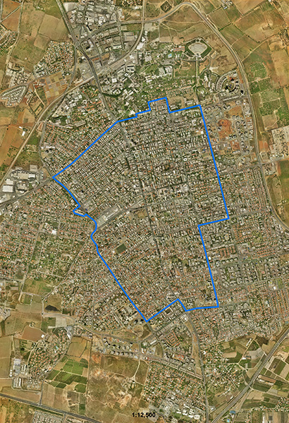 התמצאות
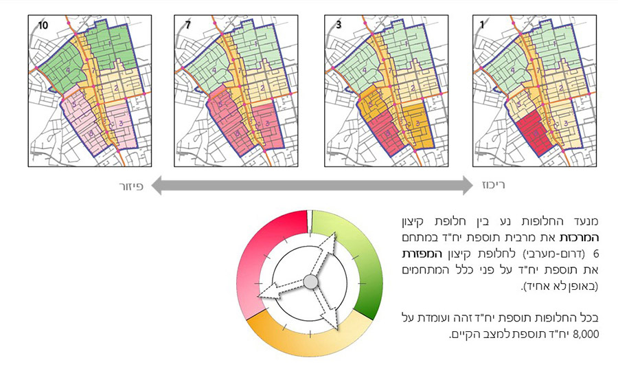
The Rehovot “City Center” currently contains 17,000 units in varying patterns of construction, mix of uses and densities. Since Rehovot’s development trends indicate that significant centers will develop in the western and eastern parts of the city in the coming years, the program proposes harnessing this developmental momentum around the city by creating a municipal and metropolitan level system of connections. A significant element in the design is the proposed strengthening of Herzl Street, referring to the “competition” for the right of way between vehicles, pedestrians, cyclists and mass transit lines in a crowded urban environment. The program proposes a total nominal addition of 8,000 housing units, which will be distributed between the various compounds in accordance with their respective carrying capacities
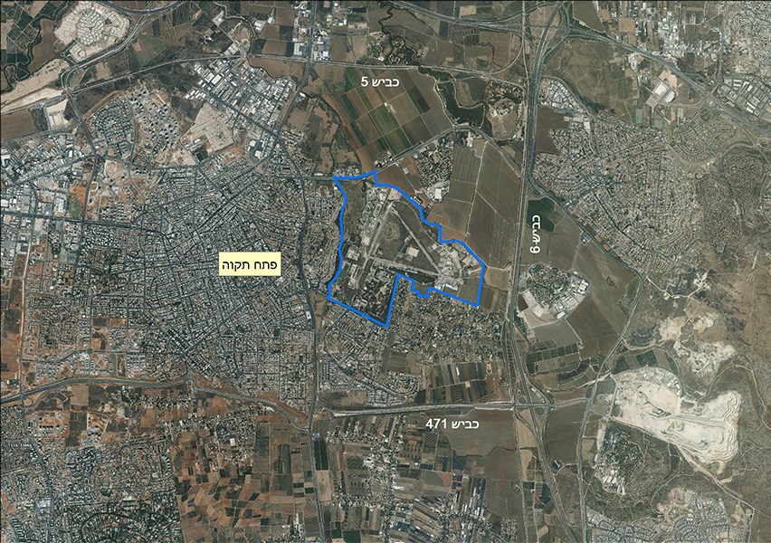
Sirkin Camp- Outline Plan
Client: Ministry of Defence
Project Initiation: 2012
Location: Petah Tikva and Southern Sharon Regional Council jurisdictional area
Project Area: 2,588 dunam
Status: Approved
Program: 12,000 residential units (with 3,000 more in future planning), 365,000 square meters employment
Planning Team: Ari Cohen, Eti Efrati-Arie, Shirit Fink-Glassner, Amir Elisha
In partnership with: Dr. Chaim Fialkoff
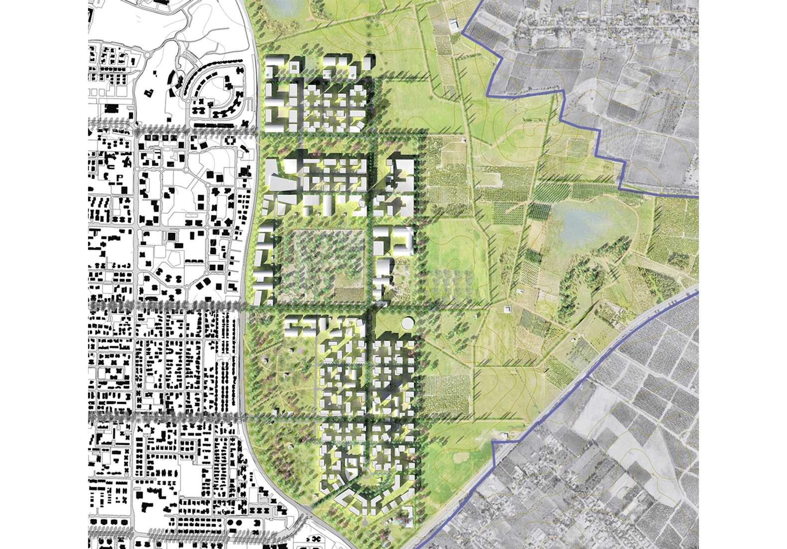
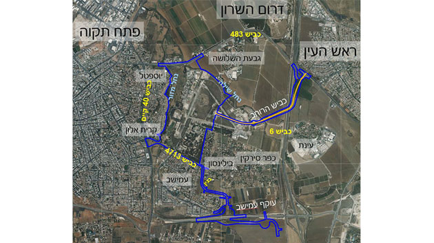
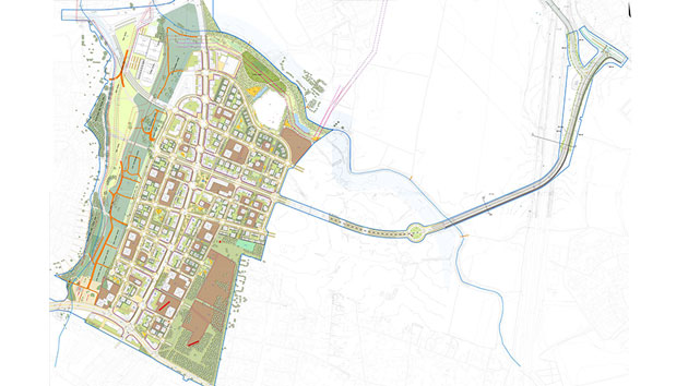
Sirkin district serves as the main land division for the intended eastern expansion of the city of Petah Tikva. The Outline Plan’s vision is to create a balanced district with mixed uses that supports and connects to the existing city. Many proposed public areas in the plan complete additional necessary public uses for existing deficiencies in adjacent neighborhoods, and together with an expansive urban park will link the existing city to the developing district. The proposed construction includes mostly low-rise dense building combined with high-rise building and mixed uses along the main roads. Identifying mass transit systems in and around the plan area, as well as the decision that new no. 40 bypass road will be sunken and mostly covered, played a significant role in advancing the plan
 התמצאות
Sirkin district serves as the main land division for the intended eastern expansion of the city of Petah Tikva. The Outline Plan’s vision is to create a balanced district with mixed uses that supports and connects to the existing city. Many proposed public areas in the plan complete additional necessary public uses for existing deficiencies in adjacent neighborhoods, and together with an expansive urban park will link the existing city to the developing district. The proposed construction includes mostly low-rise dense building combined with high-rise building and mixed uses along the main roads. Identifying mass transit systems in and around the plan area, as well as the decision that new no. 40 bypass road will be sunken and mostly covered, played a significant role in advancing the plan
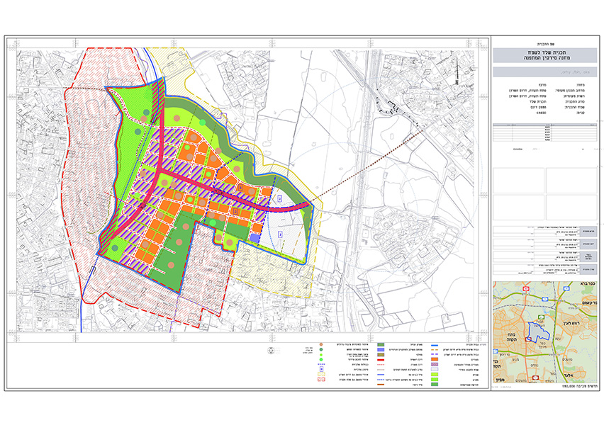
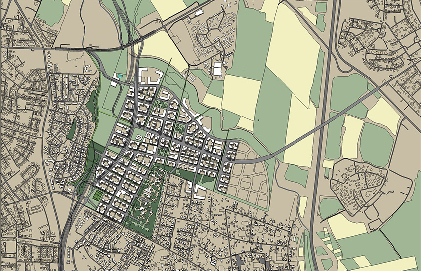
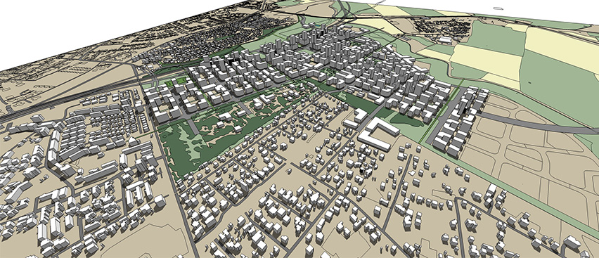
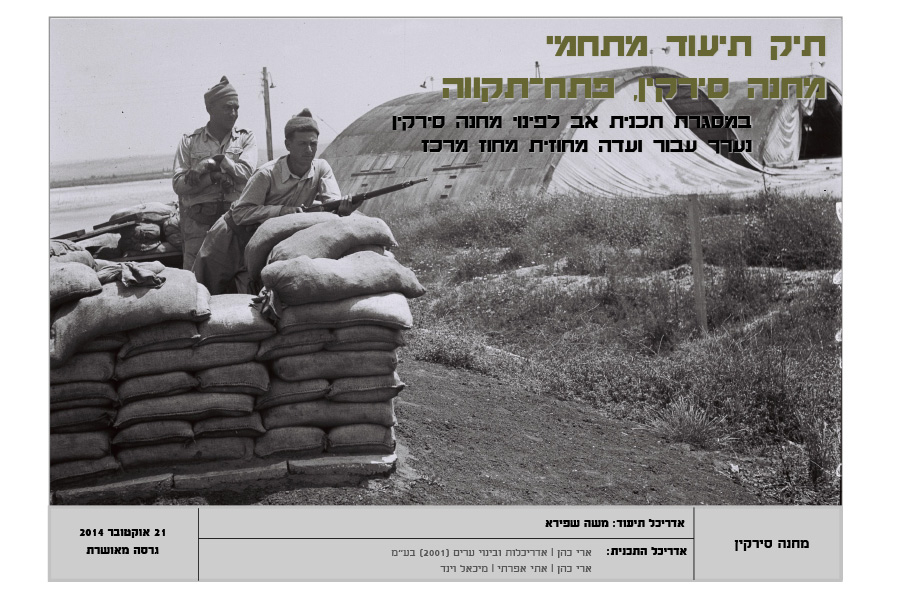
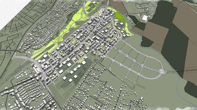
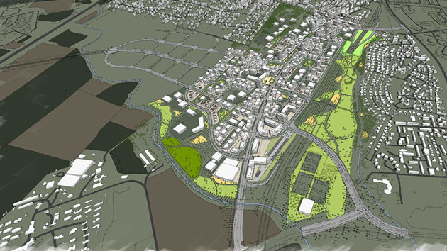
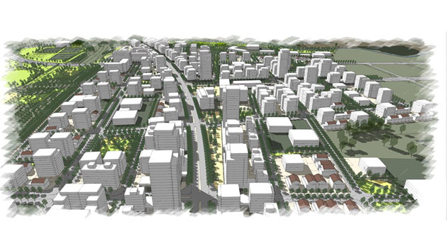
Sirkin District, Petach Tikva- Detailed Plan
Client: Ministry of Defence
Project Initiation: 2017
Location: Local planning Space Petach Tikva
Project Area: App. 2,440 Dunam
Status: Approved
Program: App. 8,500 residential units, & 300,000 Sqm of Commerce and Employment
Planning Team: Ari Cohen, Eti Efrati-Arye, Einta Gazit-Lifshitz, Shirit Fink-Glassner
Project Initiation: 2017
Location: Local planning Space Petach Tikva
Project Area: App. 2,440 Dunam
Status: Approved
Program: App. 8,500 residential units, & 300,000 Sqm of Commerce and Employment
Planning Team: Ari Cohen, Eti Efrati-Arye, Einta Gazit-Lifshitz, Shirit Fink-Glassner
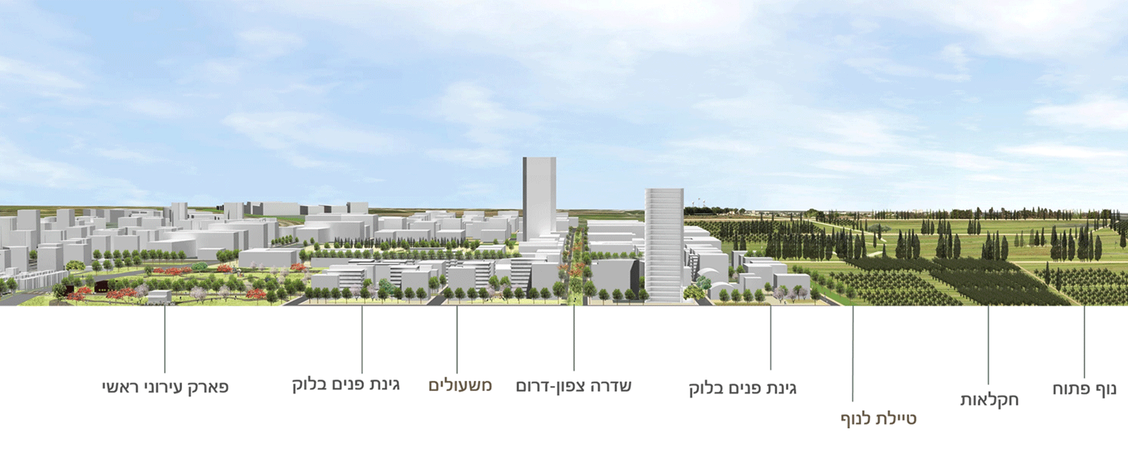
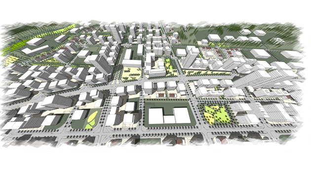
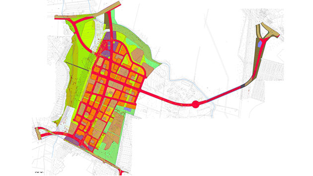
This plan is the first of two stages in the structure plan for the district.
The plan’s goal is to create a new urban district that will mesh physically, socially and economically with the existing city, and encourage its residents to conduct sustainable lifestyles. This will be accomplished through knowledge-based planning and the use of planning tools that ensure good urbanism and intelligent development.
The plan is based on mixed land use, incorporating 8,500 residential units at an average density of 29 units per dunam, and a maximum of 300,000 square meters devoted to commerce and services.
In addition to the district’s educational and public needs, the plan also includes extensive spaces devoted to supplying the educational and public needs of the city as a whole, including large open spaces: an urban park with spaces for sporting activities, a park along the Shilo River, etc.
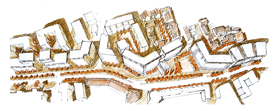
The plan proposes a grid morphology and that combines traditional urban fabric with several large towers. The urban fabric will provide the street facade, and the towers will be located along main routes and in the district’s center. The main thoroughfares will be mixed-use.
 מבט על מדרום
This plan is the first of two stages in the structure plan for the district.
The plan’s goal is to create a new urban district that will mesh physically, socially and economically with the existing city, and encourage its residents to conduct sustainable lifestyles. This will be accomplished through knowledge-based planning and the use of planning tools that ensure good urbanism and intelligent development.
The plan is based on mixed land use, incorporating 8,500 residential units at an average density of 29 units per dunam, and a maximum of 300,000 square meters devoted to commerce and services.
In addition to the district’s educational and public needs, the plan also includes extensive spaces devoted to supplying the educational and public needs of the city as a whole, including large open spaces: an urban park with spaces for sporting activities, a park along the Shilo River, etc.
The plan proposes a grid morphology and that combines traditional urban fabric with several large towers. The urban fabric will provide the street facade, and the towers will be located along main routes and in the district’s center. The main thoroughfares will be mixed-use.
Ramat Bet Shemesh- Southwestern neighborhood 1
Client: Israel Land Authority
Project Initiation: 2010
Location: Beit Shemesh
Project Area: 1,106 dunam
Status: Approved
Program: A residential neighborhood with a total built area of 735,000 square meters
Planning Team: Ari Cohen, Michael Wind, Eti Efrati-Arieh, Shirit Fink-Glassner
Project Initiation: 2010
Location: Beit Shemesh
Project Area: 1,106 dunam
Status: Approved
Program: A residential neighborhood with a total built area of 735,000 square meters
Planning Team: Ari Cohen, Michael Wind, Eti Efrati-Arieh, Shirit Fink-Glassner
The neighborhood was planned as a series of two neighborhoods (H’1, H’2) on the eastern outskirts of the city of Beit Shemesh. The plan was required to deal with unusual soil and geological conditions, in an area rich with natural and archeological values and visible from afar. The neighborhood was planned with a minimum density of 12 units per dunam, and sought to create a rich mix of housing solutions, including apartments designated for future expansion
 הדמיית תכנית שכונת דמ''ז 1. הדמיה- שלום קוולר
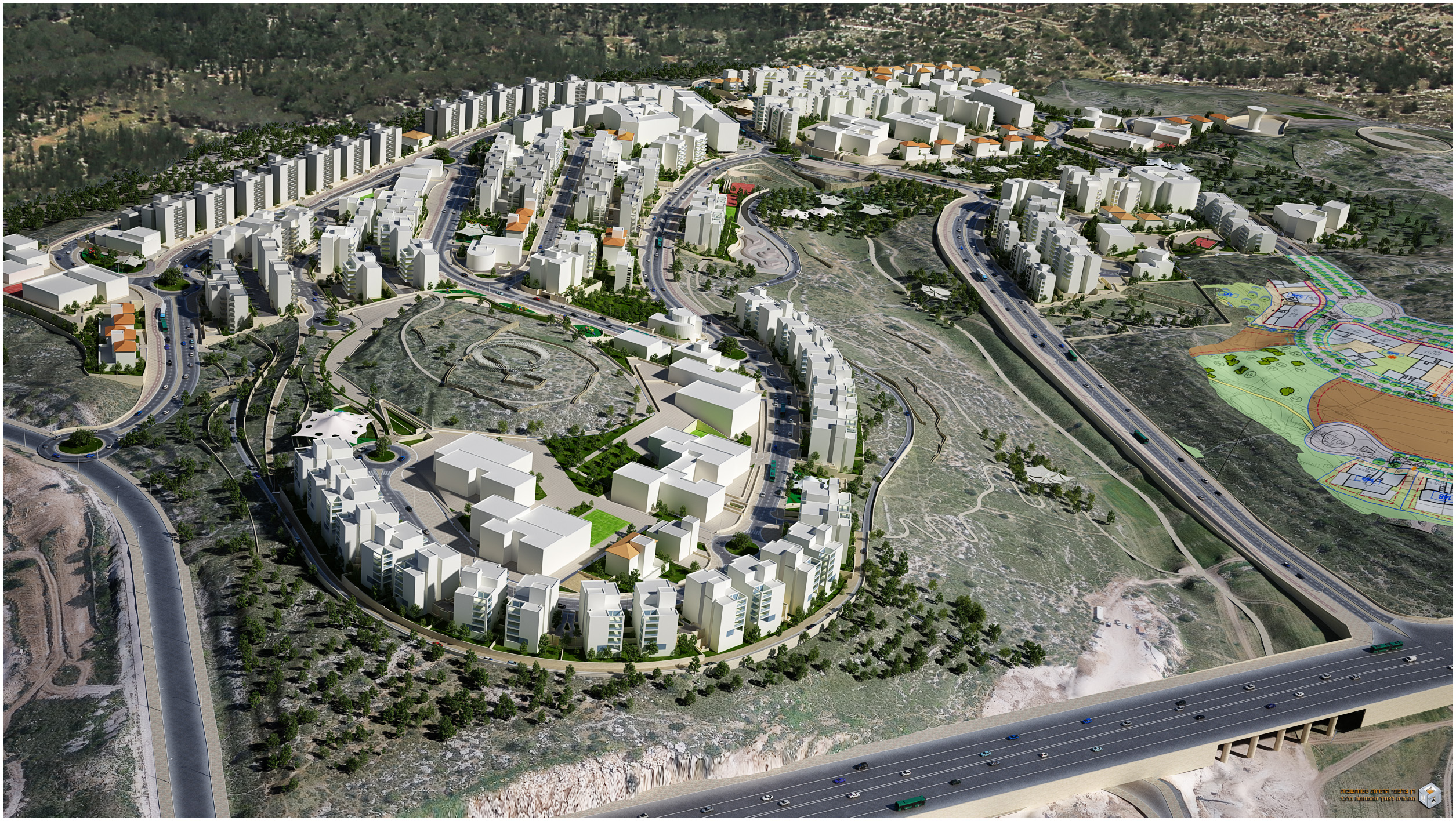
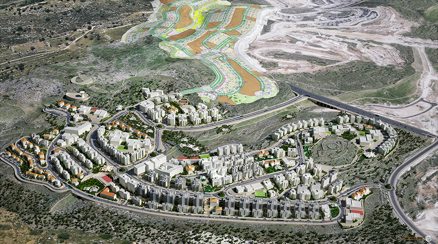
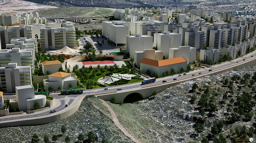
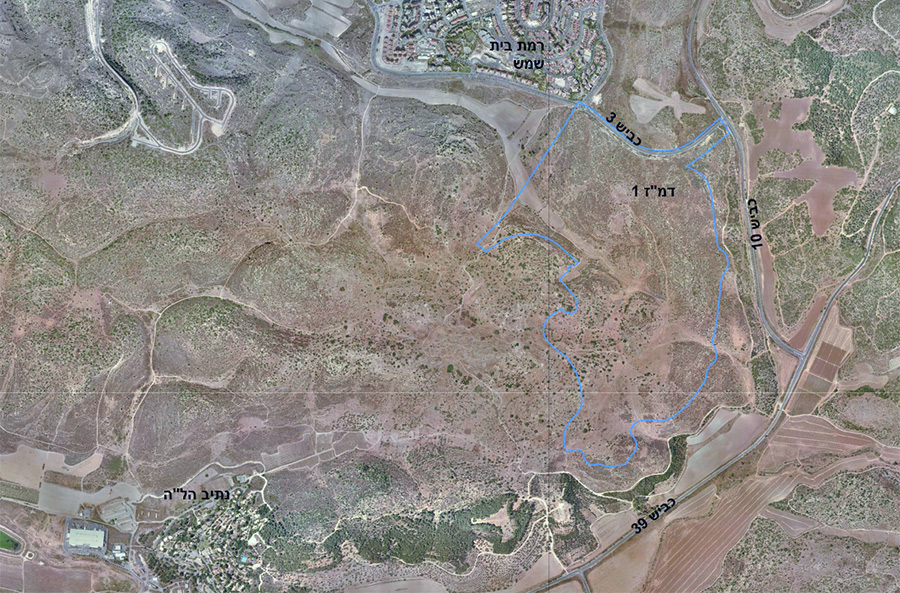
The neighborhood was planned as a series of two neighborhoods (H’1, H’2) on the eastern outskirts of the city of Beit Shemesh. The plan was required to deal with unusual soil and geological conditions, in an area rich with natural and archeological values and visible from afar. The neighborhood was planned with a minimum density of 12 units per dunam, and sought to create a rich mix of housing solutions, including apartments designated for future expansion
Hebron Road, Jerusalem- detailed plan for a residential, employment and commercial structure
Client: Private client
Project Initiation: 2014
Location: Jerusalem
Project Area: 1,657 square meters
Status: Planning
Program: Commercial space, long-term rental units and public housing for new immigrants. Total built area 8,806 square meters. 45 residential units
Planning Team: Ari Cohen, Michael Wind
Project Initiation: 2014
Location: Jerusalem
Project Area: 1,657 square meters
Status: Planning
Program: Commercial space, long-term rental units and public housing for new immigrants. Total built area 8,806 square meters. 45 residential units
Planning Team: Ari Cohen, Michael Wind
The plan is located on a lot which was originally intended exclusively for commercial use. The plan proposes extra residential floors above a commercial level. The planning challenge is to enable infrastructure to serve all the different intended uses despite the restrictive dimensions of the lot. The planned building will have accessible links to Hebron Road to the west as well as to the public park to the east. Due to the small size of the lot, it was decided that the allocations for public use in this plan will be built into the structure itself – two of the apartments will be transferred to municipal ownership for the use of new immigrants.
The construction policy providing for densification of new construction along proposed light rail lines- adopted in 2016 by municipal planning committees- raised the option of planning the building as a tower integrating complementary planning
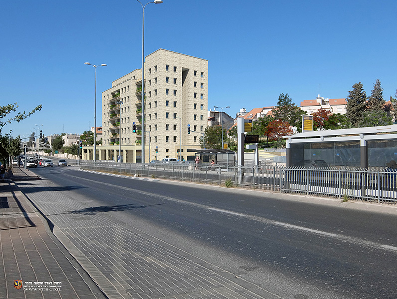 מבט מדרך חברון. הדמיה- רן ואן דרברגן
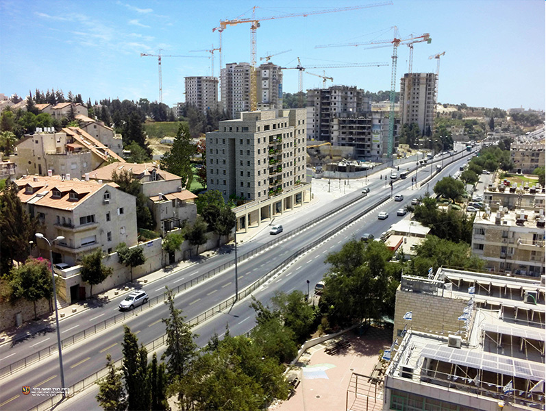
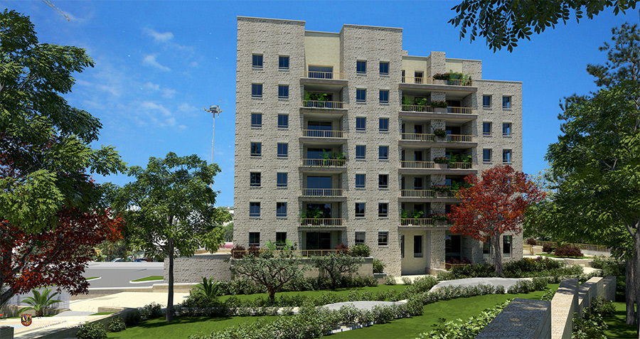
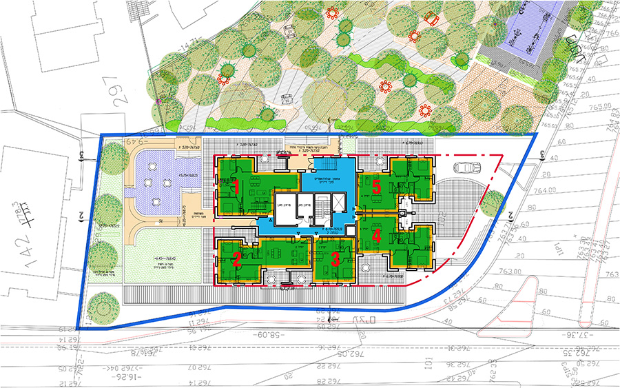
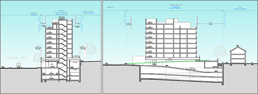
The plan is located on a lot which was originally intended exclusively for commercial use. The plan proposes extra residential floors above a commercial level. The planning challenge is to enable infrastructure to serve all the different intended uses despite the restrictive dimensions of the lot. The planned building will have accessible links to Hebron Road to the west as well as to the public park to the east. Due to the small size of the lot, it was decided that the allocations for public use in this plan will be built into the structure itself – two of the apartments will be transferred to municipal ownership for the use of new immigrants.
The construction policy providing for densification of new construction along proposed light rail lines- adopted in 2016 by municipal planning committees- raised the option of planning the building as a tower integrating complementary planning
HaPalmach 24, Jerusalem- residential building
Client: Private client
Project Initiation: 2012
Location: Jerusalem
Project Area: 0.6 dunam
Status: Approved
Program: Residential uses in a building listed for preservation, 10 residential units
Planning Team: Ari Cohen, Michael Wind
Project Initiation: 2012
Location: Jerusalem
Project Area: 0.6 dunam
Status: Approved
Program: Residential uses in a building listed for preservation, 10 residential units
Planning Team: Ari Cohen, Michael Wind
The neighborhoods of Rassco and Rehavia are undergoing a densification process; requiring complex planning in order to successfully integrate modern construction elements into historical buildings listed for preservation.
The building in this plan was built in the 1940s and served as a small hotel for its first few years. The plan was able to double the area of the total housing units and the built-up areas in the lot, while creating an automated parking infrastructure and preserving significant parts of the building exteriors and yard
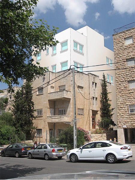 הדמיה
הדמיה
The neighborhoods of Rassco and Rehavia are undergoing a densification process; requiring complex planning in order to successfully integrate modern construction elements into historical buildings listed for preservation.
The building in this plan was built in the 1940s and served as a small hotel for its first few years. The plan was able to double the area of the total housing units and the built-up areas in the lot, while creating an automated parking infrastructure and preserving significant parts of the building exteriors and yard
Abu Ghosh- Western district
Client: Abu Ghosh Municipality, Ministry of Construction and Housing
Project Initiation: 2015
Location: Abu Ghosh
Project Area: 300 dunam
Status: Approved
Program: A residential neighborhood combining a hotel compound- about 600 residential units
Planning Team: Ari Cohen, Michael Wind, Einav Yagel, Shirit Fink-Glassner
Project Initiation: 2015
Location: Abu Ghosh
Project Area: 300 dunam
Status: Approved
Program: A residential neighborhood combining a hotel compound- about 600 residential units
Planning Team: Ari Cohen, Michael Wind, Einav Yagel, Shirit Fink-Glassner
The plan aims to increase the amount of housing units in the village in order to be able to supply demand generated by the village’s natural growth, while emphasizing the following planning principles:
- Densifying the village (minimum 7 units net per dunam) while maintaining the unique local housing and construction characteristics which have formed over time.
- Creating quality connectivity between different parts of the community living in the district by planning a continuous and accessible network of roads and paths.
- Creating an accessible open space system for the neighborhood residents, while addressing existing open space deficiencies in the wider area.
Contiguous expansion of the current built area of the village, avoiding unnecessary expansion onto sensitive natural areas
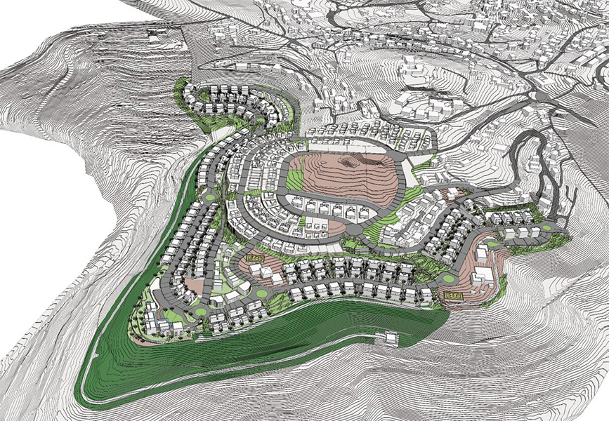 מבט על הרובע המערבי אבו גוש
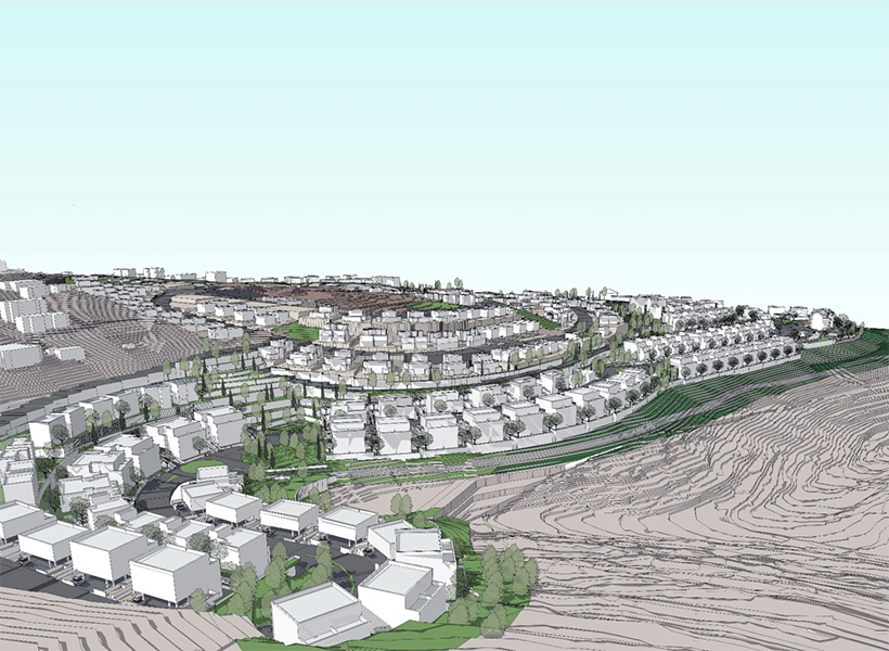
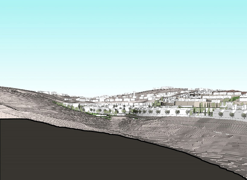
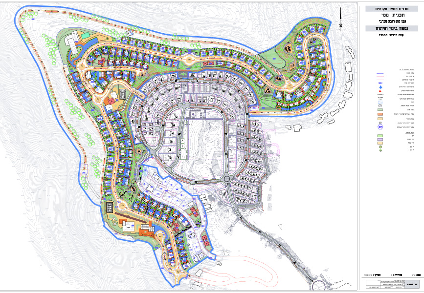
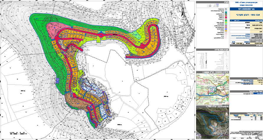
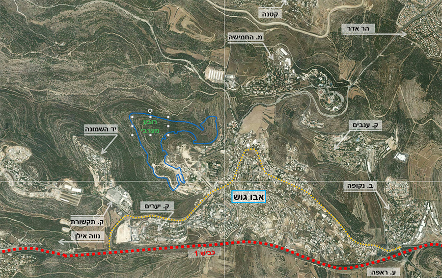
The plan aims to increase the amount of housing units in the village in order to be able to supply demand generated by the village’s natural growth, while emphasizing the following planning principles:
- Densifying the village (minimum 7 units net per dunam) while maintaining the unique local housing and construction characteristics which have formed over time.
- Creating quality connectivity between different parts of the community living in the district by planning a continuous and accessible network of roads and paths.
- Creating an accessible open space system for the neighborhood residents, while addressing existing open space deficiencies in the wider area.
Contiguous expansion of the current built area of the village, avoiding unnecessary expansion onto sensitive natural areas
Halafta 7, Jerusalem- residential building
Client: Private client
Project Initiation: 2009
Location: Jerusalem
Project Area: 0.7 dunam
Status: Approved
Program: Residential building with 11 units at a total built area of 2,230 square meters
Planning Team: Ari Cohen, Michael Wind, Inessa Yamlianova
Project Initiation: 2009
Location: Jerusalem
Project Area: 0.7 dunam
Status: Approved
Program: Residential building with 11 units at a total built area of 2,230 square meters
Planning Team: Ari Cohen, Michael Wind, Inessa Yamlianova
A plan for a residential building with two apartments per floor and an underground parking lot. The two-story parking lot was made possible thanks to an underground vehicle easement from an adjacent lot, enabling optimization of the parking lot area by avoiding the use of ramps. The more efficient parking lot enabled an increase in the number of residential units with no additional vehicular traffic on Halafta Street which is a narrow street lacking in ample parking and public passageways
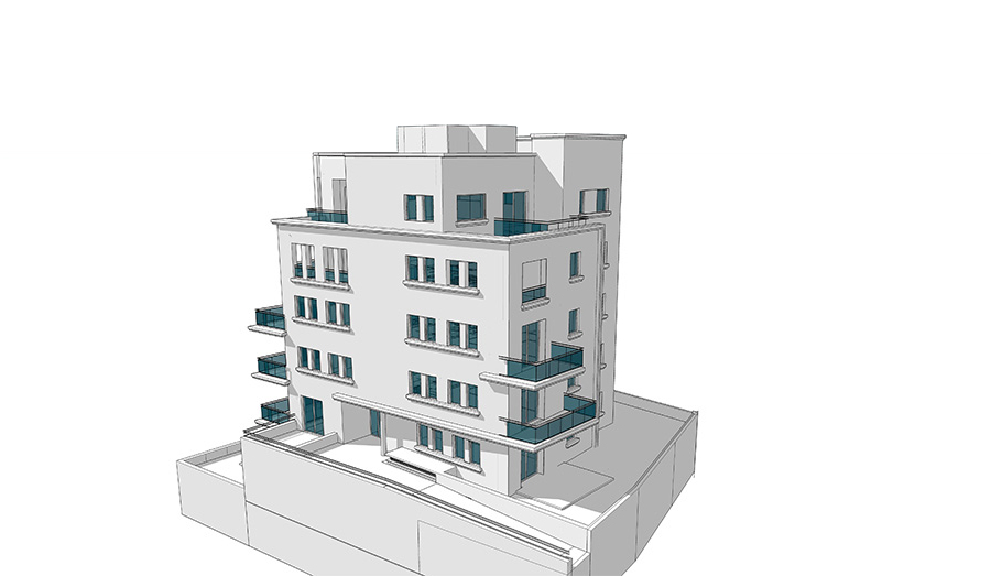 הדמיית בניין להיתר
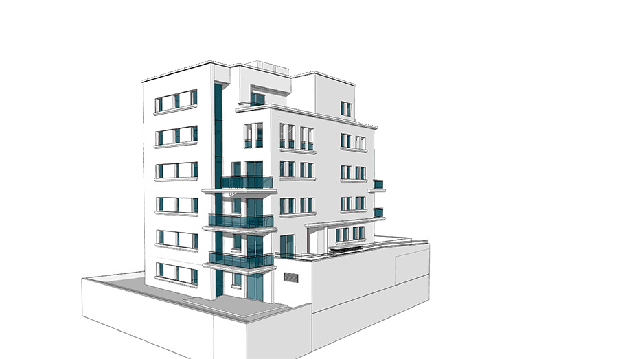
A plan for a residential building with two apartments per floor and an underground parking lot. The two-story parking lot was made possible thanks to an underground vehicle easement from an adjacent lot, enabling optimization of the parking lot area by avoiding the use of ramps. The more efficient parking lot enabled an increase in the number of residential units with no additional vehicular traffic on Halafta Street which is a narrow street lacking in ample parking and public passageways
Mevasseret Tzion, Neighborhood 10
Client: Israel Land Authority
Project Initiation: 1995
Location: Mevasseret Tzion
Project Area: Mevasseret Tzion
Status: Approved
Program: Housing and open spaces, 66 residential units
Planning Team: Ari Cohen, Eli Davidov, Michael Wind
Project Initiation: 1995
Location: Mevasseret Tzion
Project Area: Mevasseret Tzion
Status: Approved
Program: Housing and open spaces, 66 residential units
Planning Team: Ari Cohen, Eli Davidov, Michael Wind
The plan is located on the southeast outskirts of Mevasseret Zion, along Shimon Suissa Street. The plan defined residential construction on the south side of the street, while dealing with different planning challenges: steep inclines; high visibility from Route 1; creating new housing congruous with housing in the old town; creating accessibility for residents on lots with significant height differences
The plan created five residential complexes and two public parks incorporating dense low-rise housing typical of the town, with public access solutions and accessible development on a few levels
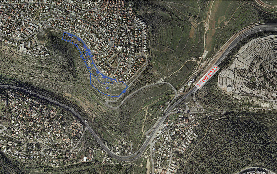 התמצאות
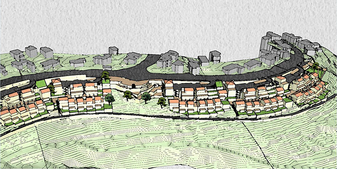
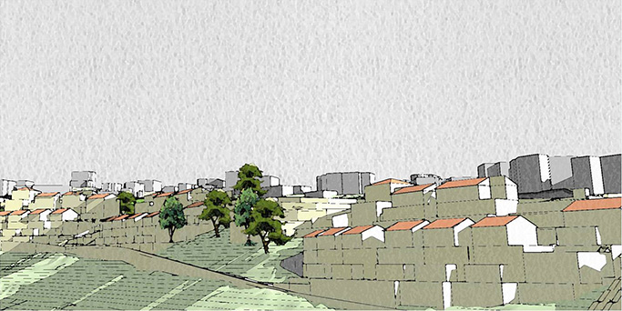
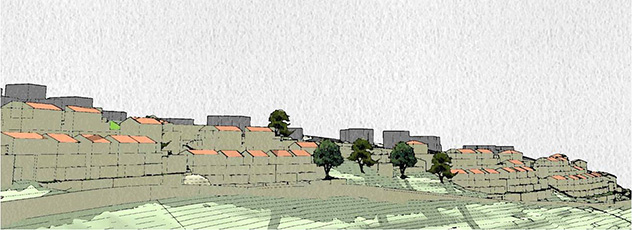
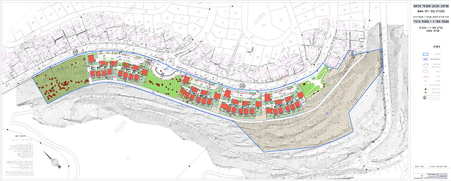
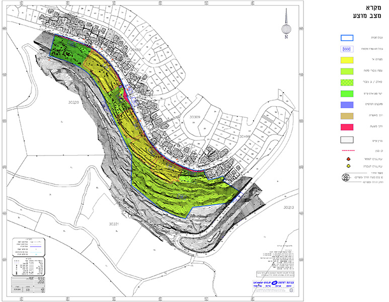
The plan is located on the southeast outskirts of Mevasseret Zion, along Shimon Suissa Street. The plan defined residential construction on the south side of the street, while dealing with different planning challenges: steep inclines; high visibility from Route 1; creating new housing congruous with housing in the old town; creating accessibility for residents on lots with significant height differences
The plan created five residential complexes and two public parks incorporating dense low-rise housing typical of the town, with public access solutions and accessible development on a few levels
Havat HaNoar HaTzioni nursery, Jerusalem
Client: Israel Land Authority
Project Initiation: 2013
Location: Jerusalem
Project Area: 23 dunam
Status: Approved
Program: A residential and commercial compound with a park and public building, 316 residential units
Planning Team: A residential and commercial compound with a park and public building, 316 residential units
Project Initiation: 2013
Location: Jerusalem
Project Area: 23 dunam
Status: Approved
Program: A residential and commercial compound with a park and public building, 316 residential units
Planning Team: A residential and commercial compound with a park and public building, 316 residential units
The plan is located at the historical Havat Hanoar HaTzioni nursery and constitutes part of this educational institution. The plan proposes densification of a residential and commercial complex approved 30 years ago, adapting it to current planning policy in the city. The program distinguishes between different areas bordering it and creates specific location-appropriate design: the façade facing Ben Zakai Street is planned with a commercial front combined with an urban plaza, while the western borders (Ma’ale Ze’ev and Halafta Street) are designed to reduce their exposure to vehicular traffic as much as possible. Special emphasis was placed on preserving the mature trees within the plan area, as well as conserving the character of the nursery which was incorporated into the planned park.
The plan includes a mix of housing types designed to provide housing solutions for a wide range of populations
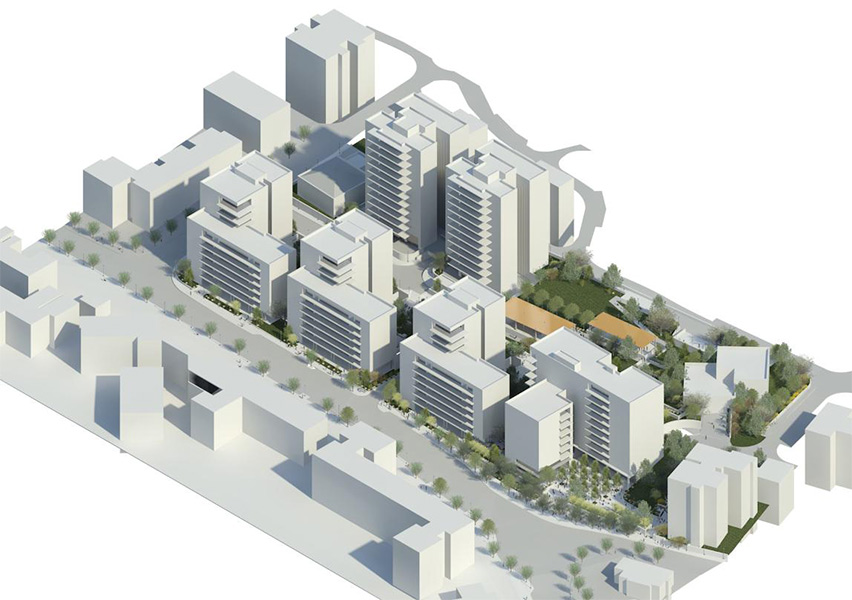 מבט על
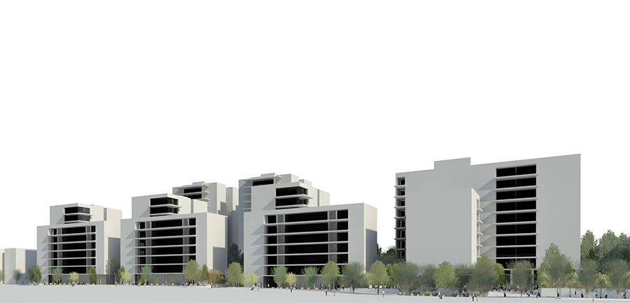
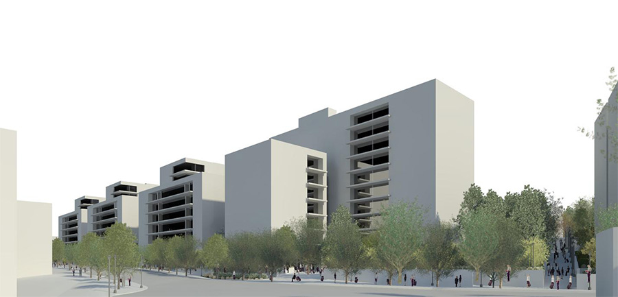

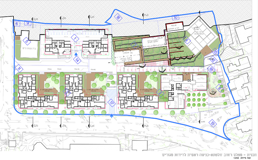
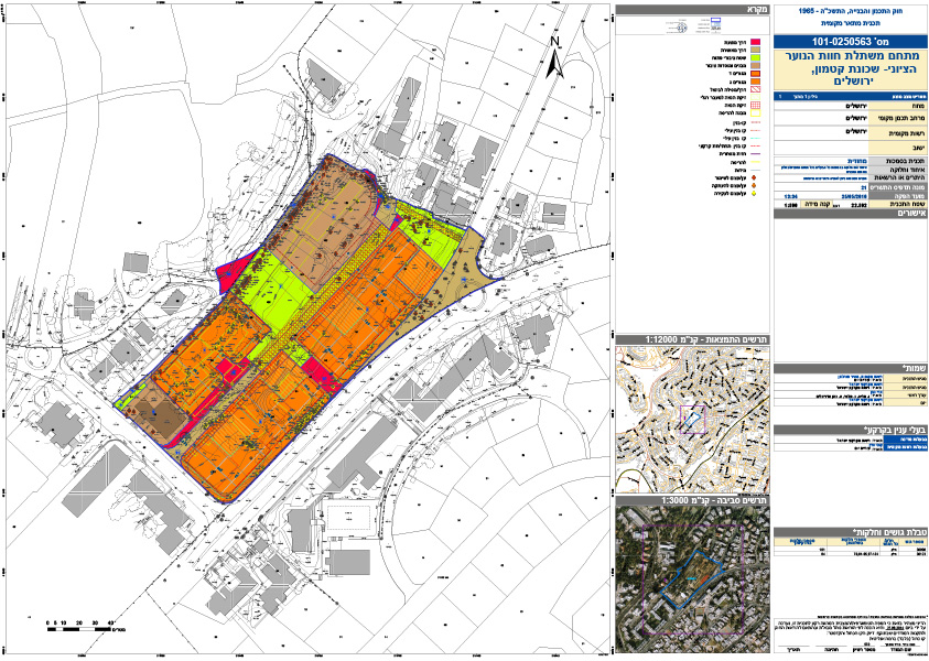
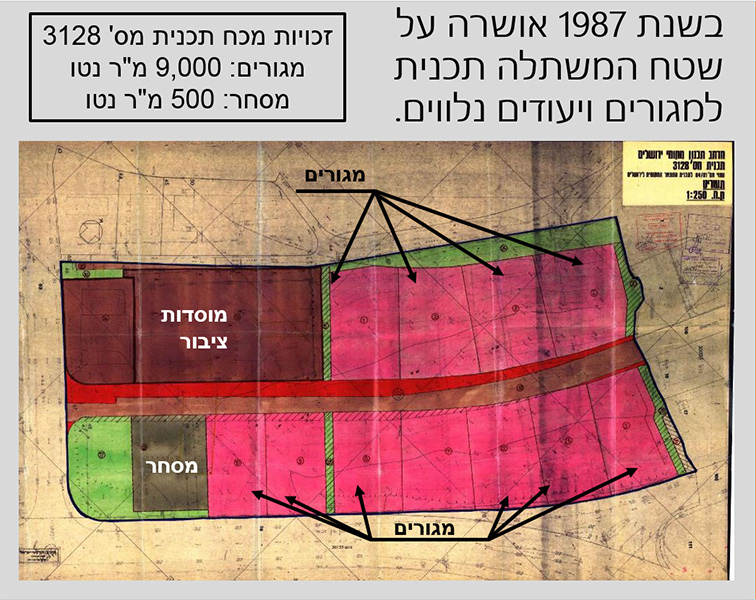
The plan is located at the historical Havat Hanoar HaTzioni nursery and constitutes part of this educational institution. The plan proposes densification of a residential and commercial complex approved 30 years ago, adapting it to current planning policy in the city. The program distinguishes between different areas bordering it and creates specific location-appropriate design: the façade facing Ben Zakai Street is planned with a commercial front combined with an urban plaza, while the western borders (Ma’ale Ze’ev and Halafta Street) are designed to reduce their exposure to vehicular traffic as much as possible. Special emphasis was placed on preserving the mature trees within the plan area, as well as conserving the character of the nursery which was incorporated into the planned park.
The plan includes a mix of housing types designed to provide housing solutions for a wide range of populations
HaSansan neighborhood, Tzur Hadassah
Client: Ministry of Construction & Housing
Project Initiation: 1999
Location: Tzur Hadassah
Project Area: 334 dunam
Status: Approved
Program: Residential neighborhood, 1,109 residential units
Planning Team: Ari Cohen, Eli Davidov, Michael Wind
Project Initiation: 1999
Location: Tzur Hadassah
Project Area: 334 dunam
Status: Approved
Program: Residential neighborhood, 1,109 residential units
Planning Team: Ari Cohen, Eli Davidov, Michael Wind
The plan was prepared in the late 1990s, following the waves of mass immigration from the Soviet Union, and was required to balance the need for finding housing solutions with the rural nature of the existing village and its landscape sensitivity. The plan created a rich mix of housing types, with a mixture of detached housing and denser construction. The plan created a variety of housing solutions which in turn attracted a heterogeneous population
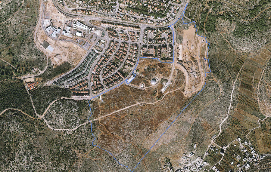 התמצאות
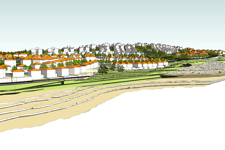
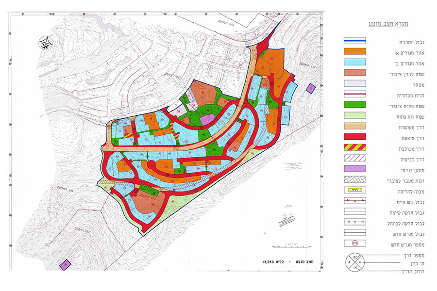
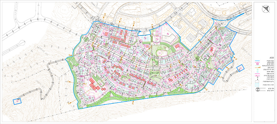
The plan was prepared in the late 1990s, following the waves of mass immigration from the Soviet Union, and was required to balance the need for finding housing solutions with the rural nature of the existing village and its landscape sensitivity. The plan created a rich mix of housing types, with a mixture of detached housing and denser construction. The plan created a variety of housing solutions which in turn attracted a heterogeneous population
Mesilat Yesharim, Jerusalem- commercial and residential building
Client: Private client
Project Initiation: 2010
Location: Jerusalem
Project Area: 0.44 dunam
Status: Approved
Program: Residential and commercial uses and offices on a 447 square meter lot, with 12 residential uses on a total built area of 2,000 square meters
Planning Team: Ari Cohen, Michael Wind, Shirit Fink-Glassner
Project Initiation: 2010
Location: Jerusalem
Project Area: 0.44 dunam
Status: Approved
Program: Residential and commercial uses and offices on a 447 square meter lot, with 12 residential uses on a total built area of 2,000 square meters
Planning Team: Ari Cohen, Michael Wind, Shirit Fink-Glassner
This project is located near the Mahane Yehuda market. Despite its limited size, the lot is relatively large compared to the adjacent lots and is located at the border between modern dense urban fabric and a historic area characterized by low-rise construction, surrounded by alleys and courtyards.
The presence of an underground parking lot in the bordering lot to the south allowed underground entry of vehicles to the lot without using ramps.
The effective planning allowed creating a high density (30 units per dunam), customary in CBD areas. A commercial front was designed at street level, with four residential floors above it.
The plan was careful to create a respectable-looking building which differentiated between the intensive building along Mesilat Yesharim Street and the inner side of the building which faces the neighborhood’s alleyways. The building includes a few preserved historic walls that remained on the lot from a historical building that was destroyed
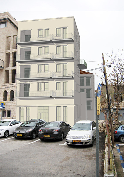 מבט מרח' מסילת ישירם
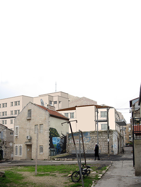

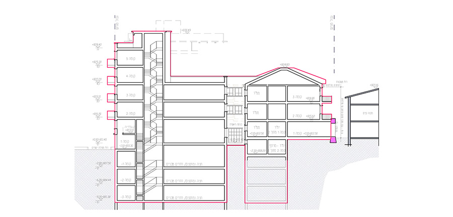
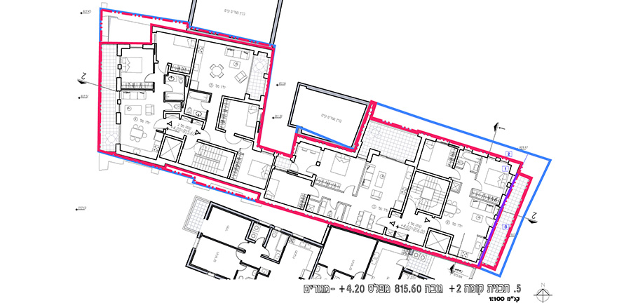
This project is located near the Mahane Yehuda market. Despite its limited size, the lot is relatively large compared to the adjacent lots and is located at the border between modern dense urban fabric and a historic area characterized by low-rise construction, surrounded by alleys and courtyards.
The presence of an underground parking lot in the bordering lot to the south allowed underground entry of vehicles to the lot without using ramps.
The effective planning allowed creating a high density (30 units per dunam), customary in CBD areas. A commercial front was designed at street level, with four residential floors above it.
The plan was careful to create a respectable-looking building which differentiated between the intensive building along Mesilat Yesharim Street and the inner side of the building which faces the neighborhood’s alleyways. The building includes a few preserved historic walls that remained on the lot from a historical building that was destroyed
Henrietta Szold Street, Jerusalem- urban renewal
Road 4- Begin South/Emek Refa’im bridge, Jerusalem
Rahat CBD
Ora Junction- employment center
Packaging and machinery services for agriculture and orchards, Pardes Hanna
Gedera Street, Romema, Jerusalem- detailed plan for a residential compound
Client: Nofei HaTzafon, Ltd.
Project Initiation: 2007
Location: Jerusalem
Project Area: 5 dunam
Status: Approved
Program: 49 residential units
Planning Team: Ari Cohen, Nahum Meltzer, Itzik April
Project Initiation: 2007
Location: Jerusalem
Project Area: 5 dunam
Status: Approved
Program: 49 residential units
Planning Team: Ari Cohen, Nahum Meltzer, Itzik April
The plan is located adjacent to the Magen David Adom building on Gedera Street in the neighborhood of Romema, Jerusalem.
The plan designates the area as an area for the construction of two new residential buildings and limited additions to a historical building listed for preservation. The new residential buildings will have four floors above the main entry level, and three residential stories and a shared underground parking below the main entry level.
Part of the lower courtyard level will be used for public buildings and institutions. In addition, a planned pedestrian walkway will link the road with the adjacent promenade, and an expansion to the western promenade is proposed
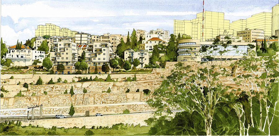 מבט ממערב. הדמיה- שלום קוולר
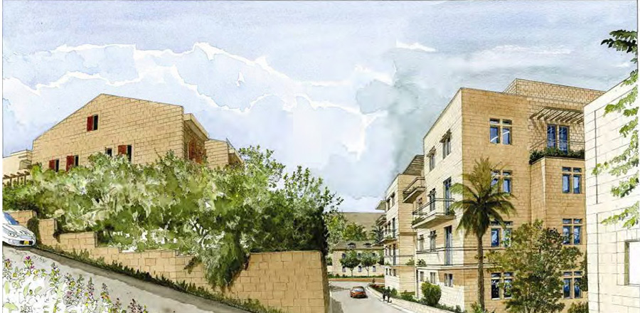
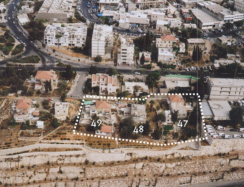
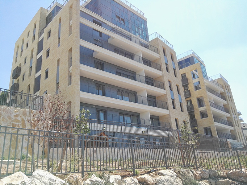
The plan is located adjacent to the Magen David Adom building on Gedera Street in the neighborhood of Romema, Jerusalem.
The plan designates the area as an area for the construction of two new residential buildings and limited additions to a historical building listed for preservation. The new residential buildings will have four floors above the main entry level, and three residential stories and a shared underground parking below the main entry level.
Part of the lower courtyard level will be used for public buildings and institutions. In addition, a planned pedestrian walkway will link the road with the adjacent promenade, and an expansion to the western promenade is proposed
Herzl Boulevard, Beit HaKerem, Jerusalem- detailed plan for a residential compound
Client: Rassco Isras Group
Project Initiation: 2005
Location: Jerusalem
Project Area: 11.5 dunam
Status: Approved
Program: 218 residential units and a kindergarten
Planning Team: Ari Cohen, Nahum Meltzer, Eti Efrati-Arieh
Project Initiation: 2005
Location: Jerusalem
Project Area: 11.5 dunam
Status: Approved
Program: 218 residential units and a kindergarten
Planning Team: Ari Cohen, Nahum Meltzer, Eti Efrati-Arieh
The proposed plan covers an area of 11.5 dunam. This area, mostly vacant, is confined between the intersection of Rupin Road and Herzl Boulevard, the intersection of HaHalutz Street and Herzl Boulevard, Herzl Boulevard and Hazon Tzion Street.
The plan designates this area for the construction of three new residential buildings, private open space, public open space, a new road, a public building and technical facilities.
Two of the three new buildings, those closest to the Rupin and Herzl intersection, will rise to a maximum of 18 floors above the main entrance plaza. Another building, adjacent to the HaHalutz and Herzl intersection, will be a six-story building above the square level.
The private open spaces will be open to the public and will allow easy passage from the adjacent neighborhood towards Herzl Boulevard and the nearby light rail station.
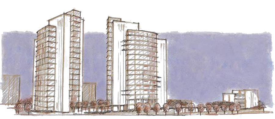 מבט משד' הרצל
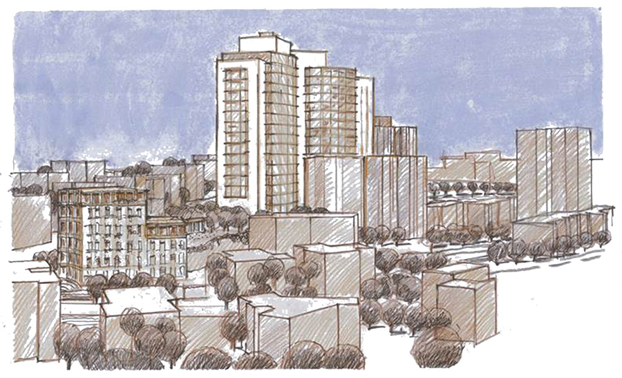
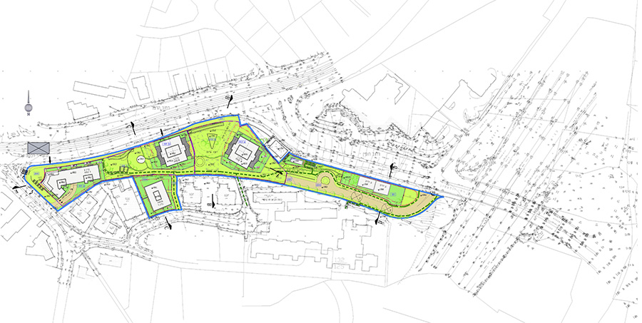
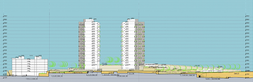
The proposed plan covers an area of 11.5 dunam. This area, mostly vacant, is confined between the intersection of Rupin Road and Herzl Boulevard, the intersection of HaHalutz Street and Herzl Boulevard, Herzl Boulevard and Hazon Tzion Street.
The plan designates this area for the construction of three new residential buildings, private open space, public open space, a new road, a public building and technical facilities.
Two of the three new buildings, those closest to the Rupin and Herzl intersection, will rise to a maximum of 18 floors above the main entrance plaza. Another building, adjacent to the HaHalutz and Herzl intersection, will be a six-story building above the square level.
The private open spaces will be open to the public and will allow easy passage from the adjacent neighborhood towards Herzl Boulevard and the nearby light rail station.
The eastern lagoon, Eilat- detailed plan for a hotel and tourism compound
Client: Eilat Foreshore Development Company Ltd.
Project Initiation: 1996
Location: Eilat
Project Area: 600 dunam
Status: Approved
Program: 2,200 hotel rooms, public building and special housing
Planning Team: Ari Cohen, Boris Markovski
Project Initiation: 1996
Location: Eilat
Project Area: 600 dunam
Status: Approved
Program: 2,200 hotel rooms, public building and special housing
Planning Team: Ari Cohen, Boris Markovski
The plan is located at the easternmost site of the north shore of Eilat. The site is intended for different uses whose combination will provide this housing and hotel compound with a unique character suited to its time and place.
The large public space in the center of the site is the lagoon, intended to extend the public beaches and provide a rich inner landscape for all the hotels not in proximity to the Red Sea. This lagoon is used for bathing.
The overall planning concept sees this complex as part of the continuous urban fabric and maintains this continuity and linkage, both to existing and planned areas to the north and to the east in the Eilat master plan. Another planning principle, derived from conceiving of the lagoon and beaches as important public spaces, is their exposure to passersby on roads and promenades.
The northern buildings have a designated height of 6 floors, while the buildings close to the beach have a designated height of 2 or 3 floors, creating a kind of “amphitheater” with the rows in back higher than those in front so as not to block the views and openness to the sea
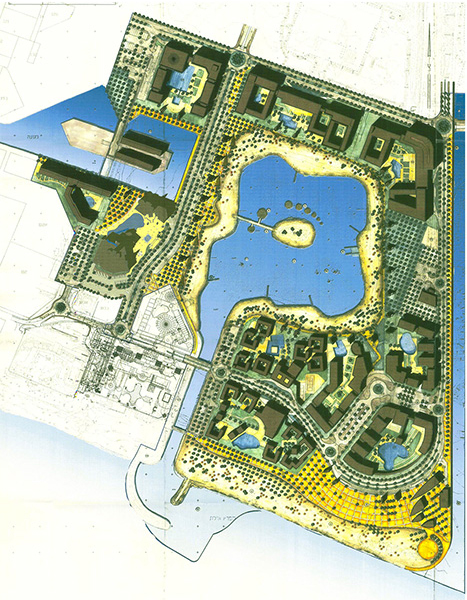 תכנית פיתוח
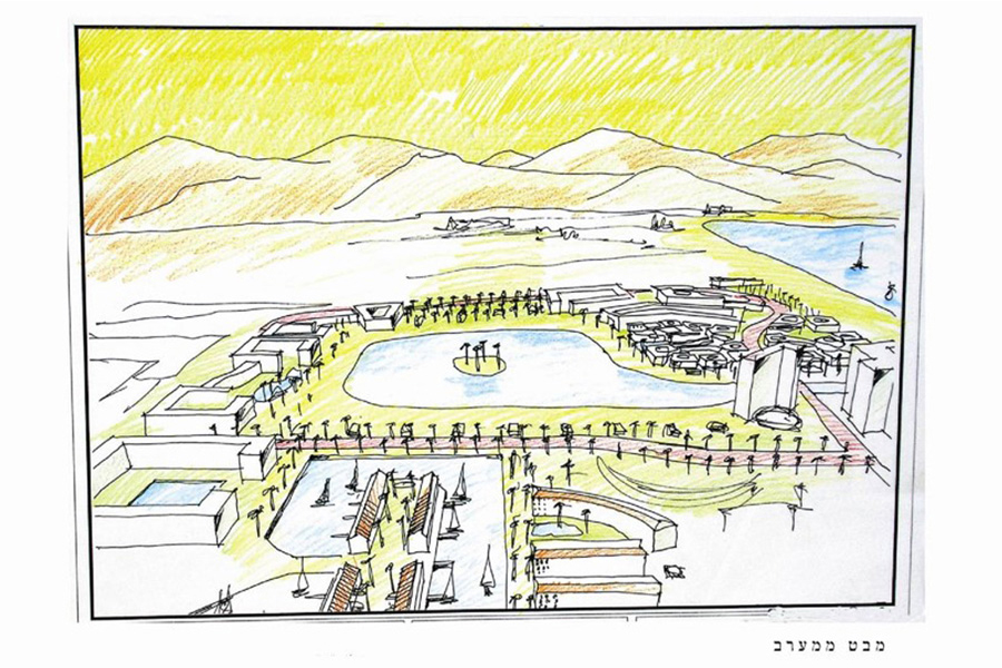
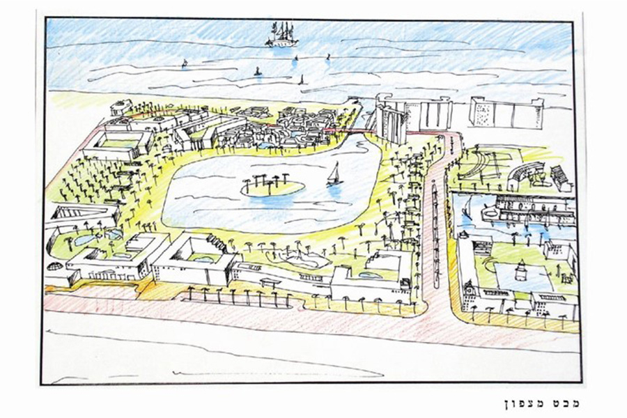
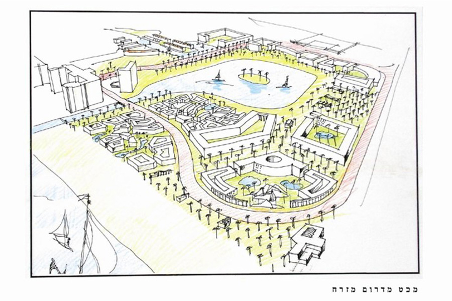
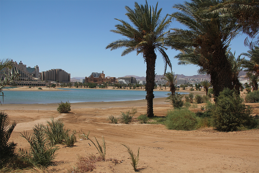
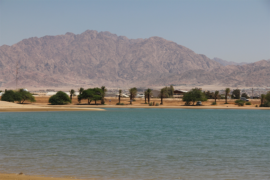
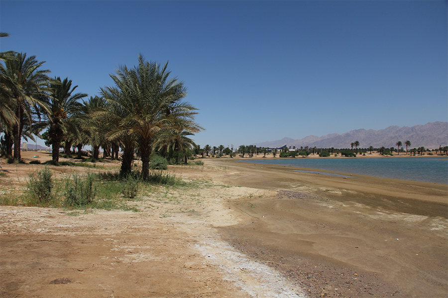
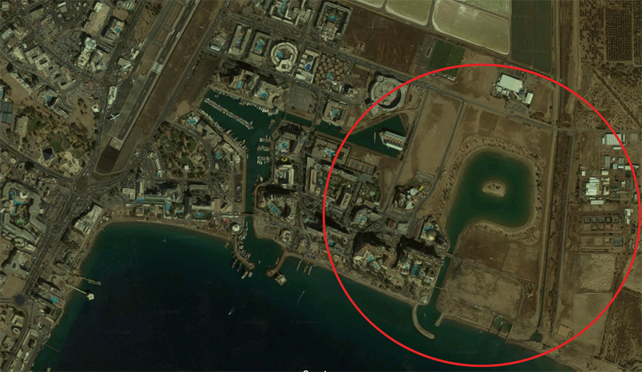
The plan is located at the easternmost site of the north shore of Eilat. The site is intended for different uses whose combination will provide this housing and hotel compound with a unique character suited to its time and place.
The large public space in the center of the site is the lagoon, intended to extend the public beaches and provide a rich inner landscape for all the hotels not in proximity to the Red Sea. This lagoon is used for bathing.
The overall planning concept sees this complex as part of the continuous urban fabric and maintains this continuity and linkage, both to existing and planned areas to the north and to the east in the Eilat master plan. Another planning principle, derived from conceiving of the lagoon and beaches as important public spaces, is their exposure to passersby on roads and promenades.
The northern buildings have a designated height of 6 floors, while the buildings close to the beach have a designated height of 2 or 3 floors, creating a kind of “amphitheater” with the rows in back higher than those in front so as not to block the views and openness to the sea
Zamenhoff, Jerusalem- detailed plan for a residential building including historic preservation
Client: Private client
Project Initiation: 2006
Location: Jerusalem
Project Area: 1.4 dunam
Status: Approved
Program: 12 residential units
Planning Team: Ari Cohen, Guy Igra, Nahum Meltzer, Sigi Be'eri
Project Initiation: 2006
Location: Jerusalem
Project Area: 1.4 dunam
Status: Approved
Program: 12 residential units
Planning Team: Ari Cohen, Guy Igra, Nahum Meltzer, Sigi Be'eri
The neighborhood of Mahane Israel is one of Jerusalem’s oldest neighborhoods. The urban development in the area has changed the architectural character of the existing buildings and in many cases destroyed the original buildings, erecting new ones in their stead.
The proposed plan seeks to prevent the demolition of the beautiful existing building, to rebuild the destroyed parts and return them to usage as living spaces. The plan proposes removing the late additions to the building and exposing as much as possible of the building’s original facades.
The design of the new additions and their position in relation to the existing building are designed to highlight the building’s various construction layers ranging from the initial construction of the building in the late 19th century to the present
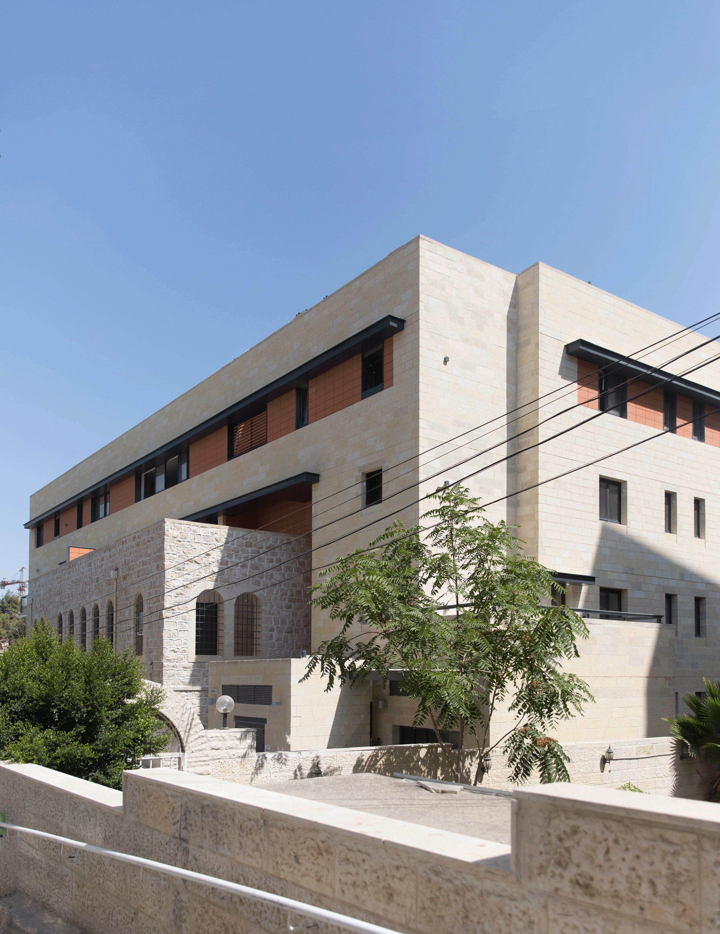 תכנון מפורט והיתר בניה- גיא איגרא אדריכלים
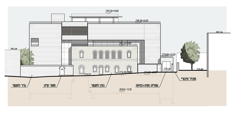
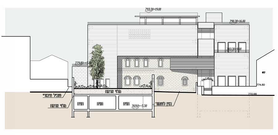

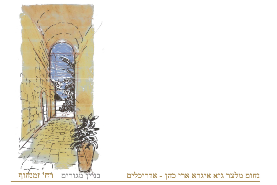
The neighborhood of Mahane Israel is one of Jerusalem’s oldest neighborhoods. The urban development in the area has changed the architectural character of the existing buildings and in many cases destroyed the original buildings, erecting new ones in their stead.
The proposed plan seeks to prevent the demolition of the beautiful existing building, to rebuild the destroyed parts and return them to usage as living spaces. The plan proposes removing the late additions to the building and exposing as much as possible of the building’s original facades.
The design of the new additions and their position in relation to the existing building are designed to highlight the building’s various construction layers ranging from the initial construction of the building in the late 19th century to the present
Arbel Vista, Tiberias- detailed plan for a residential neighborhood
Client: Israel Land Authority
Project Initiation: 1997
Location: Tiberias
Project Area: 195 dunam
Status: Approved
Program: 430 residential units
Planning Team: Ari Cohen, Yael Padan, Udi Mantzouri
Project Initiation: 1997
Location: Tiberias
Project Area: 195 dunam
Status: Approved
Program: 430 residential units
Planning Team: Ari Cohen, Yael Padan, Udi Mantzouri
The neighborhood is located on the northern slopes of the city of Tiberias, overlooking the Sea of Galilee, the Golan Heights, Mount Arbel and Tel Raqat, and offering a glimpse of the beautiful YMCA building hidden in the greenery. The place itself is arid, almost devoid of vegetation, a stark contrast made even more conspicuous by the lush vegetation along the coast and Wadi Raqat. A national/regional road separates the neighborhood from the Sea of Galilee.
This neighborhood defines Tiberias’ northern boundary. It will extend the city’s boundaries and will constitute part of the city despite its distance from the center. Along with other planned projects, it will be part of a new district with interlinked neighborhoods that together connect the city on the cliff to the sea below.
A neighborhood can be part of the identities of those living there. The physical components of a place, their spatial array and the relationship between them affect the lifestyle of the residents, and this arrangement aims to strengthen the identity and uniqueness of the neighborhood, create convenient connections to the surroundings, provide public quality, diversity, inclusive occupancy and mixed uses. All of these together would help empower Tiberias’ urbanity and increase quality of life for all the city’s residents and those of the neighborhood in particular
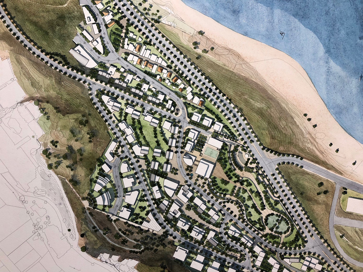 תכנית בינוי. שרטוט- שלום קוולר
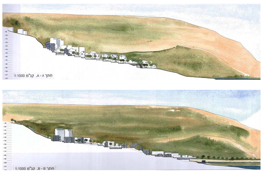
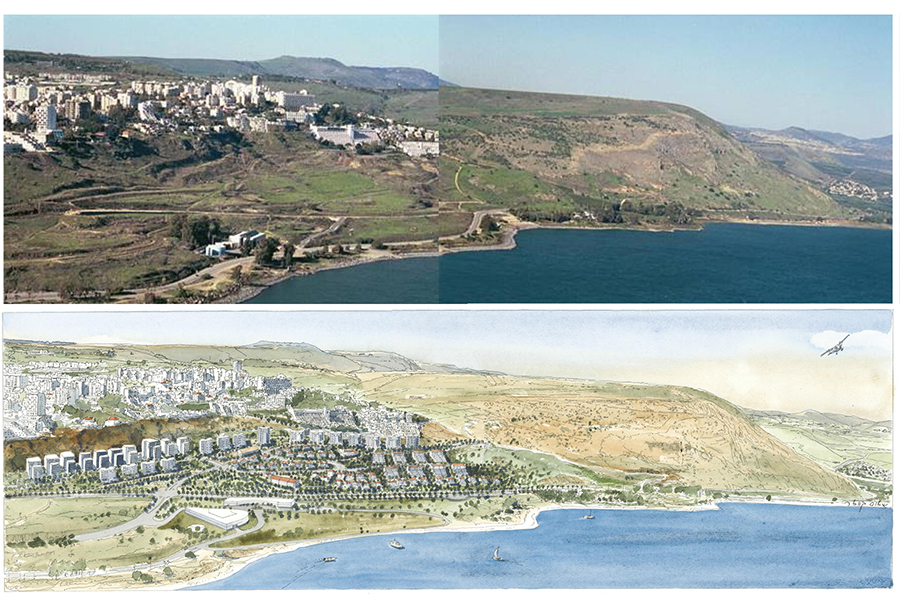
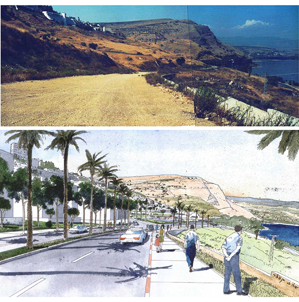
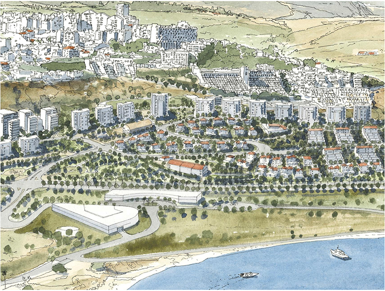
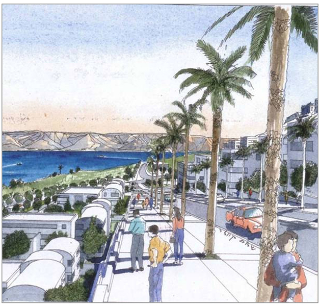
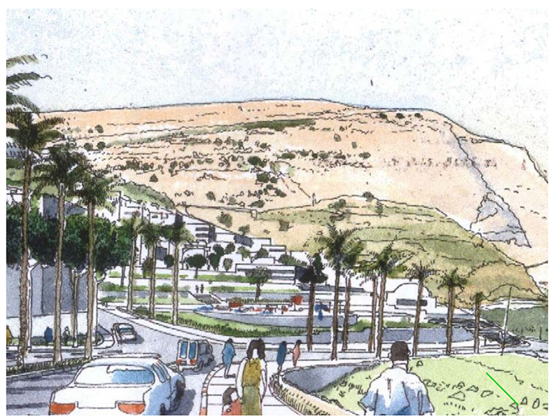
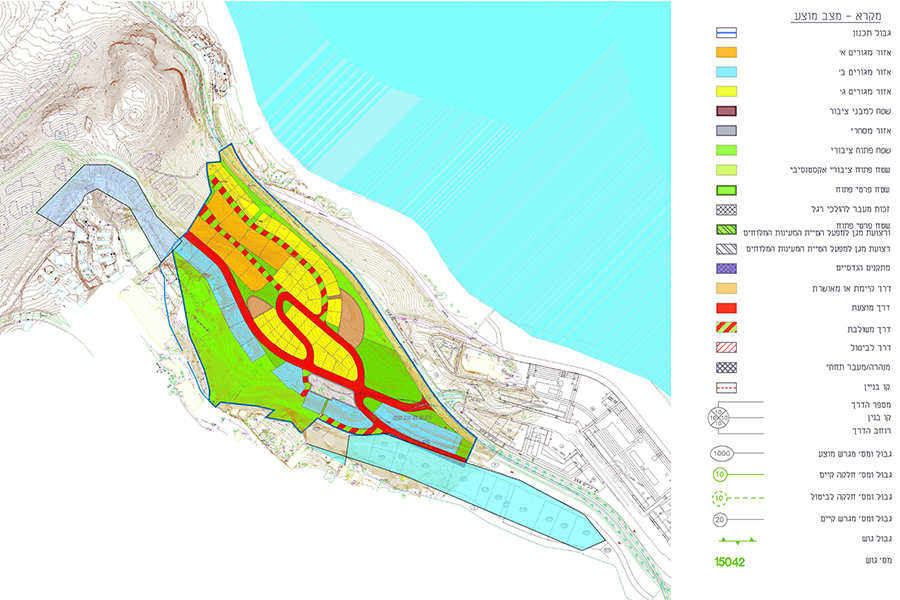
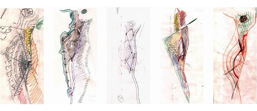
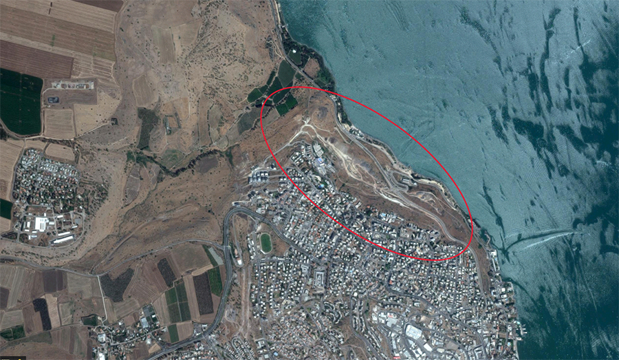
The neighborhood is located on the northern slopes of the city of Tiberias, overlooking the Sea of Galilee, the Golan Heights, Mount Arbel and Tel Raqat, and offering a glimpse of the beautiful YMCA building hidden in the greenery. The place itself is arid, almost devoid of vegetation, a stark contrast made even more conspicuous by the lush vegetation along the coast and Wadi Raqat. A national/regional road separates the neighborhood from the Sea of Galilee.
This neighborhood defines Tiberias’ northern boundary. It will extend the city’s boundaries and will constitute part of the city despite its distance from the center. Along with other planned projects, it will be part of a new district with interlinked neighborhoods that together connect the city on the cliff to the sea below.
A neighborhood can be part of the identities of those living there. The physical components of a place, their spatial array and the relationship between them affect the lifestyle of the residents, and this arrangement aims to strengthen the identity and uniqueness of the neighborhood, create convenient connections to the surroundings, provide public quality, diversity, inclusive occupancy and mixed uses. All of these together would help empower Tiberias’ urbanity and increase quality of life for all the city’s residents and those of the neighborhood in particular
Colony Hotel, the German Colony, Jerusalem
Client: Private client
Project Initiation: 2008
Location: Jerusalem
Project Area: 5.6 dunam
Status: Approved
Program: 200 hotel rooms, 14 residential units
Planning Team: Ari Cohen, Nahum Meltzer, Eti Efrati-Arieh
Project Initiation: 2008
Location: Jerusalem
Project Area: 5.6 dunam
Status: Approved
Program: 200 hotel rooms, 14 residential units
Planning Team: Ari Cohen, Nahum Meltzer, Eti Efrati-Arieh
The plan is located at the intersection of Bethlehem Road and Emek Refaim Street; the gateway to the German Colony. The planned area contains two historical German Templer buildings listed for preservation: the old school and the new school. The old school was built in 1877, a two-story symmetrical building with an elevated basement and a tiled roof. During the British Mandate two additional wings and new balconies were added to the structure, and the tiled roof was removed. The new school was built in 1882 as a similar structure; however this building underwent little changes. Once the school was shut, the structure served as offices for the British authorities, and from 1953 until 1996 served as the home of the Israeli Fiber Institute
The plan proposes restoration of the historical buildings and construction of a hotel. Above the historical old school, which includes an early Templer building addition, an additional floor is proposed in the attic space. A one-story wing, which was built as a late addition ruining the building’s symmetry, is proposed for removal.
The proposed hotel combines new construction with the historical buildings and includes commercial space as well. A separate lot within the plan includes a residential area. The proposed structures are planned around the lot’s periphery surrounding an inner courtyard.
Between the two buildings, on Emek Refaim Street, will be a plaza open to the public with access to the hotel entrance. The hotel’s main structure faces Bethlehem Road, and the residential buildings will be located on Patterson Street
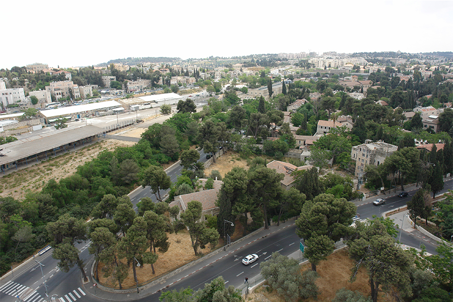 מקום התכנית - מבט אלכסוני. צילום- sky view
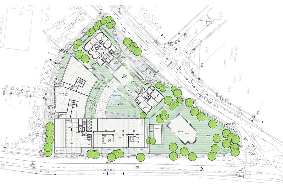
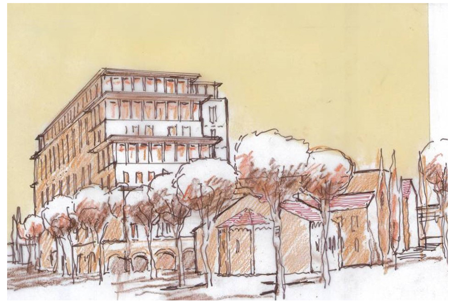
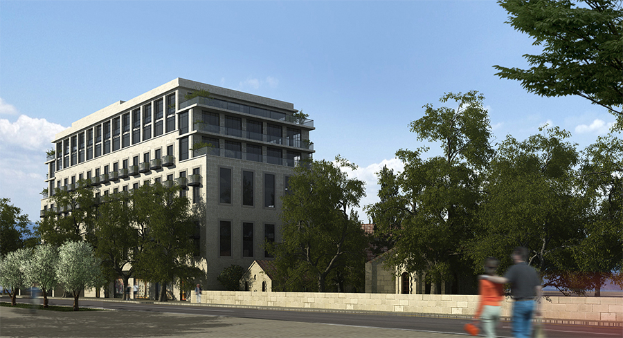
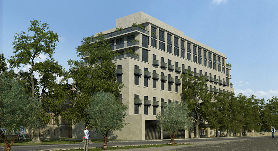
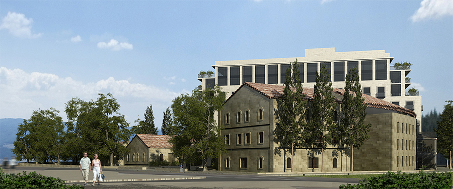
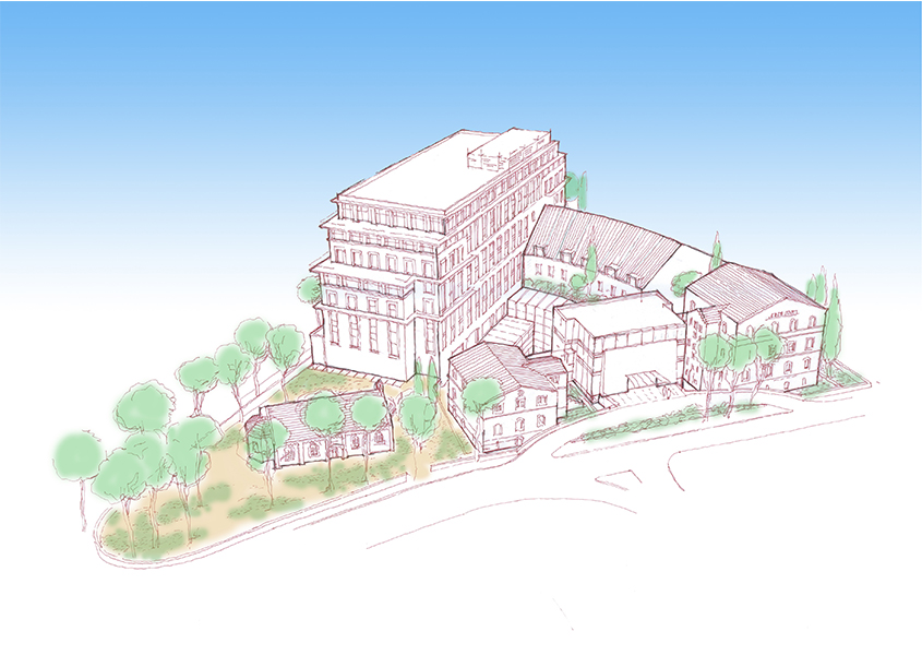
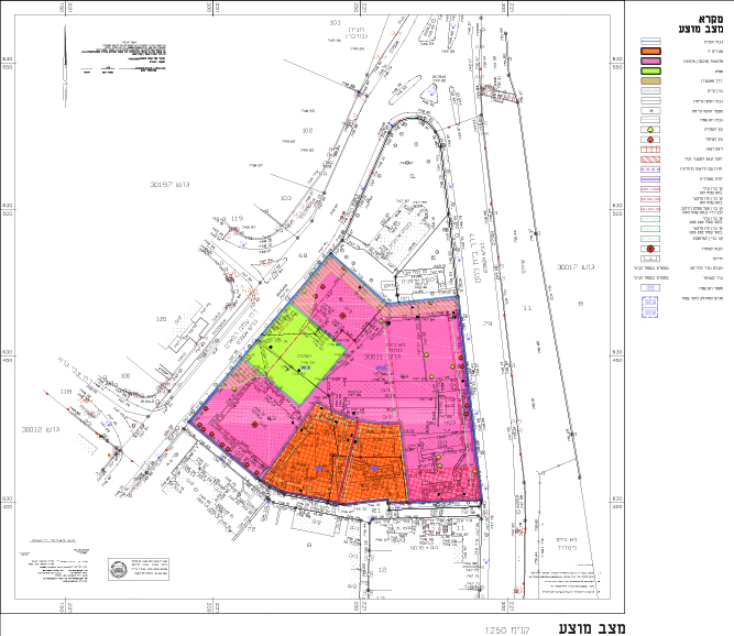
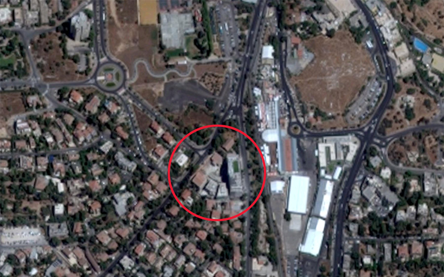
The plan is located at the intersection of Bethlehem Road and Emek Refaim Street; the gateway to the German Colony. The planned area contains two historical German Templer buildings listed for preservation: the old school and the new school. The old school was built in 1877, a two-story symmetrical building with an elevated basement and a tiled roof. During the British Mandate two additional wings and new balconies were added to the structure, and the tiled roof was removed. The new school was built in 1882 as a similar structure; however this building underwent little changes. Once the school was shut, the structure served as offices for the British authorities, and from 1953 until 1996 served as the home of the Israeli Fiber Institute
The plan proposes restoration of the historical buildings and construction of a hotel. Above the historical old school, which includes an early Templer building addition, an additional floor is proposed in the attic space. A one-story wing, which was built as a late addition ruining the building’s symmetry, is proposed for removal.
The proposed hotel combines new construction with the historical buildings and includes commercial space as well. A separate lot within the plan includes a residential area. The proposed structures are planned around the lot’s periphery surrounding an inner courtyard.
Between the two buildings, on Emek Refaim Street, will be a plaza open to the public with access to the hotel entrance. The hotel’s main structure faces Bethlehem Road, and the residential buildings will be located on Patterson Street
Northern Kinneret (Sea of Galilee)- Master Plan for Christian tourism development
Client: The ILA
Project Initiation: 2006
Location: The northern Sea of Galilee
Status: Approved
Program: Tourism
Planning Team: Nahum Meltzer, Ari Cohen, Tzafi Shelef
Project Initiation: 2006
Location: The northern Sea of Galilee
Status: Approved
Program: Tourism
Planning Team: Nahum Meltzer, Ari Cohen, Tzafi Shelef
The planning precept underlying this plan was the aim of creating a balance between the developmental versus conservation needs of the area. The critical importance of this concept is intensified by the acute need to maintain and protect the Sea of Galilee as a finite national resource. The plan’s goals are to review and identify the current state of physical, tourism, planning, economic and cultural aspects with regard to demand, and to develop planning and policy alternatives to assist decision makers and planners in determining and defining development and conservation in this area.
The reference area of this plan includes the area between: Mount Arbel-Tel Rakat; Migdal-Ginnosar Valley; Tel Kinnarot-Tabgha-Capernaum; Beit Saida Valley; Cursi Valley; Susita-Ein Gev. The plan also includes the scenic area of the northern shores of the Sea of Galilee from the west to Mount Arbel through the Netofa Valley, Cana, Sepphoris and Tur’an. The Sea of Galilee itself as well as its shores is also an integral part of the plan
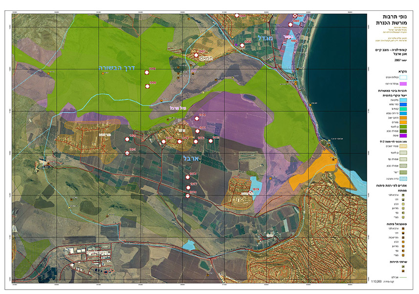 קומפילציה מצב קיים- אגן ארבל
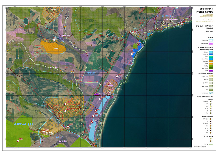
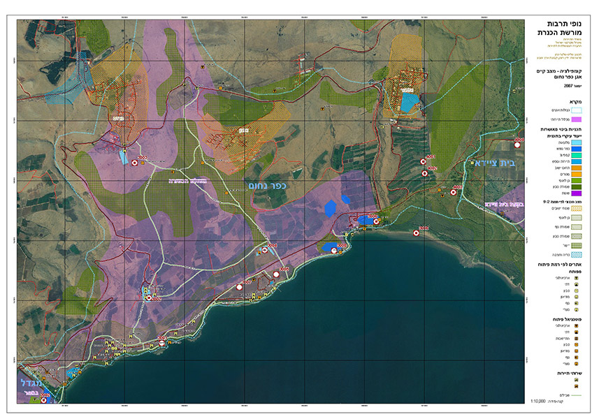
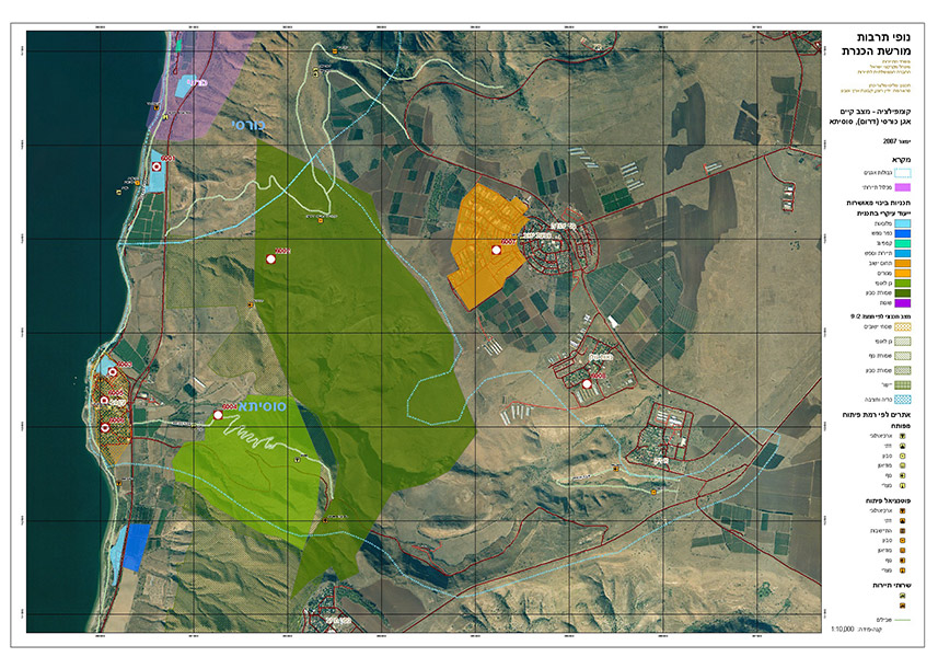
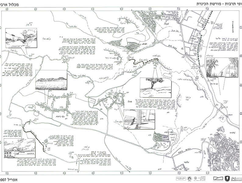
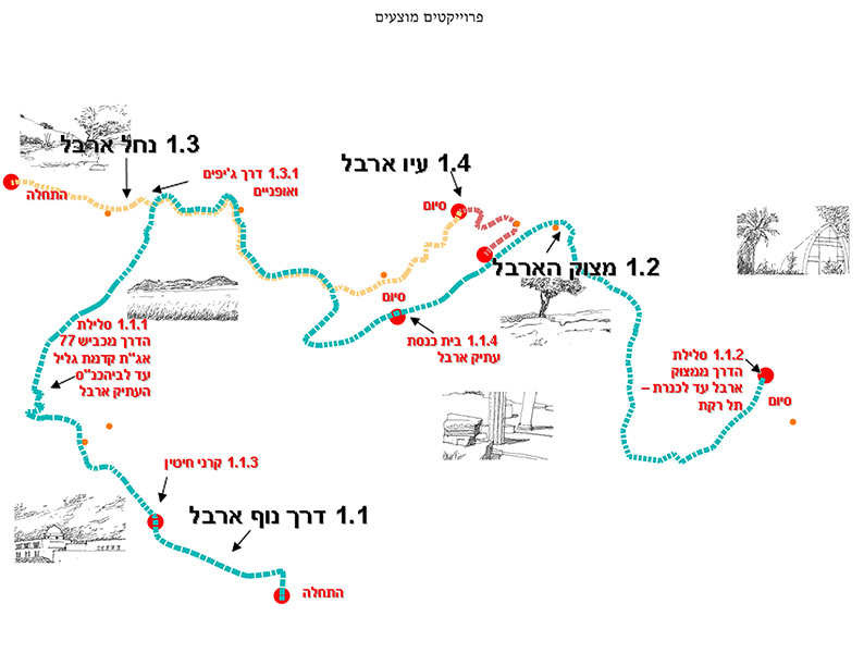
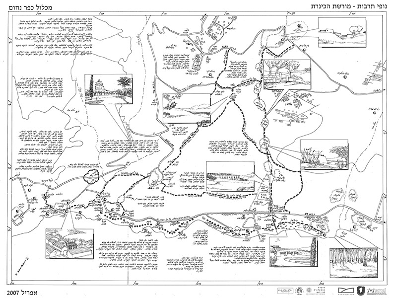
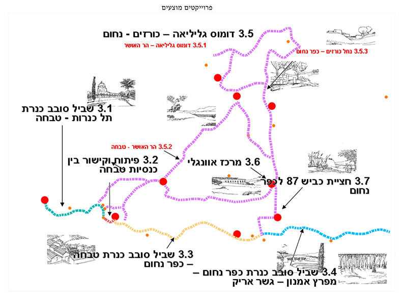
The planning precept underlying this plan was the aim of creating a balance between the developmental versus conservation needs of the area. The critical importance of this concept is intensified by the acute need to maintain and protect the Sea of Galilee as a finite national resource. The plan’s goals are to review and identify the current state of physical, tourism, planning, economic and cultural aspects with regard to demand, and to develop planning and policy alternatives to assist decision makers and planners in determining and defining development and conservation in this area.
The reference area of this plan includes the area between: Mount Arbel-Tel Rakat; Migdal-Ginnosar Valley; Tel Kinnarot-Tabgha-Capernaum; Beit Saida Valley; Cursi Valley; Susita-Ein Gev. The plan also includes the scenic area of the northern shores of the Sea of Galilee from the west to Mount Arbel through the Netofa Valley, Cana, Sepphoris and Tur’an. The Sea of Galilee itself as well as its shores is also an integral part of the plan
Shaked and Ma’of, Arad- development in between the neighborhoods
Gilo, Jerusalem- feasibility study for light rail depot location
Rehavia, Jerusalem- Development and Preservation Master Plan
Client: Jerusalem municipality
Project Initiation: 2004
Location: Jerusalem
Project Area: 647 dunam
Status: Approved
Program: 5,000 residential units
Planning Team: Nahum Meltzer, Ari Cohen, Eti Efrati-Arieh
Project Initiation: 2004
Location: Jerusalem
Project Area: 647 dunam
Status: Approved
Program: 5,000 residential units
Planning Team: Nahum Meltzer, Ari Cohen, Eti Efrati-Arieh
The plan includes the neighborhood of Rehavia and part of the surrounding neighborhoods of Kiryat Shmuel, Talbiyeh and Shaarei Chesed. The plan prescribes provisions allowing for the development of the neighborhood while preserving its unique character. The neighborhood of Rehavia has historic importance as the site of the original national institutions and the Gymnasia high school and as home to many leaders of the Zionist movement. Rehavia also has special architectural significance because it houses Jerusalem’s largest concentration of buildings built in the Bauhaus and International styles.
The planning process included a survey identifying around 150 historic buildings of different categories and determined the nature of preservation for each category. As much thought that was given to the preservation of the historic buildings was also given to the conservation of the other physical components of the neighborhood character: streets, fences, space between buildings, greenery and scale of the blocks.
The plan was accompanied by a Jerusalem Municipality team and was planned in cooperation with the regional committee, the local community administration and representatives of neighborhood residents.
The plan served as a policy document before it was given formal approval, thus enabling further development in accordance with its principles
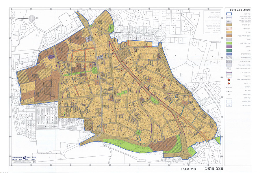 תשריט
תשריט
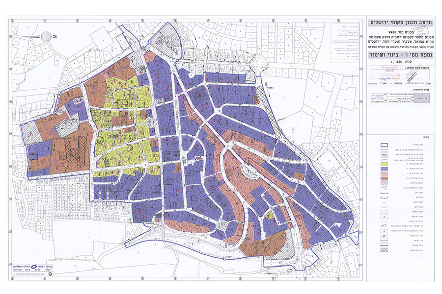
The plan includes the neighborhood of Rehavia and part of the surrounding neighborhoods of Kiryat Shmuel, Talbiyeh and Shaarei Chesed. The plan prescribes provisions allowing for the development of the neighborhood while preserving its unique character. The neighborhood of Rehavia has historic importance as the site of the original national institutions and the Gymnasia high school and as home to many leaders of the Zionist movement. Rehavia also has special architectural significance because it houses Jerusalem’s largest concentration of buildings built in the Bauhaus and International styles.
The planning process included a survey identifying around 150 historic buildings of different categories and determined the nature of preservation for each category. As much thought that was given to the preservation of the historic buildings was also given to the conservation of the other physical components of the neighborhood character: streets, fences, space between buildings, greenery and scale of the blocks.
The plan was accompanied by a Jerusalem Municipality team and was planned in cooperation with the regional committee, the local community administration and representatives of neighborhood residents.
The plan served as a policy document before it was given formal approval, thus enabling further development in accordance with its principles
Gad Street, Jerusalem- detailed plan for a residential compound
Client: Pearl of the Valley, Ltd.
Project Initiation: 2007
Location: Jerusalem
Project Area: 22 dunam
Status: Approved
Program: 210 residential units
Planning Team: Ari Cohen, Nahum Meltzer, Eti Efrati-Arieh
Project Initiation: 2007
Location: Jerusalem
Project Area: 22 dunam
Status: Approved
Program: 210 residential units
Planning Team: Ari Cohen, Nahum Meltzer, Eti Efrati-Arieh
The proposed plan covers a mostly vacant area in the neighborhood of Ge’ulim (Baka), west of the “Ulpan Etzion” building which was listed for preservation in Plan 3770. The building was built in 1937 as a theology and philosophy school of the Carmelite Order.
The proposed plan designates the area for the construction of new residential buildings, built above common underground parking. The nine proposed buildings will form a city block around a common open space which will connect the eastern and western parts of the block. The two western structures bordering a public park will be built with 8 stories above the main entry level, while the southern buildings will be 4-5 stories high and the northern buildings 6 stories high
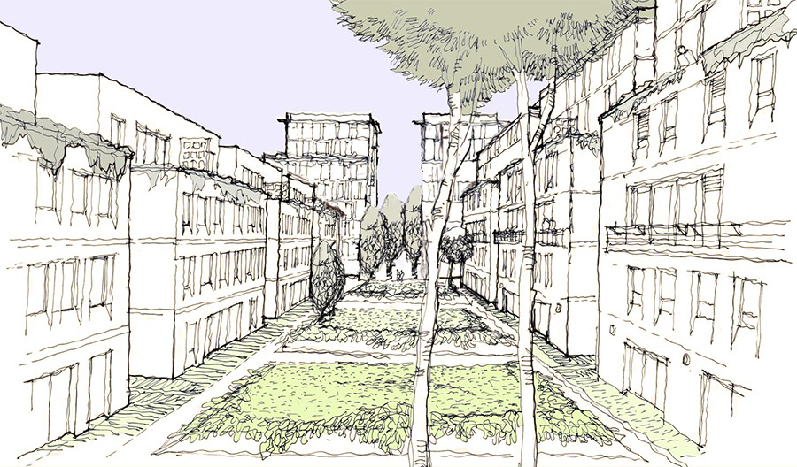 סקיצה- מבט מהחלל המרכזי
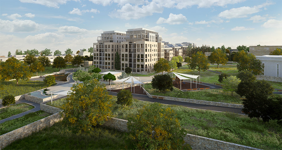
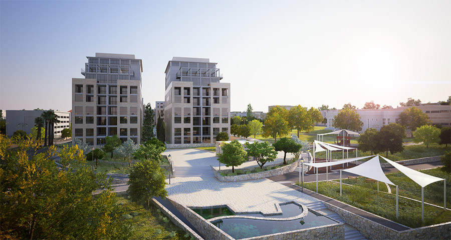
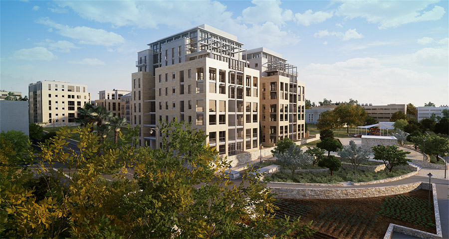
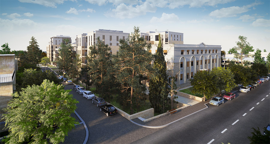
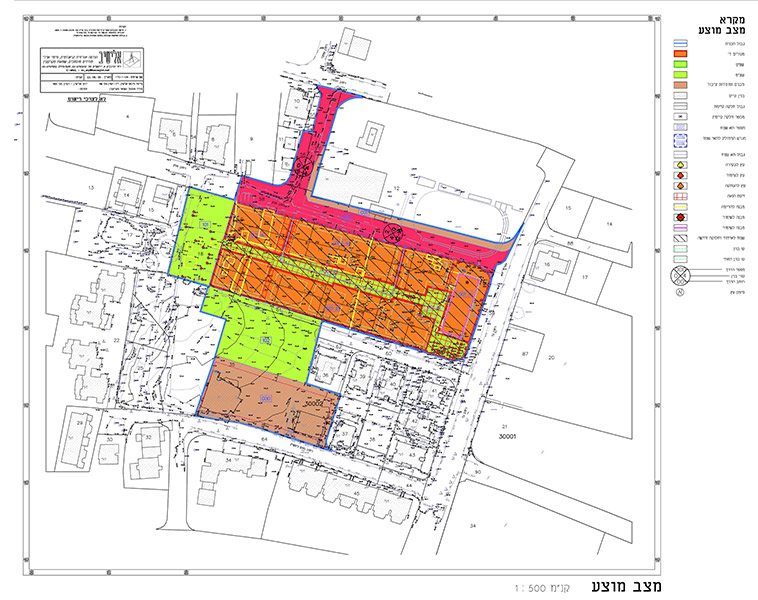
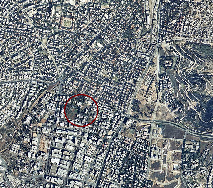
The proposed plan covers a mostly vacant area in the neighborhood of Ge’ulim (Baka), west of the “Ulpan Etzion” building which was listed for preservation in Plan 3770. The building was built in 1937 as a theology and philosophy school of the Carmelite Order.
The proposed plan designates the area for the construction of new residential buildings, built above common underground parking. The nine proposed buildings will form a city block around a common open space which will connect the eastern and western parts of the block. The two western structures bordering a public park will be built with 8 stories above the main entry level, while the southern buildings will be 4-5 stories high and the northern buildings 6 stories high
Har Nof, Jerusalem- detailed plan for Ateret Yisrael Yeshiva
Ammunition Hill, Jerusalem- Master Plan for Transport Center
Pisgat Ze’ev, Jerusalem- detailed residential plan 7928
Pisgat Ze’ev, Jerusalem- detailed residential plan 8150
Pisgat Ze’ev, Jerusalem- detailed residential plan 8151
Maintenance Center, Jerusalem- re-planning detailed plan for a employment and maintenance center
Funicular to Ein Karem, Jerusalem
Rahat, neighborhood 3 in the south- detailed residential neighborhood plan
Arad, north of the CBD- detailed plan for a residential neighborhood
Regional Master Plan 1/30- Master Plan for the Jerusalem District
Regional Master Plan 1/3- partial Master Plan for the Roglit settlement in the Jerusalem Hills
Regional Master Plan 1/29, for a mass transit system in Jerusalem
Mateh Yehuda- detailed plan for agricultural buildings and rural tourism
Client: Mateh Yehuda Regional Council
Project Initiation: 2012
Location: Mateh Yehuda
Project Area: Approx. 490,000 dunam
Status: Approved
Program: Rural tourism, agricultural structures and a third unit on the plot, according to the updated National Master Plan 35
Planning Team: Ari Cohen, Eti Efrati-Arie, Ella Zilberfarb-Ben Ezra, Liora Hami-Cohen, Sharom (matar) Arie
The plan’s overall objective is to put Mateh Yehuda on the Israeli tourism map as a “green heartland” – a focal point for tourism, vacationing and recreation in the Tel-Aviv/Jerusalem inter-metropolitan space. The combination of tourism with the production and processing of agricultural produce will serve to bolster the local economy whilst also helping to preserve the open spaces and foster a sense of identity and belonging amongst the local residents.
Specific goals include:
- Creating a flexible statutory infrastructure for the development of rural tourism and agriculture.
- Preserving high quality soil for agricultural use and protecting it from irreversible alternative land uses; maintaining reserves of choice agricultural soil for future generations.
- Expanding agricultural production and processes as a source of local distinction and identity for this area.
- Reinforcing and enhancing rural settlements in the area by drawing new residents and developing rural sources of employment and livelihood.
- Developing rural tourism and agriculture while protecting open spaces and air quality, with a view towards ecological balance and sustainable development.
- Adding a third unit onto the Moshavim’s land, in accordance with National Master Plan 35, 1b.
- Creating a mechanism for determining a system that allows splitting a plot from a privately owned land by a division plan according to Chapter D of the law, or by a plan under the authority of the local committee.
Rural tourism policy (see: Master Plan for Tourism Development and Marketing in Mateh Yehuda, 2012):
Rural tourism is a service industry that revolves around agriculture and the agricultural-rural space, and serves as a complement to agriculture. It is characterized by small businesses, generally managed by the plot owners of Moshavim, or by members of Kibbutzim and community settlements in the rural area. The development of rural tourism will, on the one hand, preserve the agricultural character of the region’s open spaces, while, on the other hand, meeting the demand for tourism in this region – including accommodation, recreational activity, education about agriculture and agricultural practices, and hiking in a natural environment. Tourism will also bring various additional benefits, such as: the development of agriculture for tourism, economic and social benefits, a range of additional employment opportunities and sources of income in the rural area – all while maintaining its rural character. Overall, the goal of the rural tourism policy is to increase and enhance the uses of rural entrepreneurialism in family farms, and on the shared lands of Moshavim and other communal settlements.
Distribution of rural tourism structures and agricultural structures:
Open spaces are Mateh Yehuda’s primary tourism resource. Therefore, most of the development of new tourism and agriculture structures will be restricted to the existing settlements. Some few agricultural buildings will be located in open spaces outside settlements, due to environmental, health or veterinary reasons, or due to the lack of another viable alternative.
The Armenian Quarter of the Old City, Jerusalem- Master Plan
Client: Armenian Patriarchate
Project Initiation: 2013
Location: Jerusalem
Project Area: 87 dunam
Program: Management of the Patriarchate properties and determining land uses for different areas, including for cultural, educational and religious institutions, commercial and residential uses, open spaces and housing welfare improvement
Planning Team: Ari Cohen, Ella Zilberfarb-Ben Ezra, Tzafi Shelef, Mike Turner
The master plan aims to take care of the planning and interface on all issues to do with the properties of the Armenian Orthodox Patriarchate and its community. The plan includes a thorough review of the existing situation of the built-up area, definition of conservation areas and areas for reconstruction, development and regulation – all in accordance with the planning policy and specific criteria for the Old City. The master plan applies to the Armenian Patriarchate properties in the Old City, as well as Patriarchate properties outside the Old City walls. The plan sets out a planning strategy while detailing concrete project portfolios including detailed plans. The master plan will help maintain the assets and values of the Old City as a World Heritage Site. It will also assist in the Patriarchate’s efforts to regulate existing construction as much as possible, as well as the removal of hazards and solving problems for the benefit of the community, the residents and the property itself
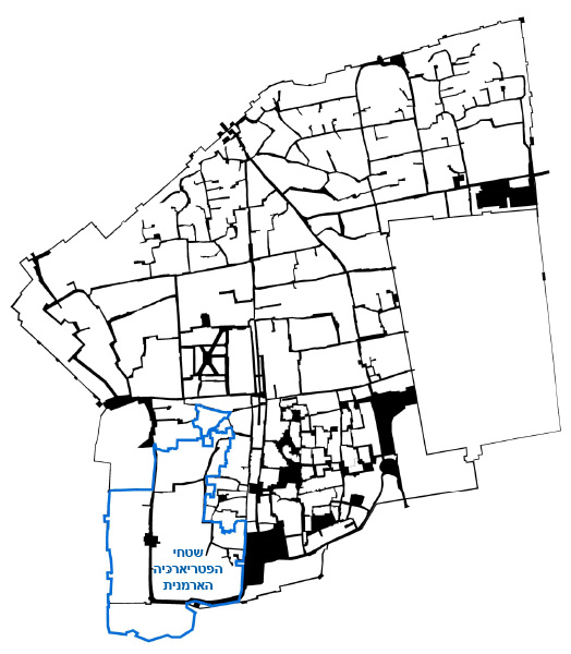 מפת העיר העתיקה

The master plan aims to take care of the planning and interface on all issues to do with the properties of the Armenian Orthodox Patriarchate and its community. The plan includes a thorough review of the existing situation of the built-up area, definition of conservation areas and areas for reconstruction, development and regulation – all in accordance with the planning policy and specific criteria for the Old City. The master plan applies to the Armenian Patriarchate properties in the Old City, as well as Patriarchate properties outside the Old City walls. The plan sets out a planning strategy while detailing concrete project portfolios including detailed plans. The master plan will help maintain the assets and values of the Old City as a World Heritage Site. It will also assist in the Patriarchate’s efforts to regulate existing construction as much as possible, as well as the removal of hazards and solving problems for the benefit of the community, the residents and the property itself
Southwestern Kseifeh- Outline Plan
Client: ILA, Bedouin Development Authority
Project Initiation: 2014
Location: Kseifeh, southwest of the existing settlement
Project Area: 9,115 dunam
Status: Approved
Program: Regulation of existing homesteads, delineating infrastructure networks, defining areas for development versus conservation and setting aside land for future municipal uses
Planning Team: Ari Cohen, Yaara Rosner-Manor, Amir Elisha, Ella Zilberfarb-Ben Ezra
In a place where future population scenarios are many and unpredictable, the outline plan aimed to address as many future scenarios as possible. The outline plan provides for regulation of existing homesteads and emphasizes an infrastructure network that can adapt to different future population scenarios, while addressing local morphology, historical systems and ownership claims. The outline plan was formulated with a detailed examination of the different planning districts on the one hand together with a holistic planning approach on the other, and it aims to serve as a high quality foundation for the development of the different districts and the future detailed plans to come.
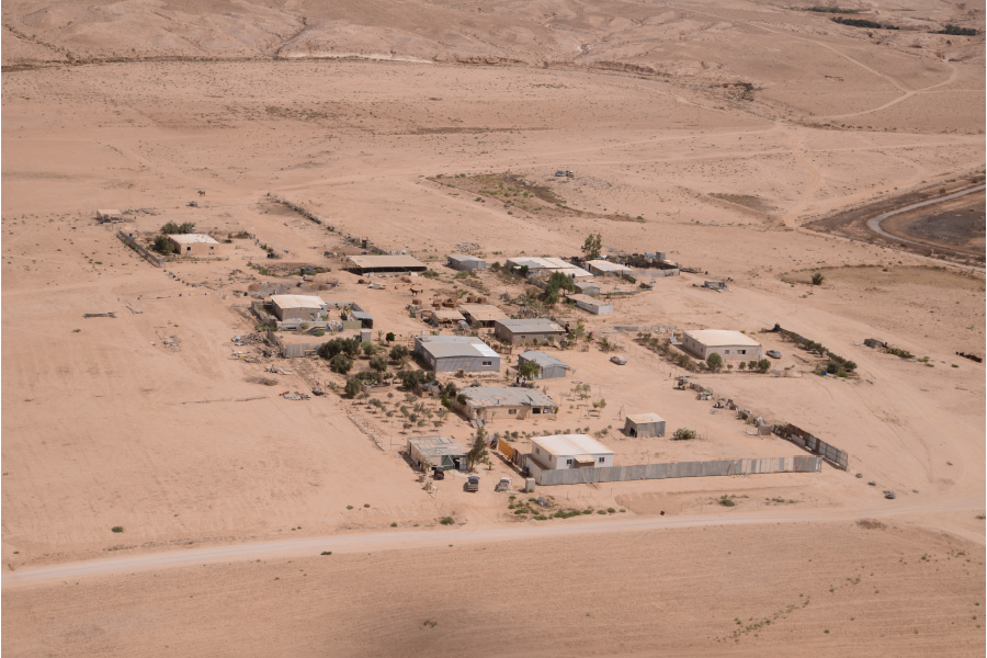 מבט לעבר מקבץ מגורים, צילום- אלי עצמון
In a place where future population scenarios are many and unpredictable, the outline plan aimed to address as many future scenarios as possible. The outline plan provides for regulation of existing homesteads and emphasizes an infrastructure network that can adapt to different future population scenarios, while addressing local morphology, historical systems and ownership claims. The outline plan was formulated with a detailed examination of the different planning districts on the one hand together with a holistic planning approach on the other, and it aims to serve as a high quality foundation for the development of the different districts and the future detailed plans to come.
Kseifeh, Neighborhood 47- detailed residential plan
Client: ILA, Bedouin Development Authority
Project Initiation: 2015
Location: Neighborhood 47, west of Beersheba River, south of Route 31 and north of the existing town of Kseifeh
Project Area: 282.5 dunam
Status: Approved
Program: A residential neighborhood of approximately 750 units, public buildings and institutions, open spaces, agricultural land and a tourism site
Planning Team: Ari Cohen, Yaara Rosner-Manor, Ella Zilberfarb, Amir Elisha
A detailed master plan including regulation of existing settlements, in an area designated as a suburban settlement area by Regional Master Plan 4/14/23. Most of the plan lies outside Kseifeh local council’s jurisdictional area; however this is an area which the local council wishes to include in its future jurisdiction. The plan proposes regulating the current residential areas within its boundaries, by defining these existing settlement areas as residential compounds. The plan also proposes additional residential lots in areas where there are no residents yet. The plan proposes a redesign of the current layout of designated agricultural land, proposing instead to change these lands to land for the use of the residents and land reserves for future development. The plan aligns with the principles of the Kseifeh outline plan with regard to infrastructure, land uses and allocation of public use land. The planning included a participatory process with residents living in the relevant area, and decisions on issues such as regulation of existing settlement, defining areas for densification and for future development and defining public spaces and roads and infrastructure networks were made with the consent of residents and suited to their needs
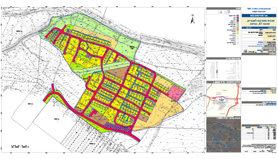 תשריט שימושי קרקע
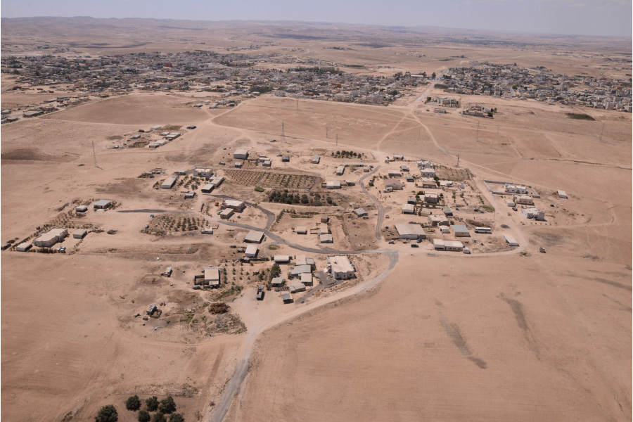
A detailed master plan including regulation of existing settlements, in an area designated as a suburban settlement area by Regional Master Plan 4/14/23. Most of the plan lies outside Kseifeh local council’s jurisdictional area; however this is an area which the local council wishes to include in its future jurisdiction. The plan proposes regulating the current residential areas within its boundaries, by defining these existing settlement areas as residential compounds. The plan also proposes additional residential lots in areas where there are no residents yet. The plan proposes a redesign of the current layout of designated agricultural land, proposing instead to change these lands to land for the use of the residents and land reserves for future development. The plan aligns with the principles of the Kseifeh outline plan with regard to infrastructure, land uses and allocation of public use land. The planning included a participatory process with residents living in the relevant area, and decisions on issues such as regulation of existing settlement, defining areas for densification and for future development and defining public spaces and roads and infrastructure networks were made with the consent of residents and suited to their needs
North of Kseifeh- Outline Plan
Client: רשות מקרקעי ישראל, הרשות לפיתוח והתיישבות הבדואים בנגב
Project Initiation: 2014
Location: צפונית לכסיפה הישוב הקיים
Project Area: כ-4850 דונם
Status: מאושר
Program: כ-4,850 דונם למגורים, תשתיות, תעסוקה וחקלאות. תכנון לקיבולת פוטנציאלית של כ-3,000 יח"ד
Planning Team: ארי כהן, יערה רוזנר מנור, אלה זילברפרב-בן עזרא
Project Initiation: 2014
Location: צפונית לכסיפה הישוב הקיים
Project Area: כ-4850 דונם
Status: מאושר
Program: כ-4,850 דונם למגורים, תשתיות, תעסוקה וחקלאות. תכנון לקיבולת פוטנציאלית של כ-3,000 יח"ד
Planning Team: ארי כהן, יערה רוזנר מנור, אלה זילברפרב-בן עזרא
The Old City of Jerusalem- Policy Document
Client: The Jerusalem Development Authority
Project Initiation: 2014
Location: The Old City of Jerusalem
Status: In approval process
Planning Team: Mike Turner, Ari Cohen, Ella Zilberfarb-Ben Ezra
In partnership with: TIK Projects
Project Initiation: 2014
Location: The Old City of Jerusalem
Status: In approval process
Planning Team: Mike Turner, Ari Cohen, Ella Zilberfarb-Ben Ezra
In partnership with: TIK Projects
The policy paper presents goals, objectives and criteria for decisions on key issues, for achieving goals of the outline process for preservation and renewal of the Old City of Jerusalem. The policy papers lay out the proposed manner of leading the preservation and renewal process. The central documents are the outline planning documents, supported by several more planning documents on various issues. This document is based on goals and objectives appearing in a series of statutory, strategic and master plans as well as different policy papers.
The paper is laid out in two different complementary chapters. The first presents the planning policy for the Old City, describes the rationale behind the chosen policy and lays out its main principles. The second chapter details the provisions and instructions for planning in the Old City and is written as a compact dedicated planning guide for future planners. This need for a unified, non-statutory guide surfaced recently, and it seems that these policy papers by definition should remain independent, non-statutory papers
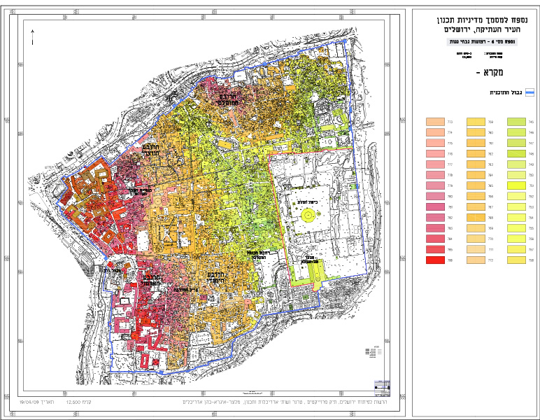 נספח גבהי גגות
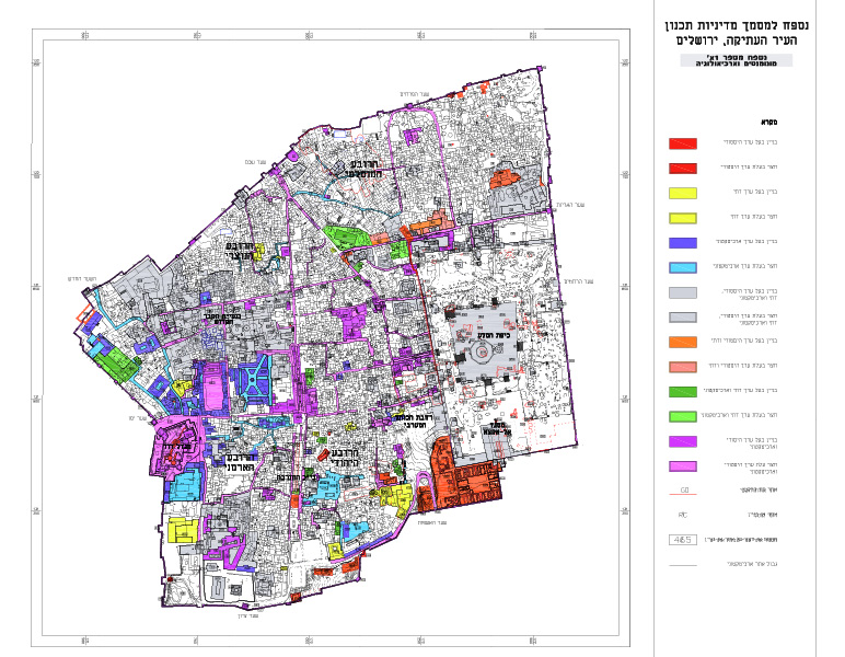
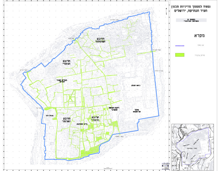
The policy paper presents goals, objectives and criteria for decisions on key issues, for achieving goals of the outline process for preservation and renewal of the Old City of Jerusalem. The policy papers lay out the proposed manner of leading the preservation and renewal process. The central documents are the outline planning documents, supported by several more planning documents on various issues. This document is based on goals and objectives appearing in a series of statutory, strategic and master plans as well as different policy papers.
The paper is laid out in two different complementary chapters. The first presents the planning policy for the Old City, describes the rationale behind the chosen policy and lays out its main principles. The second chapter details the provisions and instructions for planning in the Old City and is written as a compact dedicated planning guide for future planners. This need for a unified, non-statutory guide surfaced recently, and it seems that these policy papers by definition should remain independent, non-statutory papers
The Old City of Jerusalem- detailed plans for six blocks
Client: The Jerusalem Development Authority
Project Initiation: 2012
Location: The Old City of Jerusalem- Muslim and Christian Quarters
Status: Planning
Program: Regulating land uses and defining areas for protection and preservation, areas for regulation of existing buildings, and areas for building additions (without additional units) for housing welfare improvement and in accordance with Old City values
Planning Team: Mike Turner, Ari Cohen, Ella Zilberfarb-Ben Ezra, Tzafi Shelef
The Old City of Jerusalem, one of the world’s oldest cities, is one of the most important spiritual centers for Judaism, Islam and Christianity. In 1981 it was declared a UNESCO World Heritage Site, and in 1982 it was declared a site at risk due to accelerated urban development, the detrimental effects of tourism and lack of maintenance. Today, the statutory plans in effect for the Old City are AM/9 (for the Old City and its environs, approved in 1976) and a limited number of small-scale plans, a situation that severely limits the ability to receive building permits in the Old City, both in private as well as public space. Since the Old City continues to evolve, and in the absence of any plan providing even a partial solution for housing welfare for the local residents, the values and assets of the Old City are being violated. Despite the Old City’s complexity, these plans are designed to serve as a simple, applicable and effective solution, intended to encourage construction suitable for the Old City’s character, and thus protect its physical state and ensure that all new development in the compounds will not adversely affect the Old City’s sites, assets and values. The detailed plans allow regulation of land uses and lay the groundwork for management of the housing interface in the Old City and improving the housing welfare of the residents (without adding any additional units), while relying on planning policy and methodology formulated in the plan for renewal and preservation of the Old City
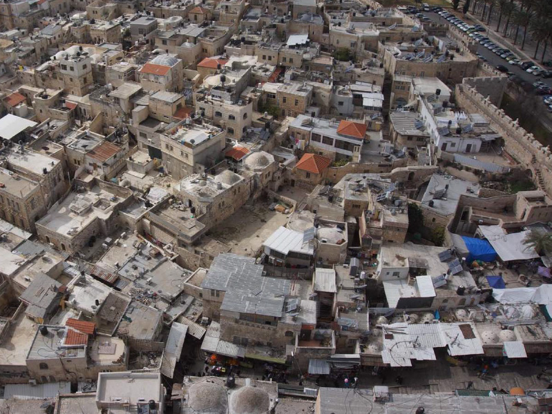 מבט אלכסוני לתוך העיר העתיקה, צילום- קראוס מודדים
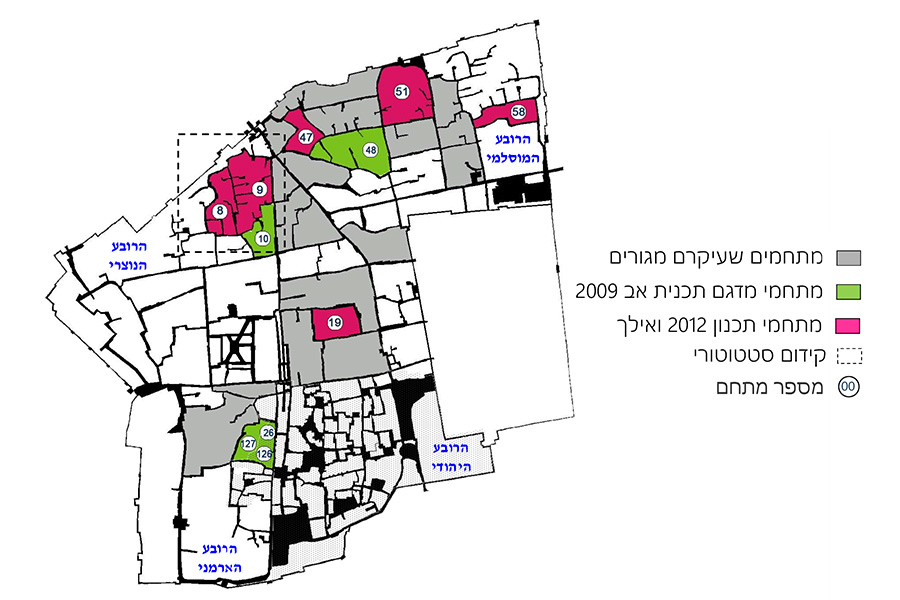
The Old City of Jerusalem, one of the world’s oldest cities, is one of the most important spiritual centers for Judaism, Islam and Christianity. In 1981 it was declared a UNESCO World Heritage Site, and in 1982 it was declared a site at risk due to accelerated urban development, the detrimental effects of tourism and lack of maintenance. Today, the statutory plans in effect for the Old City are AM/9 (for the Old City and its environs, approved in 1976) and a limited number of small-scale plans, a situation that severely limits the ability to receive building permits in the Old City, both in private as well as public space. Since the Old City continues to evolve, and in the absence of any plan providing even a partial solution for housing welfare for the local residents, the values and assets of the Old City are being violated. Despite the Old City’s complexity, these plans are designed to serve as a simple, applicable and effective solution, intended to encourage construction suitable for the Old City’s character, and thus protect its physical state and ensure that all new development in the compounds will not adversely affect the Old City’s sites, assets and values. The detailed plans allow regulation of land uses and lay the groundwork for management of the housing interface in the Old City and improving the housing welfare of the residents (without adding any additional units), while relying on planning policy and methodology formulated in the plan for renewal and preservation of the Old City
Kseifeh- light industry and workshop zone
Client: ILA, Bedouin Development Authority
Project Initiation: 2015
Location: North of Kseifeh and west of Route 80 and the planned route of the Beersheba-Arad train
Project Area: 282.5 dunam
Status: Approved
Program: 90 lots for light industry and workshops, 20 dunam of agricultural land and space for an events hall
Planning Team: Ari Cohen, Ella Zilberfarb-Ben Ezra, Amir Elisha
The plan aims to provide solutions for the many hazards and disturbances that exist within the town, in areas designated for residential use. The plan, adjacent to the existing town on the one hand while keeping a proper distance from residential areas on the other, will allow easy access to sources of employment for Kseifeh residents while ensuring separation between the residential neighborhood to the industrial area. The plan applies to vacant lands slated for “suburban development” by Regional Master Plan 4/14/23 and designates different land uses, mainly lots for light industry and workshops of about a dunam each
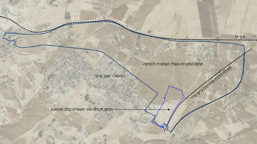 התמצאות
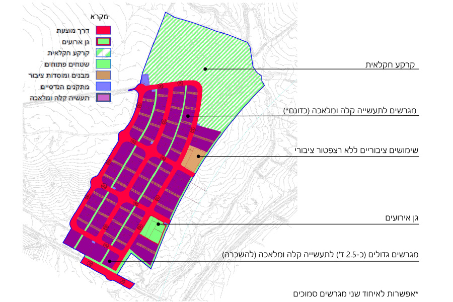
The plan aims to provide solutions for the many hazards and disturbances that exist within the town, in areas designated for residential use. The plan, adjacent to the existing town on the one hand while keeping a proper distance from residential areas on the other, will allow easy access to sources of employment for Kseifeh residents while ensuring separation between the residential neighborhood to the industrial area. The plan applies to vacant lands slated for “suburban development” by Regional Master Plan 4/14/23 and designates different land uses, mainly lots for light industry and workshops of about a dunam each
Kseifeh, Neighborhood 49- detailed residential plan
Southern Arad Valley- feasibility study for the Regulation of Bedouin Settlemen
Client: ILA, the Bedouin Development Authority
Project Initiation: 2013
Location: Arad valley
Project Area: 120,000 dunam
Status: Approved
Planning Team: Ari Cohen, Yaara Rosner-Manor, Ella Zilberfarb-Ben Ezra, Mor Kertes, Liora Hemi
Project Initiation: 2013
Location: Arad valley
Project Area: 120,000 dunam
Status: Approved
Planning Team: Ari Cohen, Yaara Rosner-Manor, Ella Zilberfarb-Ben Ezra, Mor Kertes, Liora Hemi
This feasibility study aimed to examine different options for Bedouin settlement regulation and development in the southern Arad valley. The proposal includes recommendations for the town of Kseifeh, located in the central Arad valley, as well as the non-regulated villages throughout the valley.
The plan included a participatory process including dozens of meetings with the residents of the valley at large, with specific focus on residents of Kseifeh and its immediate surroundings.
The feasibility study is based on the latest research regarding Bedouin settlement in the Negev, reflecting the Bedouin code of traditional spatial settlement layout. The study also deals with the spatial expression of social codes and the unique relationship between open and built areas. These aspects were all included without deviating from the provisions of Regional Master Plan 4/14/23 or those of the Planning and Construction Law
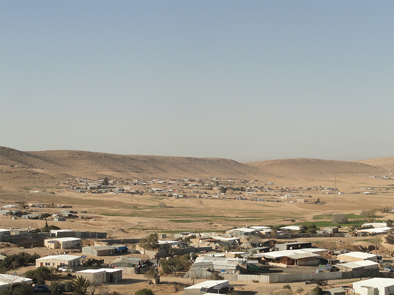 הכפרים הבדואים בנגב- מבט טיפוסי
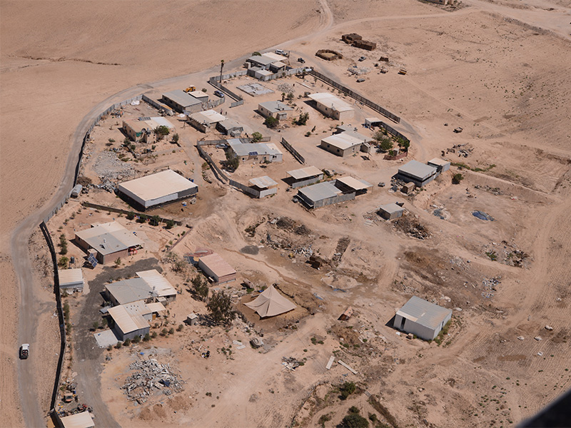
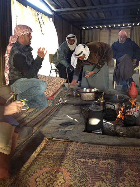
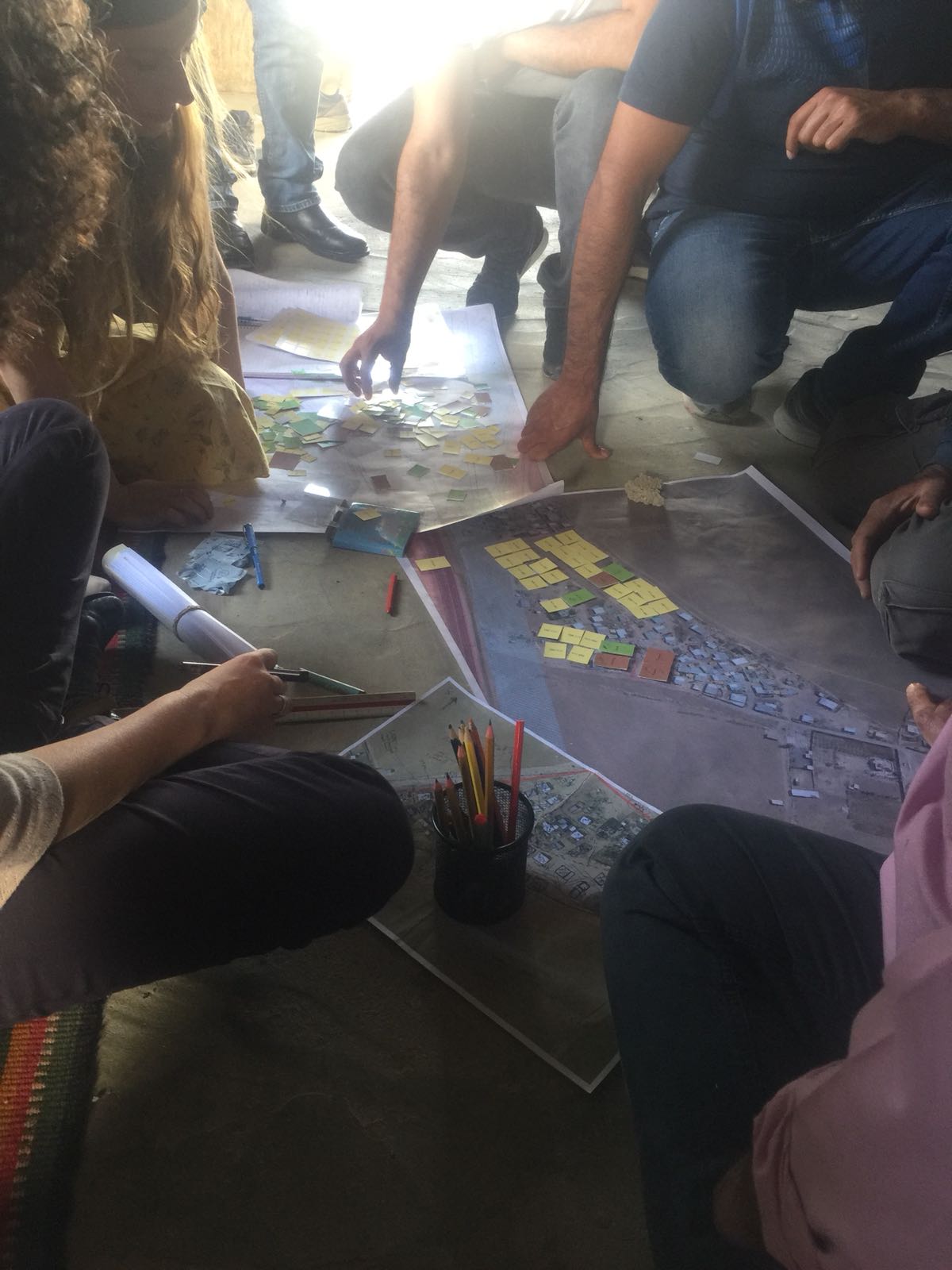
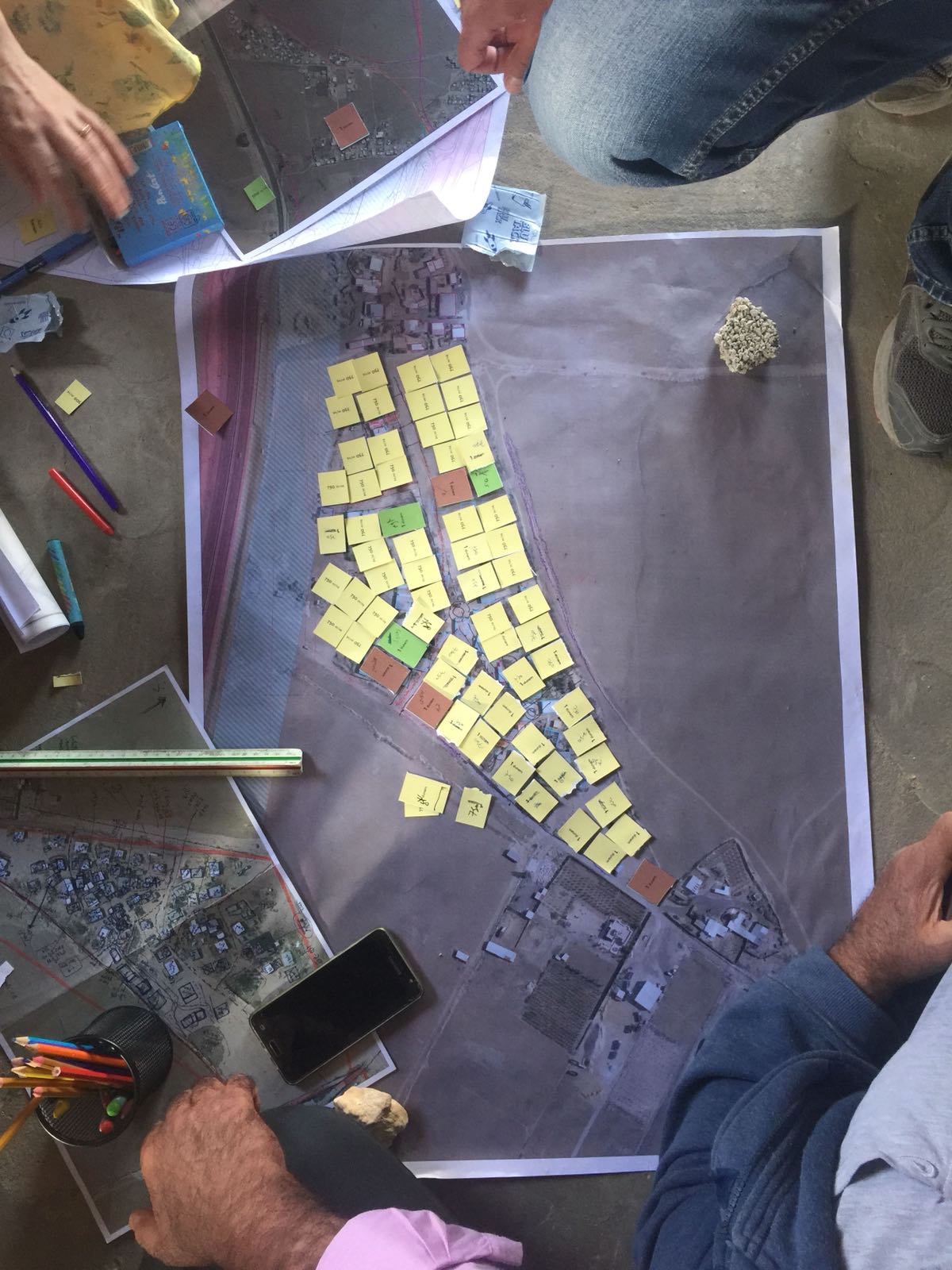
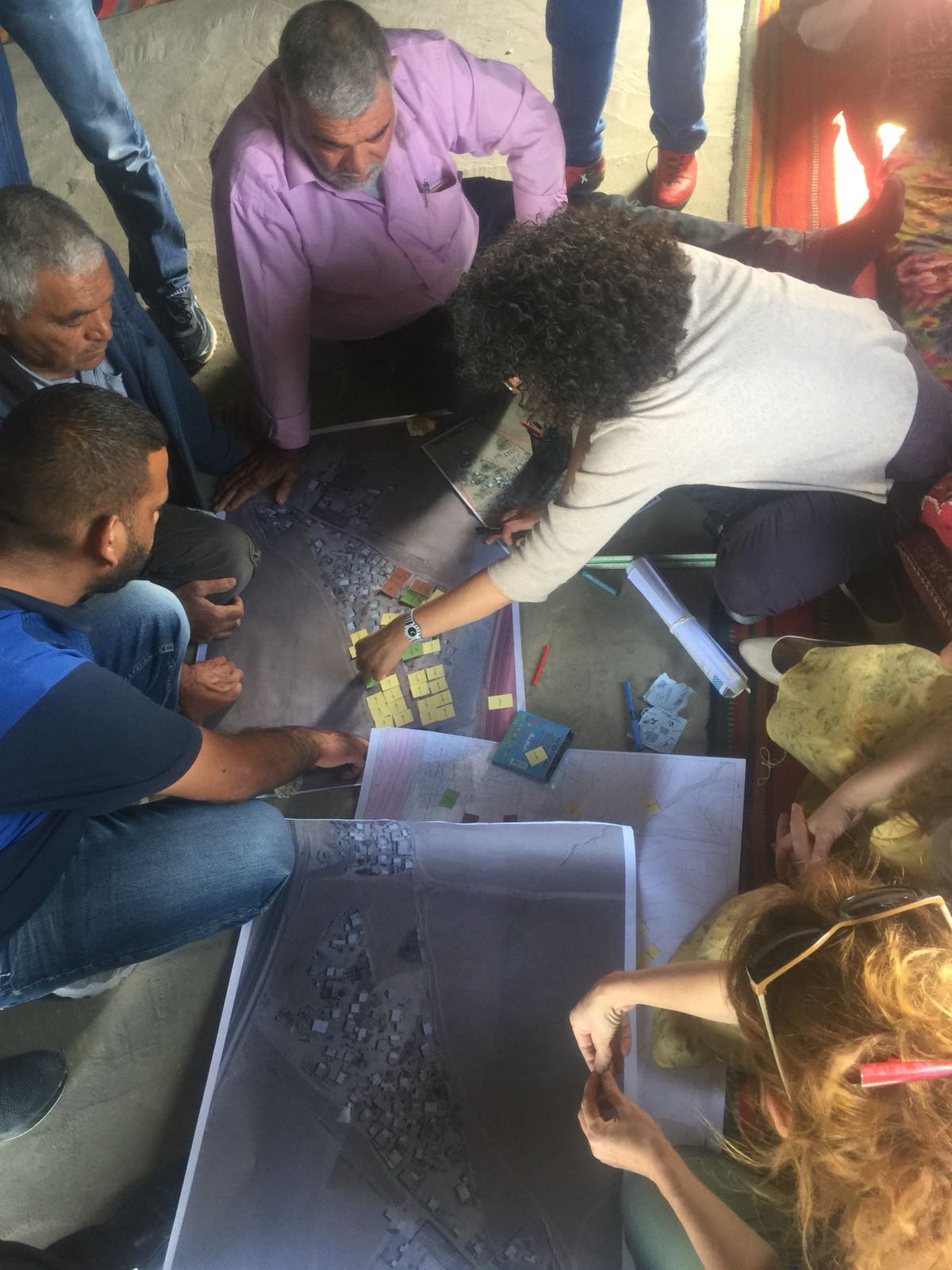
This feasibility study aimed to examine different options for Bedouin settlement regulation and development in the southern Arad valley. The proposal includes recommendations for the town of Kseifeh, located in the central Arad valley, as well as the non-regulated villages throughout the valley.
The plan included a participatory process including dozens of meetings with the residents of the valley at large, with specific focus on residents of Kseifeh and its immediate surroundings.
The feasibility study is based on the latest research regarding Bedouin settlement in the Negev, reflecting the Bedouin code of traditional spatial settlement layout. The study also deals with the spatial expression of social codes and the unique relationship between open and built areas. These aspects were all included without deviating from the provisions of Regional Master Plan 4/14/23 or those of the Planning and Construction Law
Kseifeh, Compound 9- detailed residential plan
Kseifeh- Neighborhood 51
Kseifeh- Neighborhood 50
Southwestern Jerusalem- Master Plan
HaPalmach 1, Jerusalem- residential building
Client: Private client
Project Initiation: 2006
Location: Jerusalem
Project Area: 0.5 dunam
Status: Approved
Program: Residential uses in a building listed for preservation, 6 residential units
Planning Team: Ari Cohen, Guy Igra
Project Initiation: 2006
Location: Jerusalem
Project Area: 0.5 dunam
Status: Approved
Program: Residential uses in a building listed for preservation, 6 residential units
Planning Team: Ari Cohen, Guy Igra
Plan for a new residential building on a lot including a historical two-story building above a basement level. Approved plans for the lot contain no provisions concerning the preservation of facades or trees within the lot boundaries. The plans seek to preserve most of the existing facades in their place. The proposed building includes parts of the existing structure, with a three-story terraced addition above and alongside it
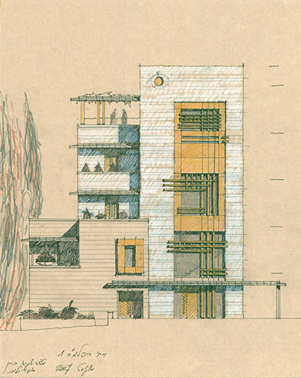 חזית לרחוב הפלמ"ח
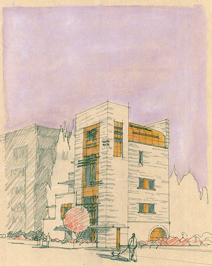
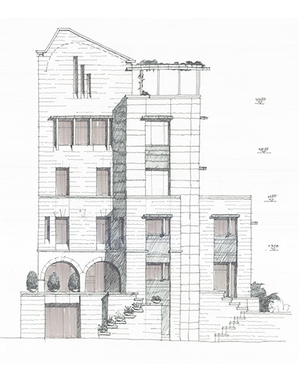
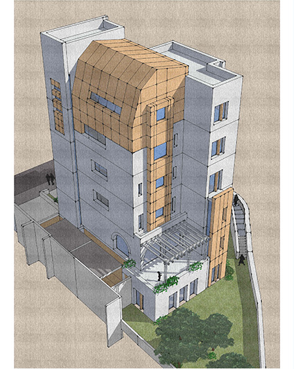
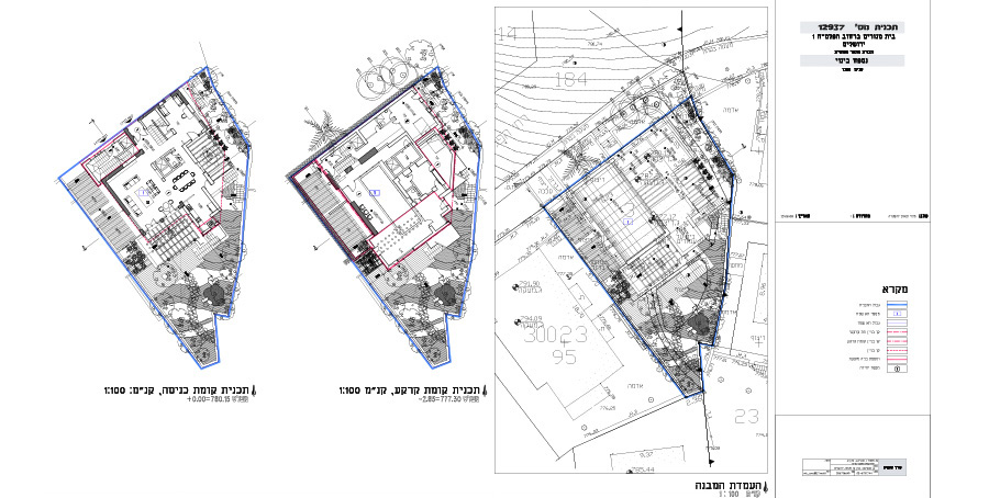
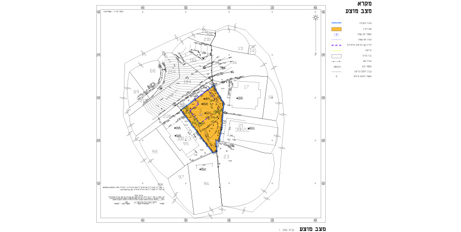
Plan for a new residential building on a lot including a historical two-story building above a basement level. Approved plans for the lot contain no provisions concerning the preservation of facades or trees within the lot boundaries. The plans seek to preserve most of the existing facades in their place. The proposed building includes parts of the existing structure, with a three-story terraced addition above and alongside it
Consulting for the Interior Ministry-comprehensive planning, simplification and consolidation of Regional Master Plans
Client: משרד הפנים, משרד האוצר
Planning Team: ארי כהן
Planning Team: ארי כהן
Aro’er outline plan
Beitar Illith- Outline Plan for District B
Abu Tor, Jerusalem- residential and public park compound
Ramot 03, Jerusalem- detailed plan for a residential compound
Kiryat Ye’arim- Residential Compound
Client: Private client
Project Initiation: 2013
Location: Kiryat Ye'arim
Project Area: 10 dunam
Status: Approved
Program: 84 residential units, kindergartens, a synagogue and a public park. Total built area: 16,000 square meters
Planning Team: Ari Cohen, Michael Wind
Project Initiation: 2013
Location: Kiryat Ye'arim
Project Area: 10 dunam
Status: Approved
Program: 84 residential units, kindergartens, a synagogue and a public park. Total built area: 16,000 square meters
Planning Team: Ari Cohen, Michael Wind
The town of Kiryat Ye’arim has been undergoing a process of densification in the past decade, which requires identifying additional areas for development and adopting urban construction patterns.
The desire to protect sensitive open spaces surrounding the town has led planning authorities to determine that additional development will take place within town borders and not beyond them.
This residential compound is located on the outskirts of town, near Highway 1, and was required to create a significant amount of additional residential units supported by an array of public spaces and buildings, while dealing with sloping land conditions and noise pollution from the adjacent Jerusalem-Tel Aviv highway. The entire plan has been very carefully examined for visibility from the road, because the site is highly visible to passengers on Route number 1
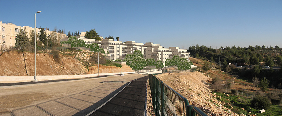 מבט מדרך האנדרטה
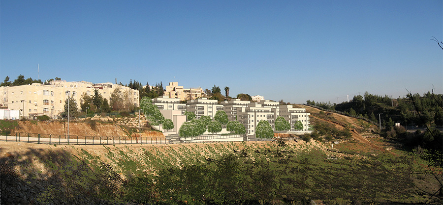
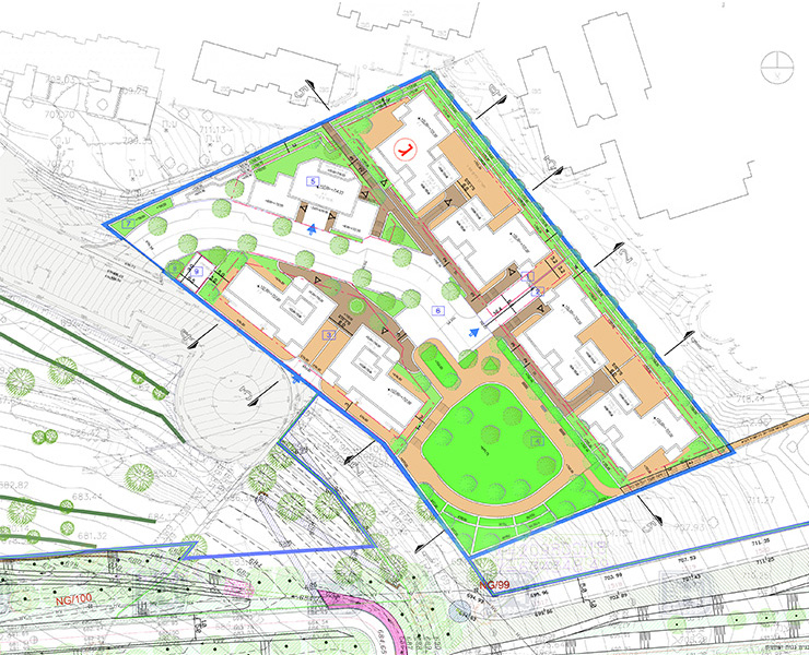
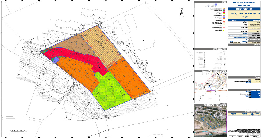
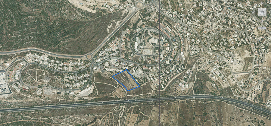
The town of Kiryat Ye’arim has been undergoing a process of densification in the past decade, which requires identifying additional areas for development and adopting urban construction patterns.
The desire to protect sensitive open spaces surrounding the town has led planning authorities to determine that additional development will take place within town borders and not beyond them.
This residential compound is located on the outskirts of town, near Highway 1, and was required to create a significant amount of additional residential units supported by an array of public spaces and buildings, while dealing with sloping land conditions and noise pollution from the adjacent Jerusalem-Tel Aviv highway. The entire plan has been very carefully examined for visibility from the road, because the site is highly visible to passengers on Route number 1
Zion Valley, Jerusalem- employment center
Client: Israel Land Authority
Project Initiation: 2015
Location: Israel Land Authority
Project Area: 80 dunam
Status: In process of approval
Program: An employment center at a total of 120,000 square meter built area
Planning Team: Ari Cohen, Michael Wind, Amir Elisha
Project Initiation: 2015
Location: Israel Land Authority
Project Area: 80 dunam
Status: In process of approval
Program: An employment center at a total of 120,000 square meter built area
Planning Team: Ari Cohen, Michael Wind, Amir Elisha
The plan is located on a site that developed as a major crossroads which includes the Begin Highway, Bait road and a light rail line. In addition, in the future the valley will serve as another city entrance with the completion of Highway 16. The high traffic capacity of this area is suitable for uses that require high accessibility together with the option of utilizing road-adjacent lands.
The plan identifies a link between the proposed employment areas and the adjacent Machon Lev and Jerusalem College of Technology, places of technologically-oriented education. The plan aims to create a planning framework that will serve the employment and education uses and will encourage the interface between them, for their benefit and for the city’s alike.
Recently, the plan has been undergoing adjustments in order to suit the predicted traffic caused by changes in the planning of Road 16
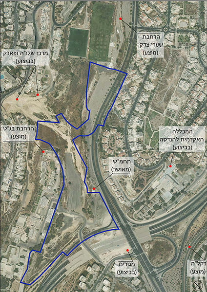 התמצאות
The plan is located on a site that developed as a major crossroads which includes the Begin Highway, Bait road and a light rail line. In addition, in the future the valley will serve as another city entrance with the completion of Highway 16. The high traffic capacity of this area is suitable for uses that require high accessibility together with the option of utilizing road-adjacent lands.
The plan identifies a link between the proposed employment areas and the adjacent Machon Lev and Jerusalem College of Technology, places of technologically-oriented education. The plan aims to create a planning framework that will serve the employment and education uses and will encourage the interface between them, for their benefit and for the city’s alike.
Recently, the plan has been undergoing adjustments in order to suit the predicted traffic caused by changes in the planning of Road 16
HaShotrim neighborhood, Beit Shemesh
Client: Beit Shemesh municipality, ILA
Project Initiation: 2015
Location: Beit Shemesh
Project Area: 72 dunam
Status: Approved
Program: Housing, open spaces, public buildings and a stadium. 200 residential units, total built area 38,000 square meters
Planning Team: Ari Cohen, Michael Wind
Project Initiation: 2015
Location: Beit Shemesh
Project Area: 72 dunam
Status: Approved
Program: Housing, open spaces, public buildings and a stadium. 200 residential units, total built area 38,000 square meters
Planning Team: Ari Cohen, Michael Wind
The plan is located at the main entrance to the city of Beit Shemesh (the “Big” Junction), close to the historic stadium. The plan aims to construct residential buildings along the western side of Ha’aliya Street, linking the Bialik neighborhood from the south to the commercial center in the north of the city. This will create an urban continuity between the different parts of the city and will afford better access to the open space at the foot of the plan to all the surrounding residents. The plan also took on the restoration of the historic stadium, reintroducing it to proper use while regulating its neglected physical and statutory status
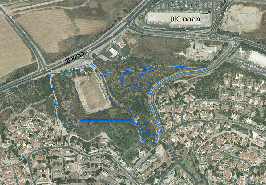 התמצאות
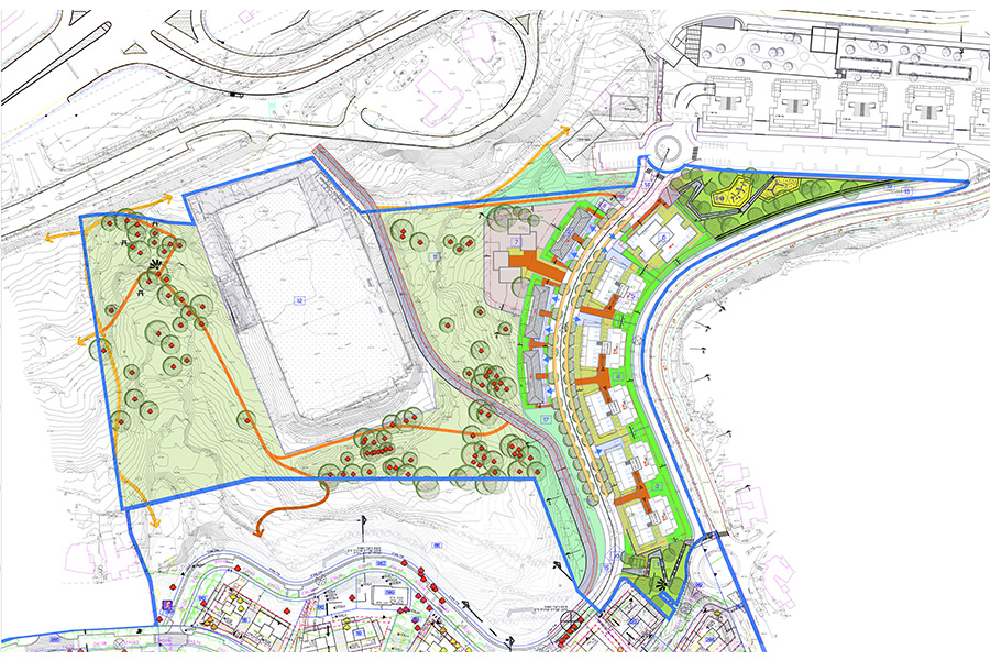
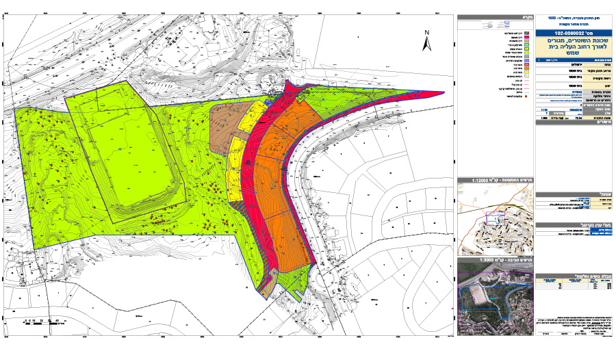
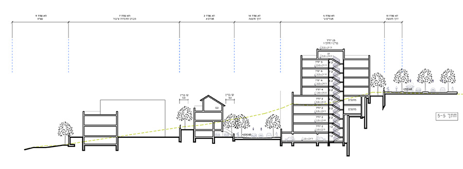
The plan is located at the main entrance to the city of Beit Shemesh (the “Big” Junction), close to the historic stadium. The plan aims to construct residential buildings along the western side of Ha’aliya Street, linking the Bialik neighborhood from the south to the commercial center in the north of the city. This will create an urban continuity between the different parts of the city and will afford better access to the open space at the foot of the plan to all the surrounding residents. The plan also took on the restoration of the historic stadium, reintroducing it to proper use while regulating its neglected physical and statutory status
Jerusalem Hills Development and Conservation Master Plan
Kiryat Yovel, Ir Ganim and Kiryat Menachem, Jerusalem- urban renewal Master Plan
Kiryat Menachem, Jerusalem- urban renewal: Mexico Street- two projects, Henrietta Szold Street, Iceland Street
Kiryat Yovel, Jerusalem- urban renewal: Hentke and Borochov streets, Bezek compound
Katamon and Katamonim, Jerusalem- urban renewal on Rabbi Meir, Yossi Ben Yo’ezer, Ma’agalei Yavne, Yitzchak Sadeh streets and Pat Junction
Arnona, Jerusalem- urban renewal: Hebron Road, Shalom Yehuda Street
Gilo, Jerusalem- urban renewal: HaShayish, HaShoham and HaTzuf streets
Beit HaKerem, Jerusalem- urban renewal on HeMeyasdim Street
Mass transit system for Jerusalem – urban planning
Kiryat Ye’arim- Residential and Hotel Compound
Client: Private client
Project Initiation: 2012
Location: Kiryat Ye'arim
Project Area: 32 dunam
Status: Approved
Program: Housing, kindergartens, a synagogue and a public park. 286 residential units, 100 hotel rooms
Planning Team: Ari Cohen, Michael Wind, Shirit Fink-Glassner
Project Initiation: 2012
Location: Kiryat Ye'arim
Project Area: 32 dunam
Status: Approved
Program: Housing, kindergartens, a synagogue and a public park. 286 residential units, 100 hotel rooms
Planning Team: Ari Cohen, Michael Wind, Shirit Fink-Glassner
The town of Kiryat Ye’arim has been undergoing a process of densification in the past decade, which requires identifying additional areas for development and adopting urban construction patterns.
The desire to protect sensitive open spaces surrounding the town has led planning authorities to determine that additional development will take place within town borders and not beyond them.
The residential compound in this project is located in the center of town and was originally designated entirely for hotels in the town’s historic master plan. The challenge in planning this project arose from the need to preserve the hospitality use while adding significant residential uses and open spaces, required due to the relatively high number of persons per family characteristic of the ultra-Orthodox population. In addition, the program’s location on a hill required visibility examinations from Route 1 and nearby communities in order to ensure the project’s respectable appearance to the surroundings, despite its urban characteristics
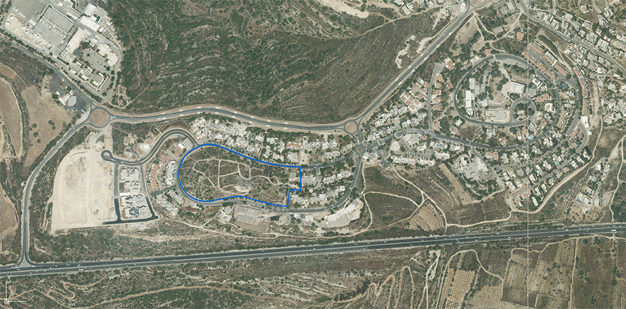 התמצאות
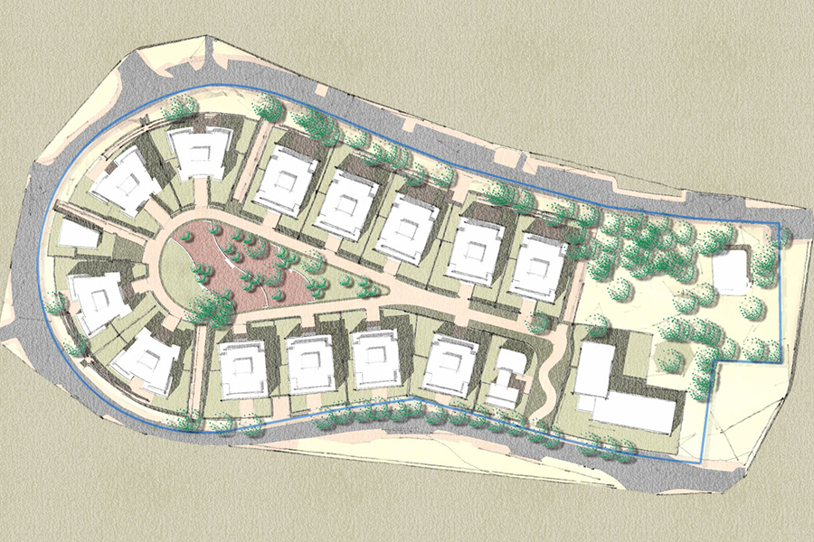

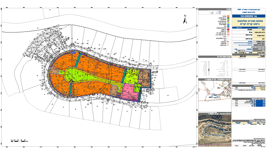
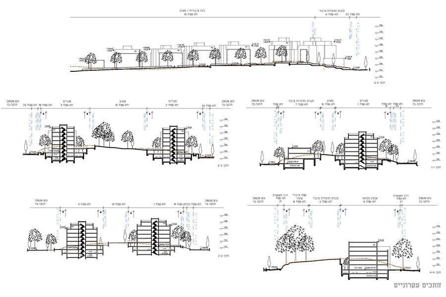
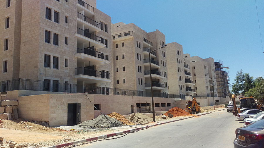
The town of Kiryat Ye’arim has been undergoing a process of densification in the past decade, which requires identifying additional areas for development and adopting urban construction patterns.
The desire to protect sensitive open spaces surrounding the town has led planning authorities to determine that additional development will take place within town borders and not beyond them.
The residential compound in this project is located in the center of town and was originally designated entirely for hotels in the town’s historic master plan. The challenge in planning this project arose from the need to preserve the hospitality use while adding significant residential uses and open spaces, required due to the relatively high number of persons per family characteristic of the ultra-Orthodox population. In addition, the program’s location on a hill required visibility examinations from Route 1 and nearby communities in order to ensure the project’s respectable appearance to the surroundings, despite its urban characteristics
Bet Shemesh on the border of Zano’ah- detailed plan for a commercial and employment center
Sde Dov- Master Plan for a new urban district
Client: Israel Land Authority, Tel Aviv Yafo Municipality, Hagush Hagadol
Project Initiation: 2013
Location: Tel-Aviv
Project Area: 2,250 dunam
Status: In process of approval
Program: Residential, commercial and employment uses, 16,000 residential units
Planning Team: Ari Cohen, Michael Wind, Shirit Fink-Glassner, Tomer Rabinowitz
In partnership with: Dr. Chaim Fialkoff, Shlomo Aronson Architects
The importance of the city of Tel Aviv to its metropolitan area as well as at to the entire country requires the city to keep growing. A central tenet of the Tel Aviv strategic plan states that the city must preserve its status as Israel’s financial capital. This principle is part of the city’s vision of the future which sees it as a “metropolitan and national financial center”.
Sde Dov district serves as the last open land division within the bounds of the historical city, and its planning vision stems from two sources. The first source is identifying the enormous advantages of its unique location, at the junction of the city’s two important landscape axes (the Yarkon Park and the beach), which attract large amounts of recreational and leisure activities, as well as its location as a continuation of the existing urban fabric to the south. The second source for the vision stems from the challenges of long-term planning for high densities.
The proposed construction combines low-rise dense building with high-rise towers while maintaining the central function of the street as the plan’s heart, alongside a coastal park which begins at the Tel Baruch beach and ends at the Reading Marina. The Marina is planned to grow and acts as an important addition to the field of sailing in the country.
The district’s planning is accompanied by environmental and sustainability consultants who strive to create an urban fabric that can compete with the most advanced cities in the world in this field today. Throughout the different planning stages, various examinations have been conducted in order to create a district which strives to minimize greenhouse gas emissions, promote greater energy use efficiency, integrate transit-oriented development principles, and more
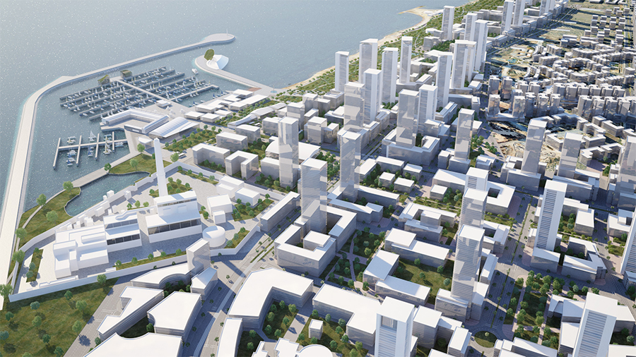 מבט על לעבר הים. הדמיה- viewpoint

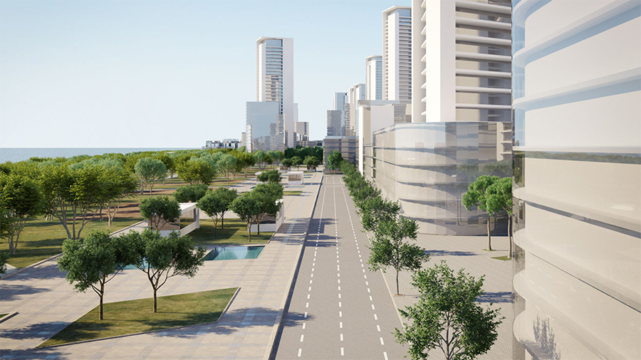
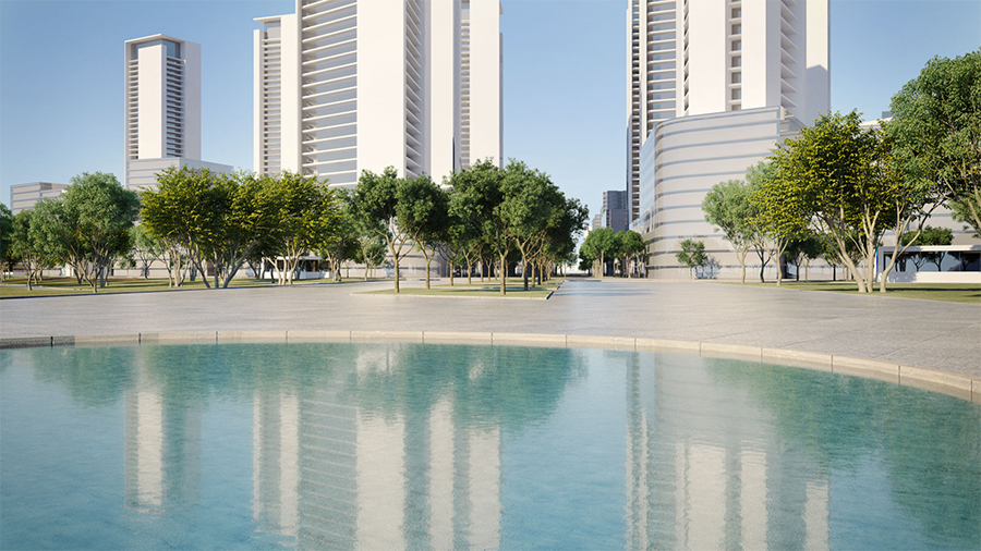
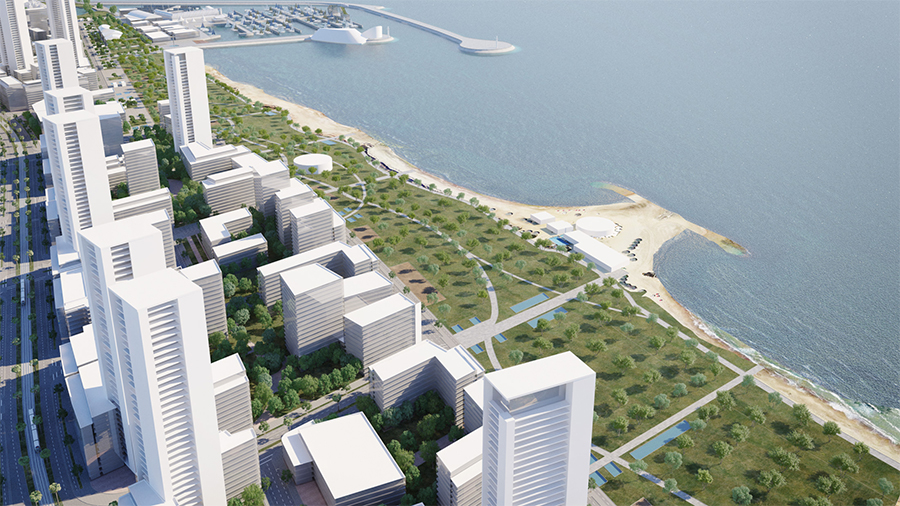
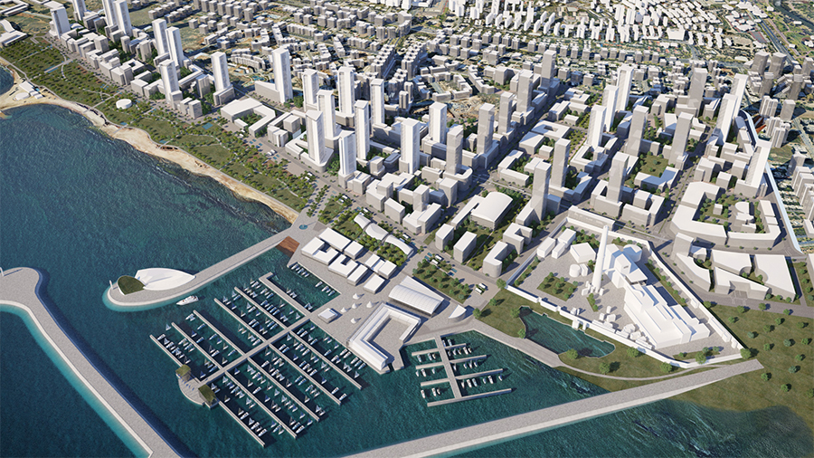
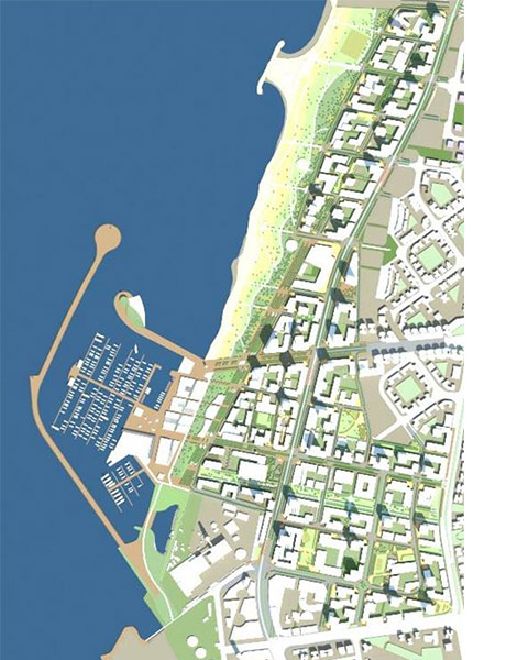
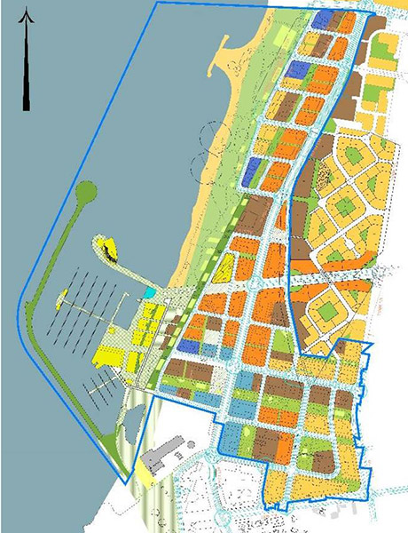
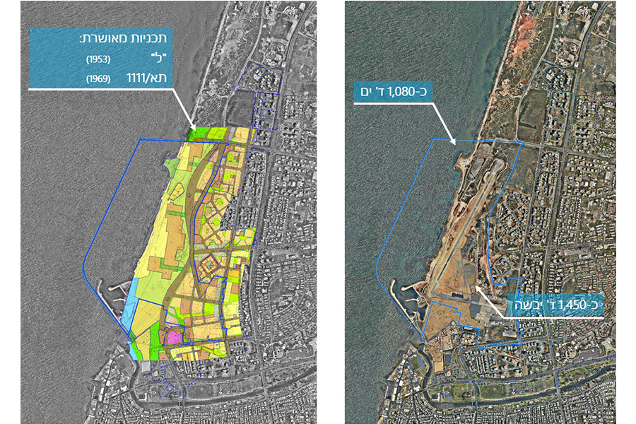
The importance of the city of Tel Aviv to its metropolitan area as well as at to the entire country requires the city to keep growing. A central tenet of the Tel Aviv strategic plan states that the city must preserve its status as Israel’s financial capital. This principle is part of the city’s vision of the future which sees it as a “metropolitan and national financial center”.
Sde Dov district serves as the last open land division within the bounds of the historical city, and its planning vision stems from two sources. The first source is identifying the enormous advantages of its unique location, at the junction of the city’s two important landscape axes (the Yarkon Park and the beach), which attract large amounts of recreational and leisure activities, as well as its location as a continuation of the existing urban fabric to the south. The second source for the vision stems from the challenges of long-term planning for high densities.
The proposed construction combines low-rise dense building with high-rise towers while maintaining the central function of the street as the plan’s heart, alongside a coastal park which begins at the Tel Baruch beach and ends at the Reading Marina. The Marina is planned to grow and acts as an important addition to the field of sailing in the country.
The district’s planning is accompanied by environmental and sustainability consultants who strive to create an urban fabric that can compete with the most advanced cities in the world in this field today. Throughout the different planning stages, various examinations have been conducted in order to create a district which strives to minimize greenhouse gas emissions, promote greater energy use efficiency, integrate transit-oriented development principles, and more
Hizkiyahu HaMelech Street, Jerusalem- detailed plan for a residential building including historic preservation
Client: Private client
Project Initiation: 2006
Location: Jerusalem
Project Area: 0.6 dunam
Status: Approved
Program: 5 residential units
Planning Team: Ari Cohen, Nahum Meltzer, Sigi Be'eri
Project Initiation: 2006
Location: Jerusalem
Project Area: 0.6 dunam
Status: Approved
Program: 5 residential units
Planning Team: Ari Cohen, Nahum Meltzer, Sigi Be'eri
The proposed plan seeks to preserve the existing building, to restore its historical parts and return them to usage as refurbished living spaces. The plan proposes removing all the late additions to the building and to rebuild them in a way that highlights the architectural elements of the historical building. There will be no parking in the residential area in order to preserve the plants and gardening.
The design of the new additions and their position in relation to the existing building are designed to highlight the building’s various construction layers ranging from the initial construction of the building until the present. The new apartments will be accessed via a renewed stairwell in place of the existing one
 התמצאות
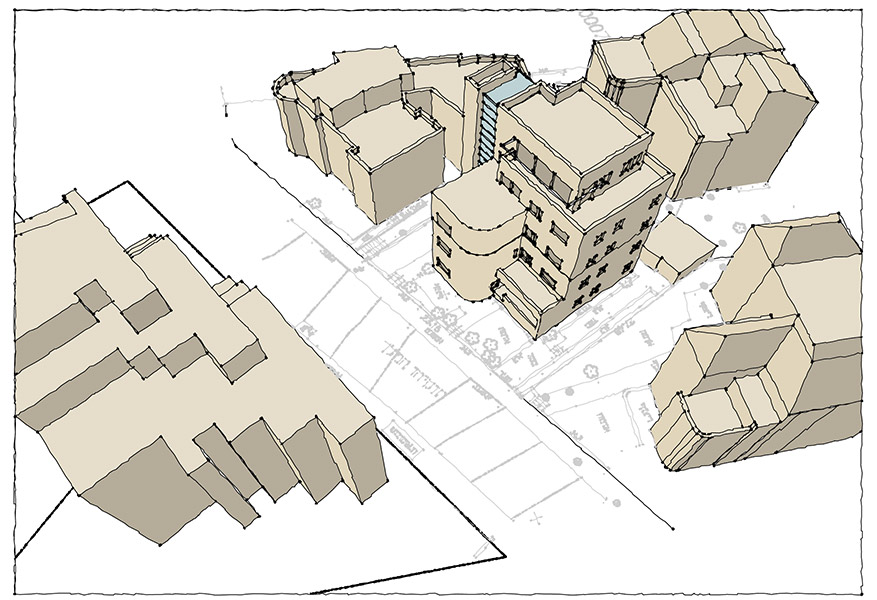
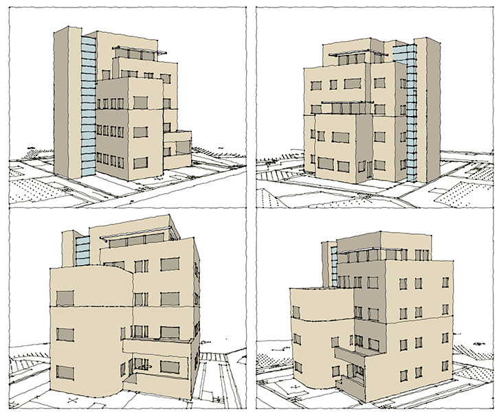
The proposed plan seeks to preserve the existing building, to restore its historical parts and return them to usage as refurbished living spaces. The plan proposes removing all the late additions to the building and to rebuild them in a way that highlights the architectural elements of the historical building. There will be no parking in the residential area in order to preserve the plants and gardening.
The design of the new additions and their position in relation to the existing building are designed to highlight the building’s various construction layers ranging from the initial construction of the building until the present. The new apartments will be accessed via a renewed stairwell in place of the existing one
Houra, compounds 12-16- three detailed plans for residential neighborhoods
National Master Plan 35- monitoring, control and updating
Client: Ministry of Interior
Project Initiation: 2007
Location: Israel
Status: Approved
Planning Team: Ari Cohen, Moti Kaplan, Yaron Turel
Project Initiation: 2007
Location: Israel
Status: Approved
Planning Team: Ari Cohen, Moti Kaplan, Yaron Turel
National Master Plan 35 is a national master plan designed to define the planning policy and settlement layout in Israel by 2020. The plan, also known as the “Integrated National Master Plan for Construction, Development and Preservation”, was published in November 2000, and approved by government at the end of 2005. The plan’s stated goals are “to meet the construction and development needs of the country while maintaining open areas and land reserves for future generations.”
In 2007, the Planning Administration of the Interior Ministry commissioned a control and update review for the plan from the planning team. The target year was set as 2030. During 2016 the government approved Amendment 1, 1/A and 1/B for NMP 35.
The main tenets of the plan include strengthening existing cities and metropolitan areas, avoiding urban sprawl, introducing new urbanism measures such as mixed land uses and in general, more urban renewal, strengthening public transport, textured urban layouts, and more. The program considers beaches public assets, and calls for ensuring green buffer zones between cities and avoiding turning Israel into one big city. In addition, the plan recommends not building any new settlements in Israel.
As a national master plan, NMP 35 serves in most cases as the basis for all development and construction initiatives in Israel, and regional and local master plans are supposed to be based on the principles formulated in the document, and should not exceed the limits defined by the program
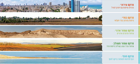 מתוך אתר משרד הפנים
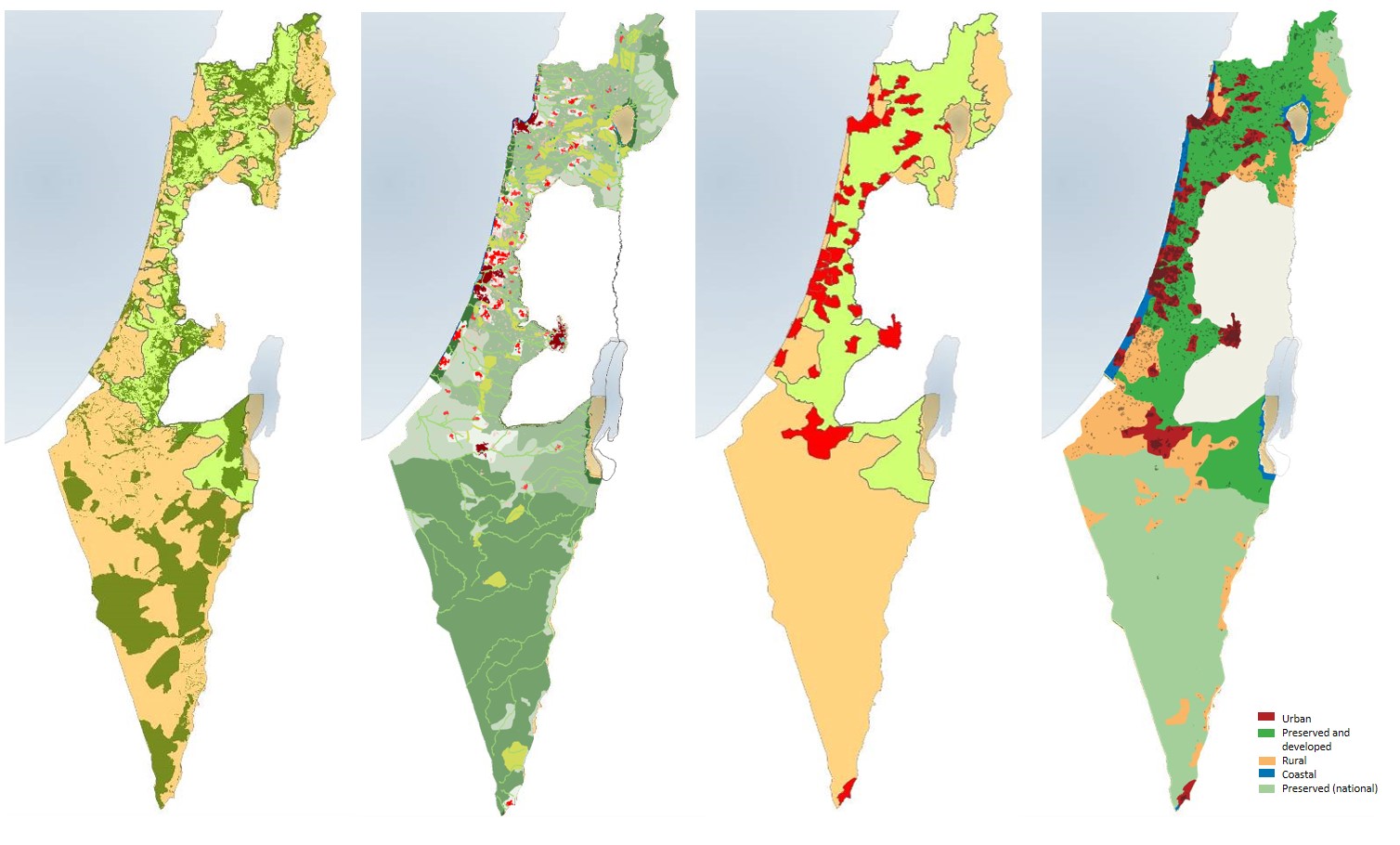
National Master Plan 35 is a national master plan designed to define the planning policy and settlement layout in Israel by 2020. The plan, also known as the “Integrated National Master Plan for Construction, Development and Preservation”, was published in November 2000, and approved by government at the end of 2005. The plan’s stated goals are “to meet the construction and development needs of the country while maintaining open areas and land reserves for future generations.”
In 2007, the Planning Administration of the Interior Ministry commissioned a control and update review for the plan from the planning team. The target year was set as 2030. During 2016 the government approved Amendment 1, 1/A and 1/B for NMP 35.
The main tenets of the plan include strengthening existing cities and metropolitan areas, avoiding urban sprawl, introducing new urbanism measures such as mixed land uses and in general, more urban renewal, strengthening public transport, textured urban layouts, and more. The program considers beaches public assets, and calls for ensuring green buffer zones between cities and avoiding turning Israel into one big city. In addition, the plan recommends not building any new settlements in Israel.
As a national master plan, NMP 35 serves in most cases as the basis for all development and construction initiatives in Israel, and regional and local master plans are supposed to be based on the principles formulated in the document, and should not exceed the limits defined by the program
Press 2, Jerusalem- preservation and addition of residential and office space- Beit Yellin
Client: Private client
Project Initiation: 2010
Location: Jerusalem
Project Area: 0.7 dunam
Status: Approved
Program: 11 residential units + offices on the entrance level
Planning Team: Ari Cohen, Nahum Meltzer, Eti Efrati-Areih, Shirit Fink-Glassner
Project Initiation: 2010
Location: Jerusalem
Project Area: 0.7 dunam
Status: Approved
Program: 11 residential units + offices on the entrance level
Planning Team: Ari Cohen, Nahum Meltzer, Eti Efrati-Areih, Shirit Fink-Glassner
The planning area includes a historical building listed for preservation currently used for offices and residential uses.
The plan will preserve the structure, proposing an additional floor and wing to the historic building for the construction of 11 residential units above an office floor. The building listed for preservation includes late additions that will be removed in the proposed plan
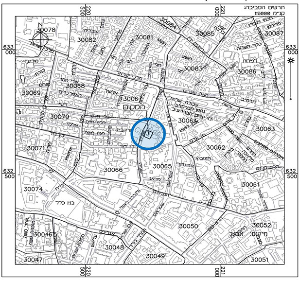 התמצאות

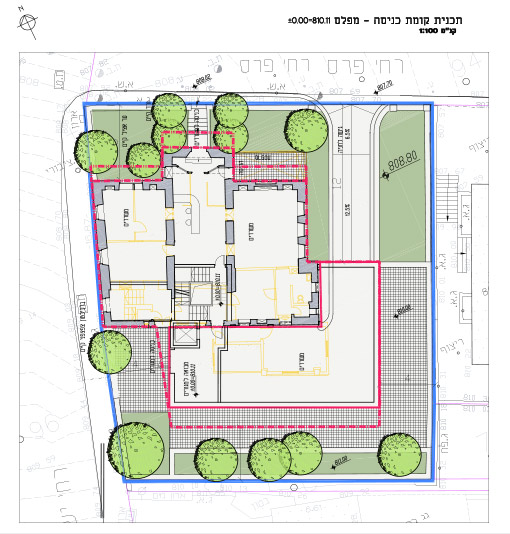
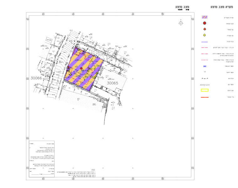
The planning area includes a historical building listed for preservation currently used for offices and residential uses.
The plan will preserve the structure, proposing an additional floor and wing to the historic building for the construction of 11 residential units above an office floor. The building listed for preservation includes late additions that will be removed in the proposed plan
The Old City of Jerusalem- conditions for issuing building permits (public sphere)
Client: The Jerusalem Development Authority
Project Initiation: 2011
Location: The Old City of Jerusalem- Muslim and Christian Quarters
Status: In approval process
Program: Regulating land uses and defining areas for protection and preservation, areas for regulation of existing buildings, and areas for building additions (without additional units) for housing welfare improvement and in accordance with Old City values
Planning Team: Mike Turner, Ari Cohen, Ella Zilberfarb-Ben Ezra, Tzafi Shelef
The Old City of Jerusalem, one of the world’s oldest cities and an important spiritual center for Judaism, Islam and Christianity, has one main statutory plan in effect – AM/9 (the Old City and its environs, approved in 1976) – and a limited number of small-scale plans. AM/9 does not have provisions allowing the issuance of building permits without additional detailed plans (in private as well as public areas), and is also lacking provisions regarding roads for vehicles and pedestrian paths. This plan aims to rectify that situation and regulate public works by issuing permits for infrastructure and public works in the Old City’s streets. The plan also determines a method for restoration and preservation of Old City monuments as well as views for preservation
 המרחב הציבורי בעיר העתיקה

The Old City of Jerusalem, one of the world’s oldest cities and an important spiritual center for Judaism, Islam and Christianity, has one main statutory plan in effect – AM/9 (the Old City and its environs, approved in 1976) – and a limited number of small-scale plans. AM/9 does not have provisions allowing the issuance of building permits without additional detailed plans (in private as well as public areas), and is also lacking provisions regarding roads for vehicles and pedestrian paths. This plan aims to rectify that situation and regulate public works by issuing permits for infrastructure and public works in the Old City’s streets. The plan also determines a method for restoration and preservation of Old City monuments as well as views for preservation